- Prince Said Ibrahim International Airport
-
Prince Said Ibrahim International Airport
Moroni Hahaya International Airport
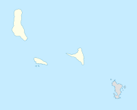
Hahaya AirportIATA: HAH – ICAO: FMCH Location of airport in Comoros Summary Airport type Public Operator Federal Republic of the Comoros Serves Moroni Location Hahaya, near Moroni, Comoros Elevation AMSL 93 ft / 28 m Coordinates 11°32′12″S 43°16′17″E / 11.53667°S 43.27139°ECoordinates: 11°32′12″S 43°16′17″E / 11.53667°S 43.27139°E Runways Direction Length Surface ft m 02/20 9,514 2,900 Asphalt Named for Prince Said Ibrahim of Grand Comore Prince Said Ibrahim International Airport (IATA: HAH, ICAO: FMCH) is an international airport located in Moroni, Comoros.
Contents
Airlines and destinations
Airlines Destinations African Express Airways Mombasa, Nairobi Air Austral Dzaoudzi, Saint-Denis de la Réunion Air Madagascar Antananarivo, Majunga, Nosy Be, Nairobi, Paris-Charles de Gaulle Comores Aviation Anjouan, Antananarivo, Dar es Salaam, Dzaoudzi, Mahajanga, Mohéli Kenya Airways Nairobi Precision Air Dar es Salaam Yemenia Sana'a Accidents and Incidents
On June 30, 2009, Yemenia Flight 626, an Airbus A310[1], flight number IY626, departed from Sana'a International Airport in Sana'a, Yemen, en route to Prince Said Ibrahim International Airport. Reportedly with 11 crew and 142 passengers aboard, including 66 French nationals, the aircraft crashed into the Indian Ocean on approach to the destination airport.
On November 23, 1996, Ethiopian Airlines Flight 961 was hijacked by three men seeking political assylum, demanding that the Boeing 767-260 be flown to Australia. Captain Abate told them that the aircraft was capable of the flight, but they would have to land and refuel. The hijackers thought he was lying. Abatae hoped to land at this airport, but had already run out of fuel and the Boeing 767 crash-landed in the ocean off the coast of the island. Only 50 out of 175 survived, because the surviving passengers had heard Captain Abate's instructions to put life vests on, but don't inflate them. The passengers who didn't survive likely inflated them and drowned under the wreckage. The aircraft was on a flight from Addis Ababa to Nairobi.
While the runway is considered long enough for modern jetliners, landings can still prove difficult because of frequently changing weather conditions and the surrounding mountains of the island.[2]
References
External links
- AIP Data
- Airport chart
- Accident history for HAH at Aviation Safety Network
- Airport information for FMCH at Great Circle Mapper. Source: DAFIF (effective Oct. 2006).
- Current weather for FMCH at NOAA/NWS
- Airport information for FMCH at World Aero Data. Data current as of October 2006.Source: DAFIF.
Categories:- Airports in Comoros
- Moroni, Comoros
- Comoros geography stubs
- East African airport stubs
- Comoros stubs
Wikimedia Foundation. 2010.

