- Cairns Army Airfield
-
Cairns Army Airfield (AAF)
Fort Rucker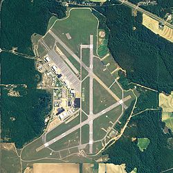
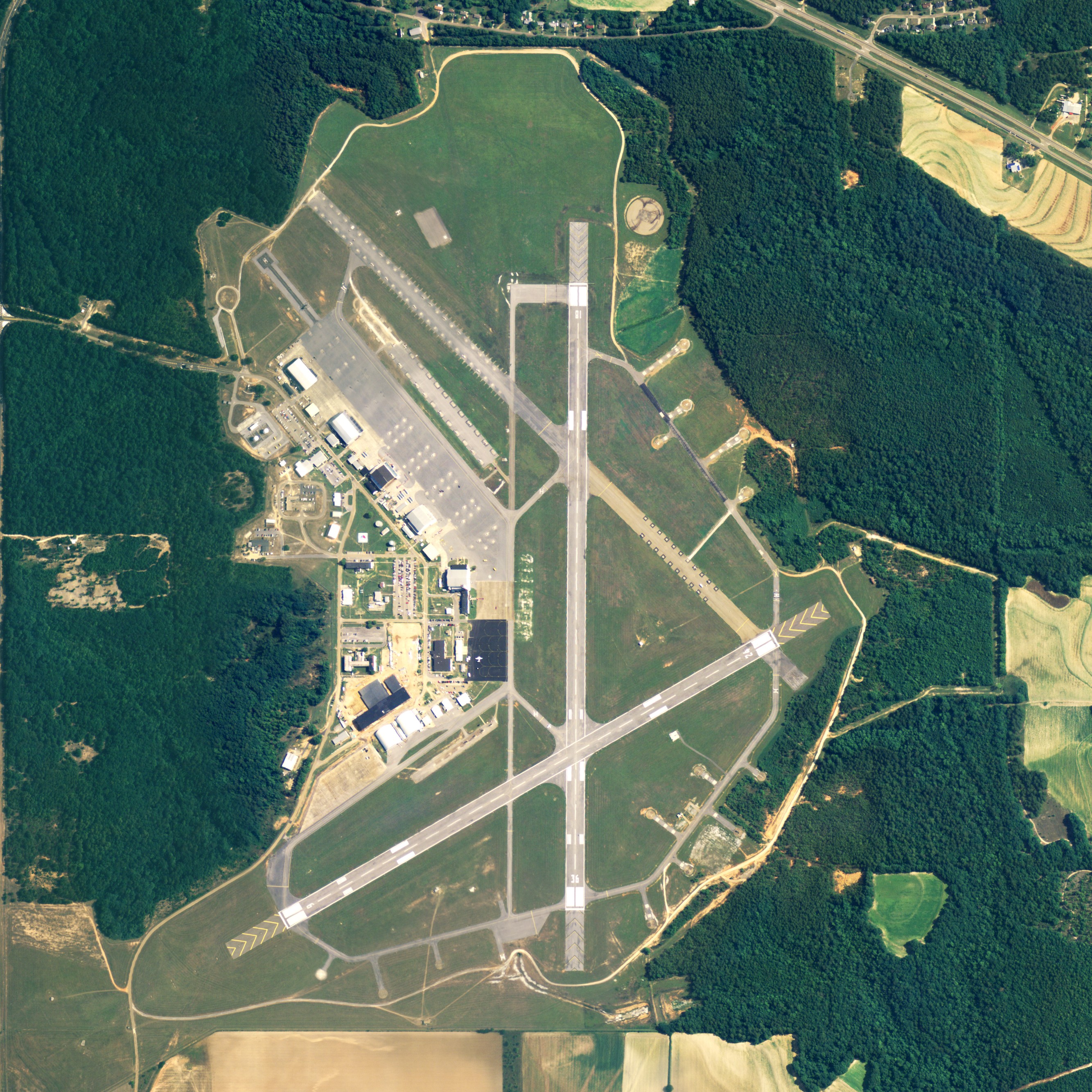
NAIP aerial image, 30 June 2006 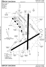
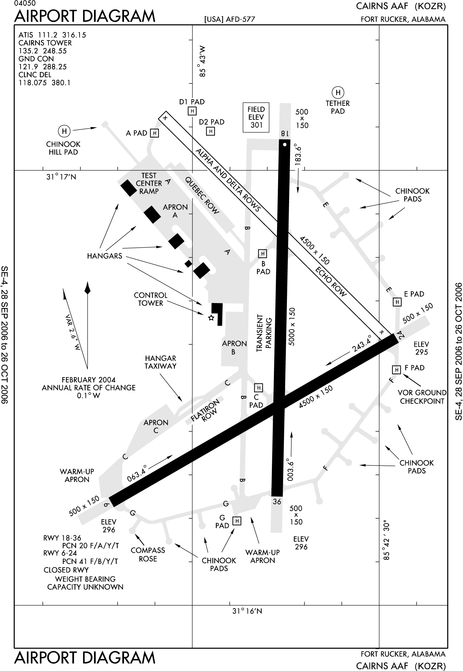
FAA diagram of runway area IATA: OZR – ICAO: KOZR – FAA LID: OZR Summary Airport type Military Owner U.S. Army Location Fort Rucker / Dale County, Alabama Elevation AMSL 301 ft / 92 m Coordinates 31°16′33″N 085°42′48″W / 31.27583°N 85.71333°W Website Runways Direction Length Surface ft m 6/24 4,546 1,386 Asphalt 18/36 5,025 1,532 Asphalt Source: Federal Aviation Administration[1] 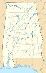
 Cairns AAFLocation of Cairns Army Airfield, Alabama
Cairns Army Airfield (IATA: OZR, ICAO: KOZR, FAA LID: OZR) is a military airport forming a part of Fort Rucker, in Dale County, Alabama, USA. It is owned by the United States Army.[1] The airfield is south of the town of Daleville, which sits between it and the main post.
Contents
History
In September 1942, 1,259 acres (5.1 km2) south of Daleville were acquired for the construction of an airfield to support the training camp. It was a training airfield as part of the United States Army Air Forces Third Air Force during World War II, then placed on inactive status with the war's end. Needing a location to shoot all takeoffs and landings for the film Twelve O'Clock High, including the spectacular B-17 belly-landing sequence early in the film, director Henry King selected Ozark since its dark runways more closely matched wartime bases in England as opposed to the light-colored runways at the Eglin Air Force Base, the primary shoot location. Since the field had been allowed to overgrow during its inactive status, it was also an ideal location for the character Harvey Stovall to reminisce about his World War II service (which is seen at the beginning of the film) before the crew mowed and dressed the field to start the rest of shooting.[2] The field was acquired by Fort Rucker in 1952. It was known as Ozark Army Airfield until January 1959, when the name was changed to Cairns Army Airfield, named for U.S. Army Major General Bogardus Snowden "Bugs" Cairns who was killed instantly when his H-13 Sioux helicopter crashed minutes after take off in dense woods northwest of Fort Rucker, Alabama headquarters on 9 December 1958. He was enroute to Matteson Range to observe a firepower rehearsal in preparation for a full-scale armed helicopter display. He was commander of the Aviation Center and Commandant of the Aviation School.[3][4] [5]
Current use
Fort Rucker is the Home of Army Aviation, where all of the Army's Aviators as well as many international and civilian personnel begin their rotary-wing flight training.
Cairns is one of the busiest airfields in the Army, training large numbers of Army aviators both day and night.
The Aviation Training Brigade consists of five battalions that conduct flight training at Fort Rucker at three training sites. 1st Battalion, 223d Aviation Regiment, Cairns Army Airfield and Knox Army Heliport conducts flight training in the CH-47, C-12 and conducts the Maintenance Test Pilot Courses, it also provides evaluations of flight training for contractors.
Facilities
Cairns AAF has two asphalt paved runways: 6/24 is 4,546 by 150 feet (1,386 x 46 m) and 18/36 is 5,025 by 150 feet (1,532 x 46 m).[1]
In 1995 the pilots handled 209,000 aircraft movements without incident. In an average day tower operators handle 800 to 1,000 movements. What makes Cairns unique is the density in which it operates. The airfield may be launching 70 to 120 aircraft in the morning and afternoon, and then 50 or 60 at night for training.
See also
- Alabama World War II Army Airfields
- Fort Rucker, located at 31°20′37″N 85°42′29″W / 31.34361°N 85.70806°W
- Lowe Army Heliport, located at 31°21′21″N 085°45′04″W / 31.35583°N 85.75111°W
- Hanchey Army Heliport, located at 31°20′46″N 085°39′16″W / 31.34611°N 85.65444°W
References
- ^ a b c FAA Airport Master Record for OZR (Form 5010 PDF). Federal Aviation Administration. Effective 3 June 2010.
- ^ http://www.airforce-magazine.com/MagazineArchive/Pages/2011/January%202011/0111high.aspx
- ^ Cairns Army Airfield. Globalsecurity.org. Retrieved on 2010-11-25.
- ^ RootsWeb: CAIRNS-L Re: [CAIRNS] Frederick Augustus Cairns. Archiver.rootsweb.ancestry.com. Retrieved on 2010-11-25.
- ^
 This article incorporates public domain material from websites or documents of the Air Force Historical Research Agency.
External links
- Fort Rucker, official site
- U.S. Army Aviation Technical Test Center, official site
- Cairns Army Airfield at GlobalSecurity.org
- Airfield photos for KOZR from Civil Air Patrol
- Aerial image as of 18 February 1997 from USGS The National Map
- FAA Airport Diagram (PDF), effective 20 October 2011
- FAA Terminal Procedures for OZR, effective 20 October 2011
- Resources for this U.S. military airport:
- AirNav airport information for KOZR
- ASN accident history for OZR
- NOAA/NWS latest weather observations
- SkyVector aeronautical chart for KOZR
Current military installations of AlabamaArmy  ArsenalDepotFortAir FieldCairns • RedstoneHeliportBirmingham • Dannelly FieldRange
Navy  Outlying FieldBarin Field • Brewton Field • Evergreen Field
Air Force  Birmingham • Dannelly FieldAbston • Dothan
Coast Guard  Aids to Navigation TeamsMobileMobileSectorMobileCategories:
- 1943 establishments
- Airfields of the United States Army Air Forces in Alabama
- Airports in Alabama
- Buildings and structures in Dale County, Alabama
- United States Army airfields
- Transportation in Dale County, Alabama


Wikimedia Foundation. 2010.