- Orealla
-
Orealla Location in Guyana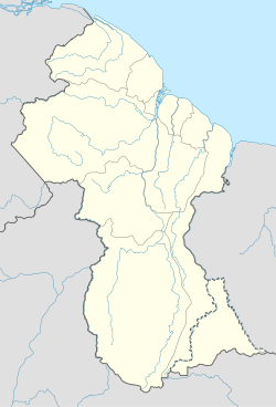
 Orealla
Coordinates: 5°17′50″N 57°20′50″W / 5.29722°N 57.34722°WCoordinates: 5°17′50″N 57°20′50″W / 5.29722°N 57.34722°W Country  Guyana
Region East Berbice-Corentyne Elevation 36 ft (11 m) Orealla (or Orealla Mission) is an American Indian community in the East Berbice-Corentyne Region of Guyana, on the Courantyne River, approximately 33 miles (53 km) south of Crabwood Creek and 11 miles (18 km) north of Epira, located at 5°17′50″N 57°20′50″W / 5.29722°N 57.34722°W, altitude 11 metres. 15 miles (24 km) south-east on the other side of the Courantyne River lies the Surinamese village of Apoera.
Orealla is the only American Indian community that has had the boundaries of its reservation demarcated, with a total area of 266 sq mi (690 km2).
The recent involvement of Orealla with the Barama company, the product of which has been a local ecological and economic disaster,[citation needed] demonstrates a major weakness of the reservation system, which while providing a large degree of autonomy to Amerindian communities may also cut them off somewhat from central sources of advice and assistance, exposing them to such predatory incursions from outside parties.
Small ocean-going vessels are able to navigate the Courantyne River for about 70 km, to the first rapids at Orealla.
Novelist Roy Heath has written about Orealla.
External links
Settlements in GuyanaFor the definition of city, town, etc see Settlements in Guyana. Cities Towns Albion · Anna Regina · Bartica · Corriverton · Fort Wellington · Ituni · Lethem · Linden · Mabaruma · Mahaica · Mahaicony · New Amsterdam · Paradise · Rosignol · Skeldon · Vreed en HoopVillages Adventure · Aishalton · Annai · Arimu Mine · Belfield · Beterverwagting · Better Hope · Biloku · Blairmont · Burma · Buxton · Campbelltown · Cane Grove · Charity · Clonbrook · Crabwood Creek · El Paso · Enmore · Enterprise · Esau and Jacob · Everton · Fort Washington · Good Hope · Governor Light · Hackney · Helena · Holmia · Hope · Hosororo · Hyde Park · Imbaimadai · Isherton · Issano · Isseneru · Jonestown · Kabakaburi · Kalkuni · Kamarang · Kamikusa · Kamwatta Hill · Kangaruma · Kartabo · Kartuni · Keweigek · Koriabo · Kumaka, Barima-Waini · Kumaka, East Berbice-Corentyne · Kuru Kuru · Kurupakari · Kurupung · Kwakwani · Kwebanna · Leonora · Long Creek · Lusignan · Mahdia · Maicobi · Makouria · Mara · Matthew's Ridge · Meten-Meer-Zorg · Moleson Creek · Mora Point · Morawhanna · Moruca · New Found Out · Nonpareil · Orealla · Orinduik · Paramakatoi · Parika · Peters Mine · Pickersgill · Port Kaituma · Port Mourant · Potaro Landing · Princeville · Providence · Rockstone · Rose Hall · Santa Rosa · Saveretik · Saxacalli · Schoon Ord · Seweyo · Silver Hill · Spring Garden · St. Monica Karawab · Suddie · Surama · Takama · Three Friends · Timehri · Towakaima · Tumatumari Landing · Tumatumari · Tumereng · Uitvlugt · Unity Village · Victoria · Wakapau · Wandaik · Wel te Vreeden · Weldaad · Wichabai · Wowetta · Zeeburg · ZeelandiaCommunities Estates Catherinas Lust · Dadanawa RanchMissions Neighbourhoods GeorgetownCategories:- Indigenous peoples of the Guianas
- Populated places in Guyana
- East Berbice-Corentyne
- Indigenous peoples in Guyana

Wikimedia Foundation. 2010.