- Corriverton
-
Corriverton Location in Guyana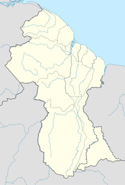
 Corriverton
Coordinates: 6°0′N 57°08′W / 6°N 57.133°W Country  Guyana
Region East Berbice-Corentyne Resort Nieuw Nickerie Population (2002) - Total 11,574 Corriverton is the most easterly town in Guyana. It lies at the mouth of the Corentyne River, opposite Nieuw Nickerie, Suriname, to which it is linked by ferry from South Drain.
Corriverton is located about 195 mi/313 km from Georgetown on the eastern side of Guyana, in the county of Berbice. Its population in 2002 was 11,574.
It is a modern administrative construction, formed from two older towns, Springlands and Skeldon, and several villages which were named, or rather numbered (e.g. '78'), after their sugar plantations, owned by Bookers.
Corriverton has a mixed population of Hindus, Christians and Muslims living together. It is the site of many mosques, temples and churches, and has an excellent educational system.
Hotels in the town include the Paraton Inn, Mahogany Hotel, Riverton Suites, Hotel Malinmar, the Swiss Guest House and many others. Corriverton is very economical for tourists.
Ferry
Since 1998, the CANAWAIMA ferry connects Moleson Creek, 10km southy of Corriverton, with South Drain in Surinam.[1] This is the only legal connection between the two countries, but before the repavement of the road many travelers preferred to take a back-track route.[2]
References
- ^ Ministerie van Transport, Communicatie en Toerisme - De Canawaima Ferry Service Incorporated
- ^ Kaieteur News - Canawaima Ferry Service seeks to boost travel
External links
Coordinates: 06°00′N 57°08′W / 6°N 57.133°W
 Settlements in Guyana
For the definition of city, town, etc see Settlements in Guyana. Cities Towns Albion · Anna Regina · Bartica · Corriverton · Fort Wellington · Ituni · Lethem · Linden · Mabaruma · Mahaica · Mahaicony · New Amsterdam · Paradise · Rosignol · Skeldon · Vreed en HoopVillages Adventure · Aishalton · Annai · Arimu Mine · Belfield · Beterverwagting · Better Hope · Biloku · Blairmont · Burma · Buxton · Campbelltown · Cane Grove · Charity · Clonbrook · Crabwood Creek · El Paso · Enmore · Enterprise · Esau and Jacob · Everton · Fort Washington · Good Hope · Governor Light · Hackney · Helena · Holmia · Hope · Hosororo · Hyde Park · Imbaimadai · Isherton · Issano · Isseneru · Jonestown · Kabakaburi · Kalkuni · Kamarang · Kamikusa · Kamwatta Hill · Kangaruma · Kartabo · Kartuni · Keweigek · Koriabo · Kumaka, Barima-Waini · Kumaka, East Berbice-Corentyne · Kuru Kuru · Kurupakari · Kurupung · Kwakwani · Kwebanna · Leonora · Long Creek · Lusignan · Mahdia · Maicobi · Makouria · Mara · Matthew's Ridge · Meten-Meer-Zorg · Moleson Creek · Mora Point · Morawhanna · Moruca · New Found Out · Nonpareil · Orealla · Orinduik · Paramakatoi · Parika · Peters Mine · Pickersgill · Port Kaituma · Port Mourant · Potaro Landing · Princeville · Providence · Rockstone · Rose Hall · Santa Rosa · Saveretik · Saxacalli · Schoon Ord · Seweyo · Silver Hill · Spring Garden · St. Monica Karawab · Suddie · Surama · Takama · Three Friends · Timehri · Towakaima · Tumatumari Landing · Tumatumari · Tumereng · Uitvlugt · Unity Village · Victoria · Wakapau · Wandaik · Wel te Vreeden · Weldaad · Wichabai · Wowetta · Zeeburg · ZeelandiaCommunities Estates Catherinas Lust · Dadanawa RanchMissions Neighbourhoods GeorgetownCategories:- Populated places in Guyana
- East Berbice-Corentyne
- Guyana–Suriname border crossings

Wikimedia Foundation. 2010.