- Clonbrook
-
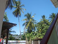 Palm Trees in a Clonbrook backyard.
Clonbrook is a village in the Demerara-Mahaica region of Guyana. The village itself has a population of about 1,000-2,000. The village is located along the East Coast Highway and is about 20 miles from Georgetown and about 4 miles from Mahaica. It is bordered in the east by the village of Bee Hive and by Ann's grove in the west.
Contents
Demographics
Historically, Clonbrook was almost 100% Indo-Guyanese, but today, that has changed due to migration within the country. The village of Clonbrook has a population of about 1,000 and most residents are of Indian Descent (Indo-Guyanese), however in recent years substantial Black migration has occurred. As a result of migration, many new houses have been constructed near the Public Road, also known as the East Coast Highway. Like many other Guyanese villages, Clonbrook is somewhat ethnically segregated: Some sections have a black majority, while others have an Indian majority. This village is well known for having friendly people, and racial disturbances rarely occur but racism does exist to some extent .
Education
Clonbrook has two schools ,a kindergarten and a primary school (junior high) but there is a secondary school (high school) in the neighboring village of Ann's Grove. However, during the 1960s and 1970s many residents did not take their education seriously, resulting in a literacy rate of only 84%, below the national average of 98%. (Source: Random Survey of 100 random people conducted in 2005).
Transportation
One can travel to Clonbrook using the #44,#50 buses or by private taxis. Almost 90% of the roads are vehicle and foot accessible.
Religion
The major religions in the village are Hinduism, Christianity & Islam.
Health services
Basic health services are provided at a health centre by a doctor and a medex(medical examiner).
Sports and leisure
The most prominent activities are cricket, football, basketball, fishing, swimming, cycling and "bush cooking".
Sources
This article was put together based on information from surveys as well as interviews from various residents, all information is 100% correct and it stated from a neutral point of view.
See also
Coordinates: 6°44′N 57°56′W / 6.733°N 57.933°W
 Settlements in Guyana
For the definition of city, town, etc see Settlements in Guyana. Cities Towns Albion · Anna Regina · Bartica · Corriverton · Fort Wellington · Ituni · Lethem · Linden · Mabaruma · Mahaica · Mahaicony · New Amsterdam · Paradise · Rosignol · Skeldon · Vreed en HoopVillages Adventure · Aishalton · Annai · Arimu Mine · Belfield · Beterverwagting · Better Hope · Biloku · Blairmont · Burma · Buxton · Campbelltown · Cane Grove · Charity · Clonbrook · Crabwood Creek · El Paso · Enmore · Enterprise · Esau and Jacob · Everton · Fort Washington · Good Hope · Governor Light · Hackney · Helena · Holmia · Hope · Hosororo · Hyde Park · Imbaimadai · Isherton · Issano · Isseneru · Jonestown · Kabakaburi · Kalkuni · Kamarang · Kamikusa · Kamwatta Hill · Kangaruma · Kartabo · Kartuni · Keweigek · Koriabo · Kumaka, Barima-Waini · Kumaka, East Berbice-Corentyne · Kuru Kuru · Kurupakari · Kurupung · Kwakwani · Kwebanna · Leonora · Long Creek · Lusignan · Mahdia · Maicobi · Makouria · Mara · Matthew's Ridge · Meten-Meer-Zorg · Moleson Creek · Mora Point · Morawhanna · Moruca · New Found Out · Nonpareil · Orealla · Orinduik · Paramakatoi · Parika · Peters Mine · Pickersgill · Port Kaituma · Port Mourant · Potaro Landing · Princeville · Providence · Rockstone · Rose Hall · Santa Rosa · Saveretik · Saxacalli · Schoon Ord · Seweyo · Silver Hill · Spring Garden · St. Monica Karawab · Suddie · Surama · Takama · Three Friends · Timehri · Towakaima · Tumatumari Landing · Tumatumari · Tumereng · Uitvlugt · Unity Village · Victoria · Wakapau · Wandaik · Wel te Vreeden · Weldaad · Wichabai · Wowetta · Zeeburg · ZeelandiaCommunities Estates Catherinas Lust · Dadanawa RanchMissions Neighbourhoods GeorgetownCategories:- Populated places in Guyana
- Demerara-Mahaica
- Guyana geography stubs

Wikimedia Foundation. 2010.