- Nousiainen
-
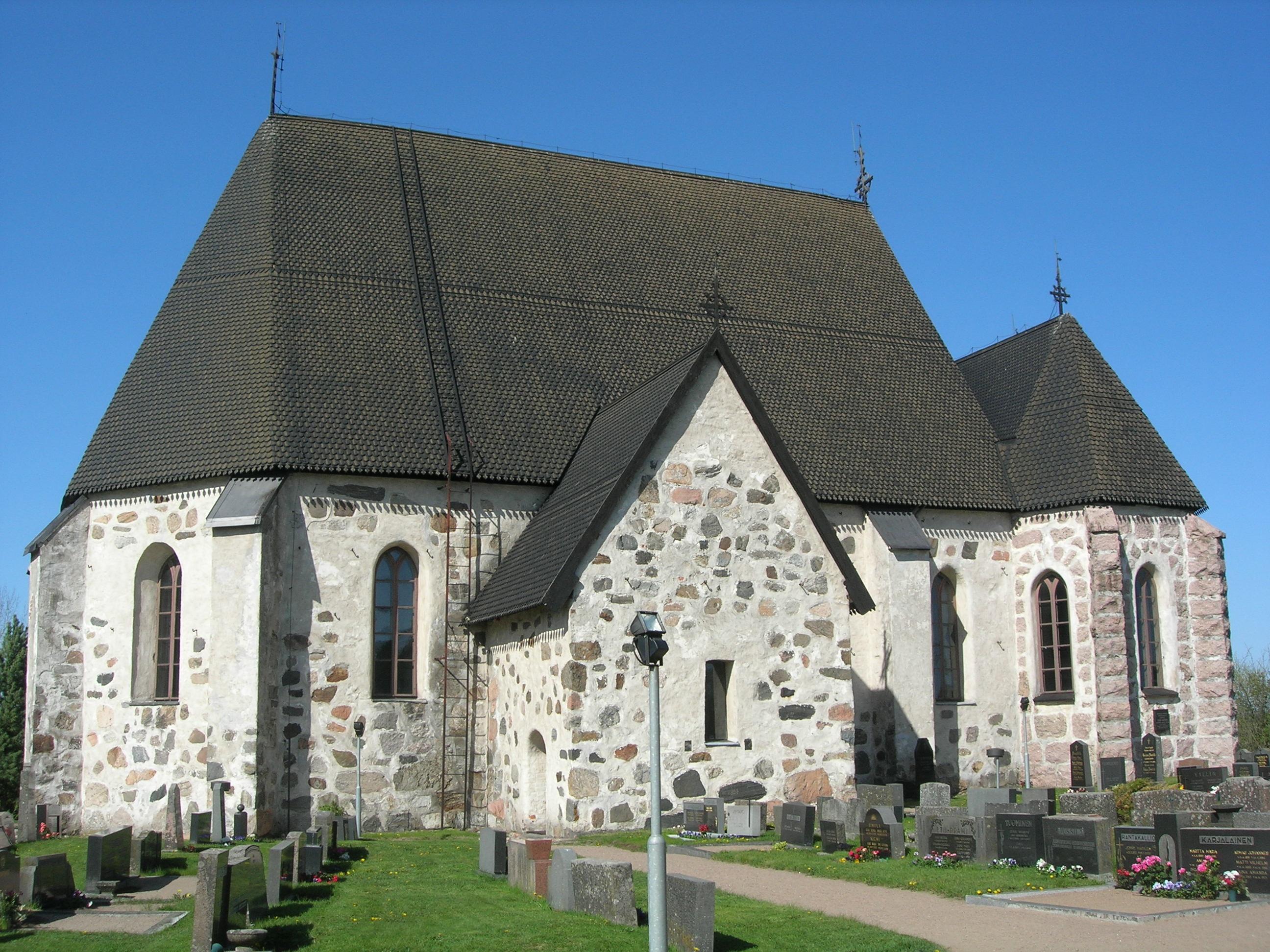
Nousiainen — Municipality — Nousiaisten kunta Nousiainen Church

Coat of armsLocation of Nousiainen in Finland
Coordinates: 60°36′N 022°05′E / 60.6°N 22.083°ECoordinates: 60°36′N 022°05′E / 60.6°N 22.083°E Country Finland Region Finland Proper Sub-region Turku sub-region Charter 1867 Government - Municipal manager Hannu Rämö Area(2011-01-01)[1] - Total 199.43 km2 (77 sq mi) - Land 198.81 km2 (76.8 sq mi) - Water 0.62 km2 (0.2 sq mi) Area rank 302nd largest in Finland Population (2011-01-31)[2] - Total 4,860 - Rank 197th largest in Finland - Density 24.45/km2 (63.3/sq mi) Population by native language[3] - Finnish 98.3% (official) - Swedish 0.8% - Others 0.8% Population by age[4] - 0 to 14 21.7% - 15 to 64 64.5% - 65 or older 13.7% Time zone EET (UTC+2) - Summer (DST) EEST (UTC+3) Municipal tax rate[5] 19.5% Website www.nousiainen.fi Nousiainen (Finnish pronunciation: [ˈnousiˌɑinen]; Swedish: Nousis) is a municipality of Finland. The seat of the bishop of Finland was in Nousis in the early 13th century.
It is located in the province of Western Finland and is part of the Finland Proper region. The municipality has a population of 4,860 (31 January 2011)[2] and covers an area of 199.43 square kilometres (77.00 sq mi) of which 0.62 km2 (0.24 sq mi) is water.[1] The population density is 24.45 inhabitants per square kilometre (63.3 /sq mi).
The municipality is unilingually Finnish.
The coat of arms of Nousiainen depicts Bishop Henry and Lalli.
Nousiainen is also a common surname within Finland.
References
- ^ a b "Area by municipality as of 1 January 2011" (in Finnish and Swedish) (PDF). Land Survey of Finland. http://www.maanmittauslaitos.fi/sites/default/files/pinta-alat_2011_kunnannimenmukaan.xls. Retrieved 9 March 2011.
- ^ a b "Population by municipality as of 31 January 2011" (in Finnish and Swedish). Population Information System. Population Register Center of Finland. http://vrk.fi/default.aspx?docid=4258&site=3&id=0. Retrieved 18 February 2011.
- ^ "Population according to language and the number of foreigners and land area km2 by area as of 31 December 2008". Statistics Finland's PX-Web databases. Statistics Finland. http://pxweb2.stat.fi/Dialog/varval.asp?ma=060_vaerak_tau_107_fi&ti=V%E4est%F6+kielen+mukaan+sek%E4+ulkomaan+kansalaisten+m%E4%E4r%E4+ja+maa%2Dpinta%2Dala+alueittain++1980+%2D+2008&path=../Database/StatFin/vrm/vaerak/&lang=3&multilang=fi. Retrieved 29 March 2009.
- ^ "Population according to age and gender by area as of 31 December 2008". Statistics Finland's PX-Web databases. Statistics Finland. http://pxweb2.stat.fi/Dialog/varval.asp?ma=050_vaerak_tau_104_fi&ti=V%E4est%F6+i%E4n+%281%2Dv%2E%29+ja+sukupuolen+mukaan+alueittain+1980+%2D+2008&path=../Database/StatFin/vrm/vaerak/&lang=3&multilang=fi. Retrieved 28 April 2009.
- ^ "List of municipal and parish tax rates in 2011". Tax Administration of Finland. 29 November 2010. http://www.vero.fi/nc/doc/download.asp?id=7996;193801. Retrieved 13 March 2011.
External links
 Media related to Nousiainen at Wikimedia Commons
- Municipality of Nousiainen – Official website
Municipalities of Finland Proper Municipalities 
Former municipalities Alastaro · Angelniemi · Askainen · Dragsfjärd · Halikko · Hiittinen · Houtskär · Iniö · Kakskerta · Kalanti · Karinainen · Karjala · Karuna · Kimito · Kiikala · Kisko · Kiukainen · Korpo · Kuusisto · Kuusjoki · Lemu · Loimaan kunta · Lokalahti · Maaria · Mellilä · Merimasku · Metsämaa · Mietoinen · Muurla · Naantalin maalaiskunta · Nagu · Paattinen · Pargas · Pargas landskommun · Perniö · Pertteli · Piikkiö · Pyhämaa · Rymättylä · Särkisalo · Somerniemi · Suomusjärvi · Uskela · Uudenkaupungin maalaiskunta · Vahto · Västanfjärd · Velkua · YläneFinland Proper · Finland Categories:- Municipalities of Finland Proper Region
- Populated places established in 1867
- Western Finland geography stubs


Wikimedia Foundation. 2010.