- Matanzas Province
-
Matanzas Province Province 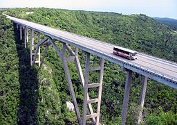 The Bridge of Bacunayagua marks the western boundary of the province along Via Blanca
Country  Cuba
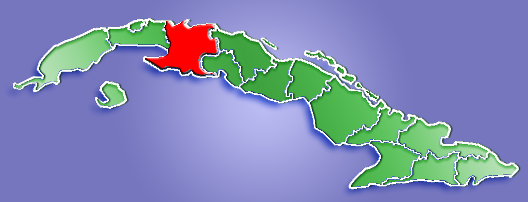
CubaCapital Matanzas Area 11,802.72 km2 (4,557 sq mi) Population 675,980 (2004) [1] Density 57.27 / km2 (148 / sq mi) Timezone EST (UTC-5) Area code +53-52 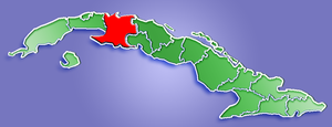 Location of Matanzas Province in Cuba
Website: Provincial portal Matanzas is one of the provinces of Cuba. Major towns in the province include Cárdenas, Colón, Jovellanos and the capital of the same name, Matanzas. The resort town of Varadero is also located in this province.
Of Cuba's provinces, Matanzas is one of the most industrialised, with petroleum wells, refineries, supertanker facilities, and 21 sugar mills to process the harvests of the fields of sugarcane in the province.
Contents
Geography
The second largest in Cuba, Matanzas province is largely flat, with its highest point (Pan de Matanzas) at only 380m above sea level.
The north-western coast is largely rocky, with a few beaches, while the north-eastern coast has numerous small cays of its coast (part of Sabana-Camaguey Archipelago), and scrubland and mangroves near the shoreline. Cuba's northern most point is located in on Hicacos Peninsula.
The southern coast has one of Cuba's most distinctive features: an enormous marsh, Ciénaga de Zapata that covers both the southern part of the province and the Zapata Peninsula. East of the peninsula lies the Bay of Pigs, the site of the failed US backed invasion.
Municipalities
From 1976 to 2010 Matanzas was sub-divided into 14 municipalities.[2] Starting from 2011, the municipality of Varadero was abolished and merged to Cárdenas. This Matanzas now has 13 municipalities.
Source: Population from 2004 Census.[1] Area from 1976 municipal re-distribution.[3]
Demographics
In 2004, the province of Matanzas had a population of 675,980.[1] With a total area of 11,802.72 km2 (4,557.06 sq mi),[4] the province had a population density of 57.3 /km2 (148 /sq mi).
References
- ^ a b c Atenas.cu (2004). "2004 Population trends, by Province and Municipality". Archived from the original on 2007-09-27. http://web.archive.org/web/20070927111826/http://www.atenas.inf.cu/todo/Estadisticas/TABLA+No_3balance.htm. Retrieved 2007-10-06. (Spanish)
- ^ Atenas.cu. "Municipalities of Matanzas". Archived from the original on 2007-09-11. http://web.archive.org/web/20070911170740/http://www.atenas.inf.cu/todo/Municipios/Municipios.htm. Retrieved 2007-10-02.
- ^ Statoids (July 2003). "Municipios of Cuba". http://www.statoids.com/ycu.html. Retrieved 2007-10-06.
- ^ Government of Cuba (2002). "Population by Province". http://www.cubagob.cu/otras_info/censo/tablas_html/ii_4.htm. Retrieved 2007-10-02. (Spanish)
External links
 Provinces of Cuba
Current Artemisa · Camagüey · Ciego de Ávila · Cienfuegos · Ciudad de La Habana · Granma · Guantánamo · Holguín · Isla de la Juventud · Las Tunas · Matanzas · Mayabeque · Pinar del Río · Sancti Spíritus · Santiago de Cuba · Villa Clara
Historical Municipalities of MatanzasCalimete · Cárdenas · Ciénaga de Zapata · Colón · Jagüey Grande · Jovellanos · Limonar · Los Arabos · Martí · Matanzas · Pedro Betancourt · Perico · Unión de Reyes · Varadero
Categories:

Wikimedia Foundation. 2010.