- Sancti Spíritus Province
Geobox Region
name = Sancti Spíritus Province
native_name =
other_name =
other_name1 =
category =
image_size = 250
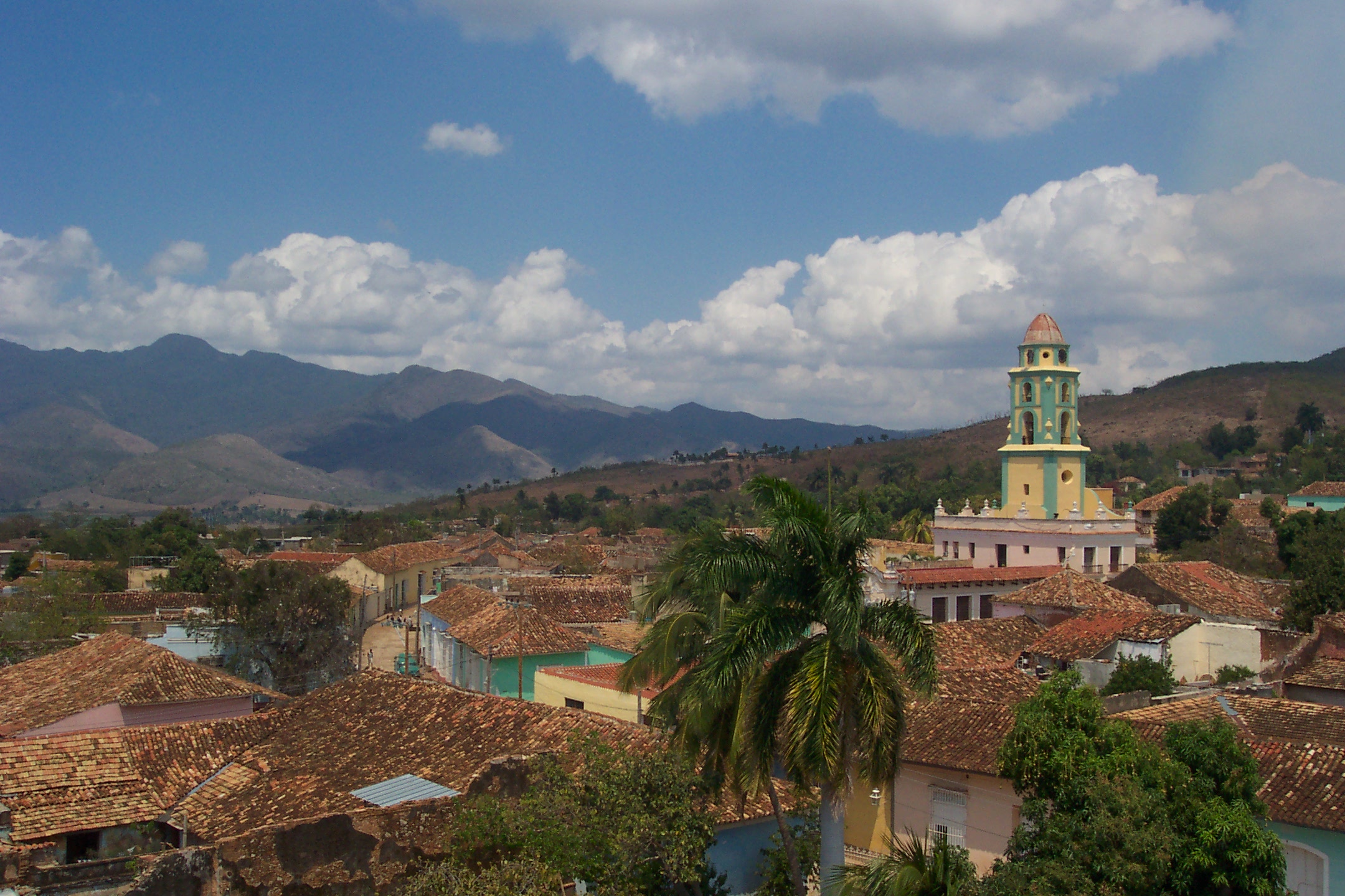
image_caption = Trinidad,Valley de los Ingenios andEscambray Mountains
flag_size =
symbol =
symbol_size =
country = CUB
state =
region =
district =
capital =Sancti Spíritus
capital_type = Capital
capital_lat_d =
capital_lat_m =
capital_lat_s =
capital_lat_NS =
capital_long_d =
capital_long_m =
capital_long_s =
capital_long_E =
capital_elevation =
city_type =
city =
part_type =
part_count =
part =
part1 =
area = 6736.51
highest =
highest location =
highest_lat_d =
highest_lat_m =
highest_lat_s =
highest_lat_NS =
highest_long_d =
highest_long_m =
highest_long_s =
highest_long_EW =
highest_elevation =
lowest =
lowest_location =
lowest_lat_d =
lowest_lat_m =
lowest_lat_s =
lowest_lat_NS =
lowest_long_d =
lowest_long_m =
lowest_long_s =
lowest_long_EW =
lowest_elevation =
population_as_of = 2004
population_note =
population = 463009
population_density = 68.73
established_type =
established =
leader =
timezone = EST
utc_offset = -5
timezone_DST =
utc_offset_DST =
code_type = Area code
code = +53-41
free_type =
free =
free1_type =
free1 =
map_size = 300
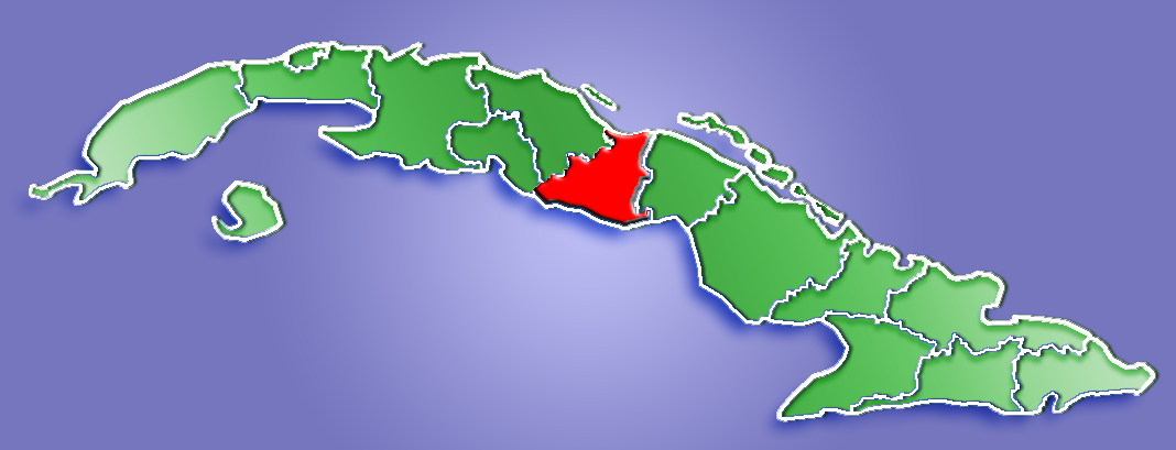
map_caption = Location of Sancti Spíritus Province inCuba
map_locator =
map_locator_x =
map_locator_y =
map_first = 1
website =
footnotes =Sancti Spíritus is one of the
provinces of Cuba . Its capital is the identically namedSancti Spíritus . Another major city is Trinidad.The southern coast of the province is flat, but the western portion of Sancti Spíritus province is
mountain ous. The southeast has numerousmangrove s andswamp s. The northern coast contains significant wetlands and protected areas such as theBay of Buena Vista and theCaguanes National Park .The largest man made reservoir in
Cuba , theEmbalse Zaza , is in Sancti Spíritus province.History
During the
1600s , both Dutch and Britishpirate s attempted to take control of what is today Sancti Spíritus province, but with little success, as the Spanish garrison held them off. From1660 to1680 , Trinidad was plagued by pirates fromJamaica andTortuga , and on two occasions, pirates razed the city.The provinces of Cienfuegos, Sancti Spíritus, and Villa Clara were once all part of the now defunct province of Las Villas.
Economy
Tourism is a big earner for the province, with most of the tourism centred around the old city of Trinidad, aWorld Heritage listed city which has dozens of colonial buildings (and almost no 20th century architecture) dating back to the Spanish conquest in the1500s , and, as with most of Cuba,sugarcane andcattle are important commodities. Large surfaces are irrigated in the farmland betweenZaza Reservoir , Zaza River and Jatibonico River in La Sierpe region. Sometobacco andrice is also grown.Municipalities
:"Source: Population from 2004 Census."Cite web| url=http://www.atenas.inf.cu/todo/Estadisticas/TABLA%20No_3balance.htm| title=2004 Population trends, by Province and Municipality| author= Atenas.cu| year= 2004| accessdate=2007-10-06 Es icon] "Area from 1976 municipal re-distribution."Cite web|url=http://www.statoids.com/ycu.html|title=Municipios of Cuba|author=Statoids| year=2003| month=July| accessdate=2007-10-06 ]
Demographics
In 2004, the province of Sancti Spiritus had a population of 463,009.Cite web| url=http://www.atenas.inf.cu/todo/Estadisticas/TABLA%20No_3balance.htm| title=2004 Population trends, by Province and Municipality| author= Atenas.cu| year= 2004| accessdate=2007-10-02 Es icon] With a total area of km2 to mi2|6736.51|abbr=yes|wiki=yes,Cite web| url=http://www.cubagob.cu/otras_info/censo/tablas_html/ii_4.htm| title=Population by Province| author= Government of Cuba| year= 2002| accessdate=2007-10-02 Es icon] the province had a population density of Pop density km2 to mi2|68.7|abbr=yes.
References
External links
*es icon [http://www.magon.cu/ Sancti Spiritus portal]
Wikimedia Foundation. 2010.