- Tarama, Okinawa
-
Tarama
多良間村— Village — 
FlagLocation of Tarama in Okinawa (Miyako) Coordinates: 24°40′10″N 124°42′6″E / 24.66944°N 124.70167°ECoordinates: 24°40′10″N 124°42′6″E / 24.66944°N 124.70167°E Country Japan Region Kyūshū (Ryukyu) Prefecture Okinawa (Miyako) District Miyako Government – Mayor Masaaki Shimoji Area – Total 21.91 km2 (8.5 sq mi) Population (January 2008) – Total 1,266 – Density 57.8/km2 (149.7/sq mi) Time zone Japan Standard Time (UTC+9) City symbols - Tree Fukugi (Garcinia subelliptica) - Flower Safflower - Bird Japanese Quail - Fish Grouper Phone number 0980-79-2011 Address 99-2 Nakasuji, Tarama-son, Miyako-gun, Okinawa-ken
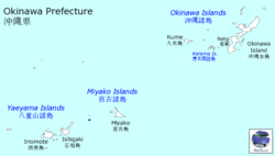
906-0602Website Village of Tarama Tarama (多良間村 Tarama-son, Miyako & Okinawan: Tarama) is a village located in Miyako District, Okinawa, Japan. The village consists of Tarama Island and Minna Island between Ishigaki Island and Miyako Island.
As of 2008, the village has an estimated population of 1,266 and the density of 57.8 persons per km². The total area is 21.91 km².
Tarama Airport serves the island.
External links
 Media related to Tarama, Okinawa at Wikimedia Commons
- Tarama official website (Japanese)
Categories:- Villages in Okinawa Prefecture
- Okinawa geography stubs
Wikimedia Foundation. 2010.


