- Cyclone Percy
-
Severe Tropical Cyclone Percy Category 5 cyclone (Australian scale) Category 5 cyclone (SSHS) 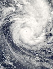
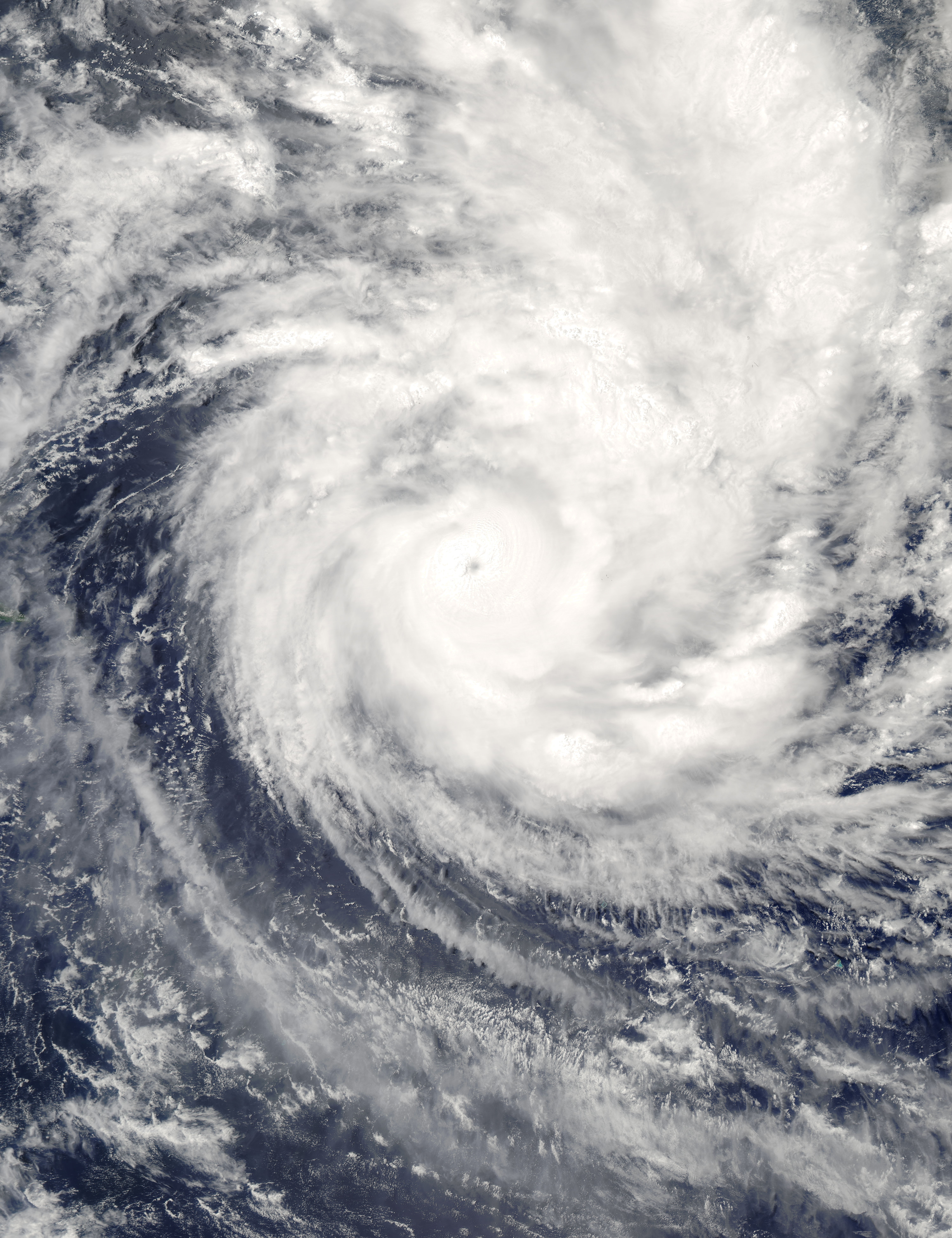
Cyclone Percy at peak intensity Formed 24 February 2005 Dissipated 5 March 2005 Highest winds 10-minute sustained:
230 km/h (145 mph)
1-minute sustained:
260 km/h (160 mph)Lowest pressure 900 mbar (hPa; 26.58 inHg) Fatalities None Areas affected American Samoa, Tokelau, Cook Islands Part of the 2004-05 South Pacific cyclone season Cyclone Percy was the seventh named storm of the 2004-05 South Pacific cyclone season and the fourth and final cyclone to form during the February 2005 outbreak in the South Pacific Ocean.
Percy was also the most damaging of the February cyclones as it battered the Cook Islands, which were still recovering from the impacts of Cyclones Meena, Nancy and Olaf. Percy then devastated the island of Tokelau, leaving many homeless and millions in dollars in property damages (although exact damage figures are unavailable). Because of warnings in anticipation of the storm, there were no deaths and there were only a few injuries.
Contents
Meteorological history
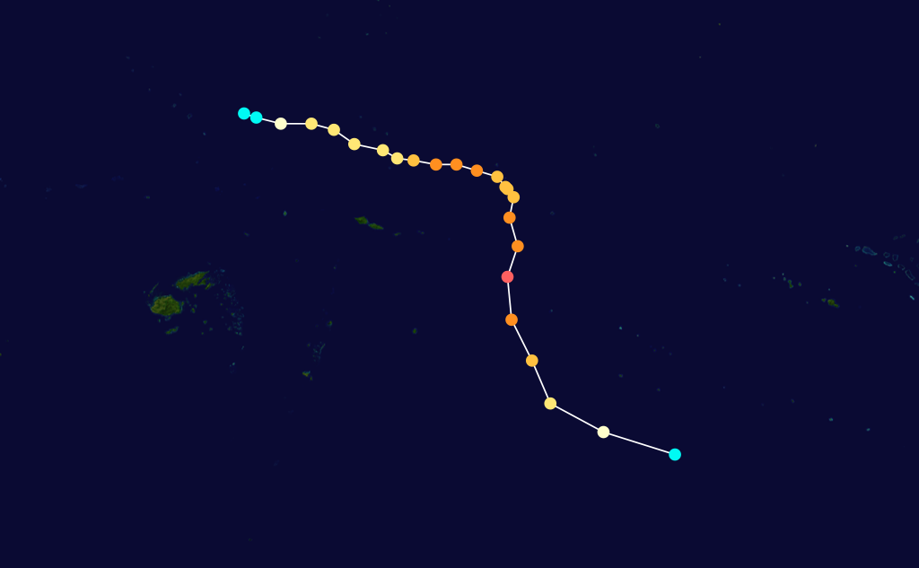
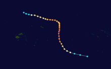 Storm path
A discernible area of low pressure formed east of Tuvalu on 23 February. The area of low pressure moved eastward, where it strengthened into Tropical Depression 10F a day later. Since the depression was located in an area of low wind shear and warm water temperatures, it was able to quickly strengthen into Tropical Storm Percy. At this point in time, Percy was located 120 miles (190 km) east of Fongafale, Tuvalu, and was moving towards the east-southeast at 14 kt (16 mph, 26 km/h). On 26 February, Percy reached Category 1 status, while located 400 miles (644 km) north of American Samoa. While Percy moved east-southeast, a shortwave trough developed southwest of the storm. The trough caused the cyclone to intensify even further to a Category 3 storm as it passed between Fakaofa and Swains Island. Percy then reached Category 4 status north of Pago Pago as it winds reached over 135 mph (115 knots, 213 km/h) and the barometric pressure at its center fell to 925 millibars. On 27 February, Cyclone Percy encountered a high pressure ridge which slowed its forward speed. Because of this, the cyclone's structure became elliptical, which caused the cyclone to weaken back to Category 3 status.[1] By 28 February, Percy bypassed the Pukapuka and Nassau Islands as a Category 3 cyclone as it continued to move east-southeast.
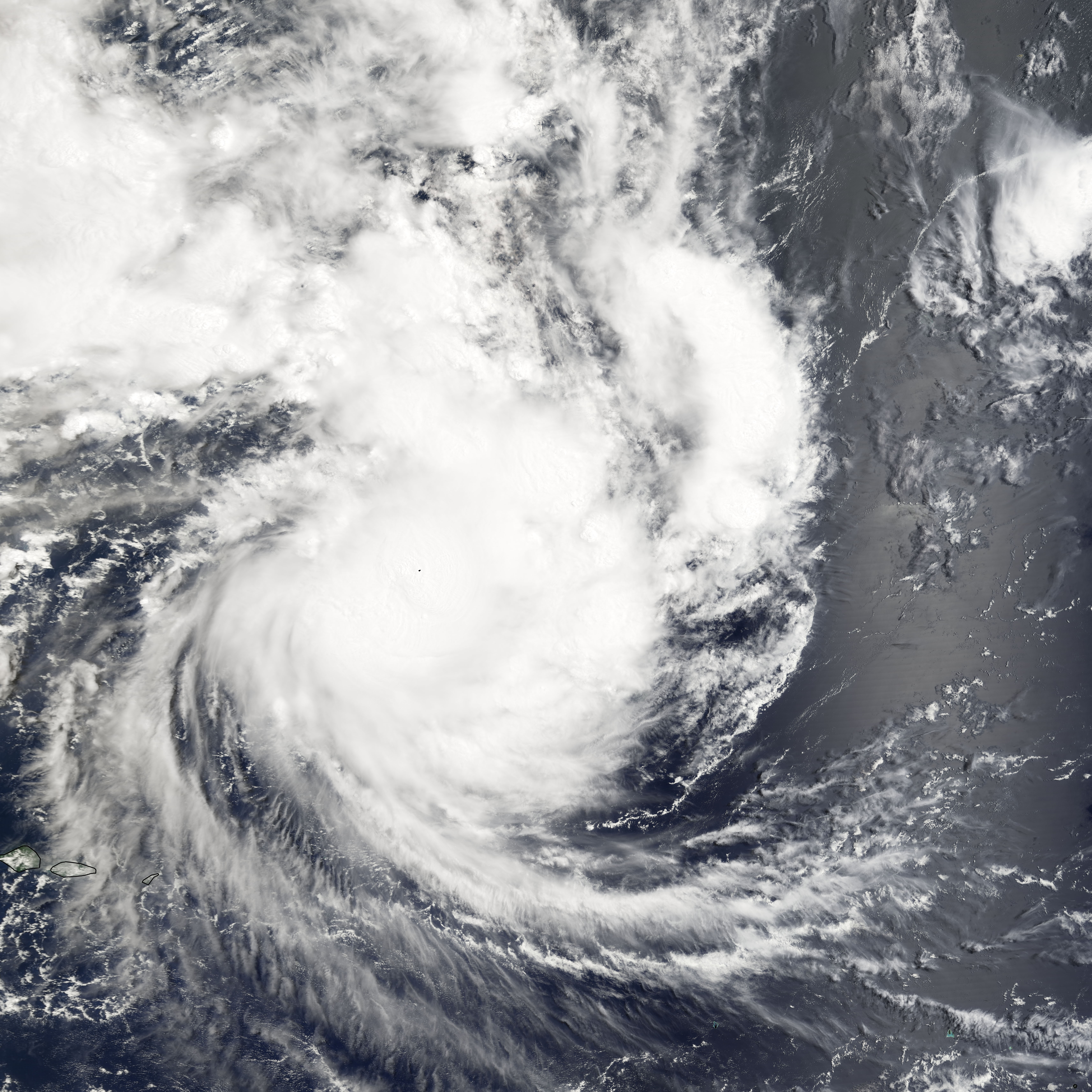
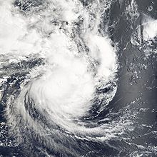 Cyclone Percy hitting Swains Island on 27 February 2005
By then, the cyclone was re-organizing as the storm steered to the southeast. On 2 March, Percy reached its second peak intensity. Its winds reached 160 mph (140 knots, 265 km/h) on the Saffir-Simpson Hurricane Scale, and an estimated barometric pressure of 900 millibars. Cyclone Percy maintained Category 5 status for 18 hours, while located 110 mi (177 km) west of Palmerston Island. After reaching Category 5 status, Percy began to weaken, due to increasing wind shear. During its weakening phase, Cyclone Percy passed south of Tropical Depression 20S. Pulled by an upper level trough, Percy swung to the east, passing Tropical Depression 24S in the process, before being caught up by another trough. By 4 March, the center of Percy became detached from the main area of convection and Percy quickly weakened to a tropical storm. Tropical Storm Percy then quickly accelerated to 20 kt (23 mph, 37 km/h) as it became an extratropical storm.[1]
Percy briefly entered the New Zealand area of responsibility before becoming extratropical at 1200 UTC. By 5 March, the remnants of Percy finally dissipated 700 mi (1127 km) southwest of Rarotonga.[1]
Preparations
When Percy quickly reached cyclone strength, forecasters began to issue watches and warnings for the American Samoa and Tokelau areas, which were impacted by earlier storms Nancy and Olaf.[2] As Percy continued to move eastward, forecasters predicted the storm to strengthen into a Category 2 or Category 3 storm within 12–24 hours. meanwhile, forecasters issued gale warnings for Tokelau.[3] On 26 February, forecasters predicted Percy would stay on its current track and miss the island of Atafu by 50–70 miles (80–113 km), even though the storm could bring damaging gale force winds and heavy rains to the island. However, forecasters predicted Percy would make landfall on Tokelau. In American Samoa, hurricane warnings were issued for Swains Island, while the rest of American Samoa remained under a hurricane watch.[4] Later, the gale warnings for Tokelau were changed to hurricane warnings as Percy moved to within 75 miles (121 km) north of Atafu. In Nukunou and Fakaofo, forecasters predicted that the cyclone would bring 60-70 mph (95–111 km/h) winds, heavy rains and possible flooding in low lying areas.[5]
Forecasters predicted that Cyclone Percy was going to turn to the southeast and hit the islands of Pukapuka and Nassau directly. Because of this, evacuations were ordered and emergency shelters were activated in Rarotonga. Forecasters also predicted that Percy was going to cause a strong storm surge. The Joint Typhoon Warning Center and NOAA also predicted that the storm was going to strengthen further within 12–24 hours. In addition, forecast models predicted that Cyclone Percy would take a similar track like Cyclone Olaf weeks earlier. That prompted officials in the southern Cook Islands to order evacuations.[6]
Impact
Like the earlier cyclones Meena, Nancy, and Olaf, Percy left widespread damage across Swains Island, Tokelau, and the northern Cook Islands. However, because of well-executed warnings, there were no deaths and there were only a few injuries. Percy was the worst cyclone to strike Tokelau since a similar cyclone hit the area in 1966.[7]
American Samoa and Tokelau
The strong winds from Percy knocked out power and communications infrastructure in Swains Island. Efforts to re-establish contact with the island were unsuccessful for a week. After the storm, however, all eight people who rode out the storm survived, though nine of the eleven buildings on the islands were destroyed or severely damaged.[1] Damage in American Samoa was minimal.[8] In Tokelau, Percy damaged trees and knocked down powerlines.[1] During the height of the storm, one person was injured by flying debris, and two others were swept out to sea, but all three survived. In Nokonunu, the cyclone destroyed the only school and damaged 80% of the structures. The local hospital completely lost power during the storm and its emergency generator was overwhelmed by the flooding.[9][10]
In Fakaofo, the storm surge from Percy partially damaged a sea wall and caused major beach erosion. One house was destroyed while others were severely damaged. Percy also damaged much of the coconut harvest and 50% of the livestock were killed by the cyclone. Atafu also suffered similar damage as the storm damaged a UHF tower and several storage sheds. Damage to crops was also significant as the storm damaged much of the banana and pandanus harvests. The schools in Atafu suffered only minimal damage (mostly wind damage).[10]
Cook Islands
The northern Cook Islands were hardest hit by Percy as the storm left 640 people homeless, of which 600 were in Pukapuka, and 40 were in Nassau. Of the buildings and houses destroyed or severely damaged, only ten were left standing.[1] One person was rescued when his fishing boat stalled during the storm.[11] Percy also damaged a solar power station, making it inoperable.[12] Percy also battered the southern Cook Islands while weakening, although the damage there was minimal.[13]
Aftermath
Relief efforts followed after Cyclone Percy. In Swains Island, a rescue plane dropped food and supplies.[1] In Tokelau and northern Cook Islands, the governments of Australia and New Zealand offered over $200,000 dollars (2005 USD) in relief aid.[14]
In Tokelau, many of the local officials feared about contamination since the cyclone had scattered human waste, trash, and other debris in the ocean and across the island. There was also an increase of mosquitoes and other insects, increasing the threat of a dengue fever outbreak. In addition, the storm damaged many of the hospitals, making treatment of the injured or displaced difficult.[15] Criticism of government preparedness followed after Percy as emergency plans were not easily understood by the local population. In Nukunonu, the school, which was destroyed by Percy, was poorly built and vulnerable, and there was no early warning system. Also, many of the population had little time to prepare for the storm because of a social event held hours earlier.[10]
See also
References
- ^ a b c d e f g Percy report Retrieved:12 June 2006
- ^ AP Warning 1 Retrieved:12 June 2006
- ^ AP Warning 2 Retrieved:12 June 2006
- ^ AP Warning 3 Retrieved:12 June 2006
- ^ AP Warning 4 Retrieved:12 June 2006
- ^ AP Warning 5 Retrieved:12 June 2006
- ^ Evaluations and Lessons Learned: Cook Islands and Tokelau: Tropical Cyclone Percy - March 2005, Cook Islands and Tokelau: Tropical Cyclone Percy - OCHA Situation Report No. 5, Situation Reports: Cook Islands and Tokelau: Tropical Cyclone Percy - 20 March
- ^ AP Warning Retrieved 12 June 2006
- ^ ABC (Australia) News Online: Percy devastates Tokelau
- ^ a b c UNDP damage assessment Retrieved 12 June 2006
- ^ Planet Ark.com: State of Emergency declared after Cyclone Percy Retrieved:12 June 2006
- ^ www.ser.org
- ^ Keepmedia.com Retrieved:12 June 2006
- ^ Australian Government Overseas Aid Retrieved:12 June 2006
- ^ Relief Web Retrieved:12 June 2006
External links
- Joint Typhoon Warning Center (JTWC).
- Fiji Meteorological Service (RSMC Nadi).
- Meteorological Service of New Zealand, Ltd. (TCWC Wellington).
1970s 1980s 1990s 2000s 2010s Categories:- Retired South Pacific cyclones
- 2004–05 South Pacific cyclone season
- 2005 in American Samoa
- 2005 in the Cook Islands
- 2005 in Tokelau
- Tropical cyclones in the Cook Islands
- Category 5 South Pacific cyclones
Wikimedia Foundation. 2010.