- Temiskaming Shores, Ontario
Infobox City
official_name = City of Temiskaming Shores
other_name =
native_name =
nickname =
motto =
imagesize =
image_caption =
flag_size =
image_
seal_size =
image_shield =
shield_size =
image_blank_emblem =
blank_emblem_size =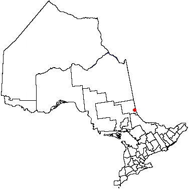
mapsize =
map_caption =
pushpin_
pushpin_label_position =
subdivision_type = Country
subdivision_name =Canada
subdivision_type1 = Province
subdivision_name1 =Ontario
subdivision_type2 = District
subdivision_name2 = Timiskaming District
subdivision_type3 =
subdivision_name3 =
subdivision_type4 =
subdivision_name4 =
government_type =
leader_title = Mayor
leader_name = Judy Pace
leader_title1 = Governing Body
leader_name1 = Temiskaming Shores City Council
leader_title2 =MPs
leader_name2 =Anthony Rota (LPC)
leader_title3 =MPPs
leader_name3 =David Ramsay (OLP)
leader_title4 =
leader_name4 =
established_title = Established
established_date = 2004
established_title2 =
established_date2 =
established_title3 =
established_date3 =
area_magnitude =
unit_pref =
area_footnotes =
area_total_km2 =
area_land_km2 =
area_water_km2 =
area_total_sq_mi =
area_land_sq_mi =
area_water_sq_mi =
area_water_percent =
area_urban_km2 =
area_urban_sq_mi =
area_metro_km2 =
area_metro_sq_mi =
population_as_of = 2006
population_footnotes =ref label|Stats_Canada|1|1(sc)
population_note =
settlement_type =
population_total = 10,732
population_density_km2 =
population_density_sq_mi =
population_metro =
population_density_metro_km2 =
population_density_metro_sq_mi =
population_urban =
population_density_urban_km2 =
population_density_urban_mi2 =
timezone = EST
utc_offset = −5
timezone_DST = EDT
utc_offset_DST = −4
latd=47 |latm=31 |lats= |latNS=N
longd=79 |longm=41 |longs= |longEW=W
elevation_footnotes =
elevation_m = 347.5
elevation_ft =
postal_code_type = Postal code
postal_code = P0J
area_code =705
website = [http://www.temiskamingshores.ca/ City of Temiskaming Shores]
footnotes =Temiskaming Shores is a
city inNortheastern Ontario ,Canada . It was created by the amalgamation of the town of New Liskeard, the town of Haileybury, and the township of Dymond in 2004. The city had a totalpopulation of 10,442 in theCanada 2006 Census . Temiskaming Shores is Ontario's second-smallest city, in terms of population, after Dryden. Haileybury is the seat of Timiskaming District.Prior to the amalgamation of Temiskaming Shores, the region was commonly nicknamed The Tri-Towns, a designation that also encompassed the neighbouring town of Cobalt. Cobalt was also part of the original Temiskaming Shores amalgamation plan, but ultimately rejected the proposal. The Tri-Towns designation may still be used on occasion, but has become significantly less common since the municipal amalgamation.
Geography
Temiskaming Shores is located along the southern edge of the
Clay Belt area, near theQuebec border on the shores ofLake Timiskaming 's Wabi Bay. The separate township municipality of Harris separates the city from the Ontario-Quebec border. The nearest town on the Quebec side of the border is Notre-Dame-du-Nord.The city is located within the
Timiskaming Graben , a smaller branch of the Ottawa Valley. A largeescarpment , known asDevil's Rock , is located near Haileybury.History
The
Ottawa River , which drains into and out of Lake Timiskaming, has been a well-travelled route from the earliest times, and served as the initial point of access to the Temiskaming area. Native peoples travelled this route, followed byvoyageurs after theHudson's Bay Company established a trading post on Bear Island in nearbyLake Temagami . In 1886, Alexander H. Telfer led a survey trip up Lake Timiskaming and gave a report to the Temiskaming Settlers' Association. [Worth Travelling Miles to See: Diary of a Survey Trip to Lake Temiskaming 1886By A. H. Telfer] By this time, the Quebec side of Lake Timiskaming was also being settled, and steamboats, the primary mode of transportation in the area, were ferrying new settlers into the area.Before more settlements could be established, The Quebec - Ontario boundary north of Lake Timiskaming had to be accurately surveyed. Earlier surveys by Quebec and Ontario resulted in a boundary dispute, so the Canadian government sent a survey team to resolve the issue in 1890. William Ogilvie, who had recently distinguished himself by accurately surveying the Canada - Alaska boundary, led the expedition. A benchmark near Mattawa was used to establish an accurate benchmark north of Lake Timiskaming, using astronomical methods. From the head of Lake Timiskaming, they proceeded north to James Bay, fixing accurate positions of the provincial boundary at regular intervals using
geodesy data derived fromstar transit s. Ogilvie's journal describe conditions in this area and the early settlers he met. His report on this expedition describes the details of this expedition. [Report of exploratory survey to Hudson's Bay, William Ogilvie 1891]Land in the area was not offered for sale until the 1890s, when Crown Lands Agent John Armstrong was dispatched to the area. The first settlers in the area arrived in Dymond in 1891, attracted by the offer of cheap land. They founded a prosperous agricultural center, taking advantage of the rich soil in the Little Claybelt region. New Liskeard was founded soon after settlers began to arrive in Dymond, and the two towns were soon incoroporated, in 1903 and 1901, respectively. John Armstrong served as New Liskeard's first Mayor. His descendents still live in the area today.
Haileybury was founded in 1889 by Charles Cobbold Farr, who named the newly-founded town after the
Haileybury and Imperial Service College , his former school in England. Haileybury was formally incorporated as a town in 1904. Farr encouraged settlement in the area, penning his own promotional pamphlet, entitled "The Lake Temiskamingue District", in an effort to attract new settlers to the region. Marketed to settlers as prime agricultural land, Haileybury had only a handful of residents until the arrival of the Temiskaming and Northern Ontario Railway in the early 1900s, and the subsequent discovery of large silver deposits in neighboring Cobalt in 1903. During the Cobalt's Silver Rush, Haileybury became a 'bedroom community' that served the needs of the many miners and, most famously, many mine owners and managers. These mine managers and owners were responsible for the construction of the row of stately homes, nicknamed 'Millionare's Row' that stretched along the waterfront on what is now Lakeshore Road, many of which still stand today. In 1909, theHaileybury Hockey Club played its first and only season in the NHA. The club was taken over and moved by Montreal's Club Antique-Canadien for the following season, and became theMontreal Canadiens . By 1912, Haileybury had been named the Judicial Seat for the Temiskaming Region, a title it retains to this day. The town of Haileybury annexed the neighbouring community of North Cobalt in 1971.The region was affected by the
Great Fire of 1922 , considered one of the worst disasters ever to befall the area. Haileybury suffered the worst damage, and approximately ninety percent of the town was destroyed, leaving only Millionare's Row and a few other neighborhoods intact. The mass destruction is partially attributable to strong wind on the day of the fire. Approximately 3500 people were left homeless by the fire. As well, the area was affected by the1935 Timiskaming earthquake , which had its epicentre atLac Kipawa in Quebec, approximately halfway between the Haileybury/New Liskeard area and North Bay.In more recent history, Dymond still functions largely as an agricultural center, while the commercial and industrial interests in the area have mostly shifted operations to the former town of New Liskeard Fact|date=September 2008. Haileybury maintains its status as a judicial seat, and is also home to the new City Hall. A strong link to agriculture means that Temiskaming Shores has largely avoided the boom-and-bust cycle typical of most mining- and forestry-dependent small towns, and has been able to maintain a stable population base with a healthy local economyFact|date=September 2008. Temiskaming Shores has also become an ideal retirement and recreational destinationFact|date=September 2008, with small retirement communities like the Bayport Village being developed in the former town of Haileybury.
Amalgamation issues
Though now established as one city, Temiskaming Shores is not fully integrated as such — there exists a noticeable demarcation between New Liskeard/Dymond and Haileybury/North Cobalt. The downtown areas of New Liskeard and Haileybury are separated by 8 km-long Lakeshore Road. Most of this road's length does not include
sidewalks and this makes it quite impractical to travel through the city without using amotor vehicle . The proposed STATO Trail would resolve this problem. Construction on the STATO trail began recently. The inaugural section was paved in early June, and runs along the waterfront by City Hall.City council has yet to approach
Canada Post to have Temiskaming Shores recognized as a mailing address. Currently, mail is delivered to PO boxes and rural routes in the pre-amalgamation towns of New Liskeard (P0J 1P0), Haileybury (P0J 1K0), and North Cobalt (P0J 1R0).Transportation
Highway 11 and Highway 65 pass through the city. The primary arterial route through Haileybury and New Liskeard also formerly held the
business route designation Highway 11B.Temiskaming Shores and Cobalt share a small
public transit system, Tri-Town Transit.hopping
The city's one shopping mall,
Timiskaming Square , is located in the Dymond area.Education
eparate schools
*Ecole catholique Sainte-Croix, Ecole catholique Sacré-Coeur, Ecole catholique St-Michel, Ecole catholique secondaire Sainte-Marie (administered by
Conseil scolaire catholique de district des Grandes-Rivières )
*English Catholic Central School, St. Patrick School (administered byNortheastern Catholic District School Board )Public schools
*New Liskeard Public School, Haileybury Public School, Temiskaming District Secondary School (administered by
District School Board Ontario North East )
*Ecole publique des Navigateurs (administered byConseil scolaire de district du Nord-Est de l'Ontario )Colleges
*
Northern College
*Collège Boréal Media
Radio
*99.7 FM CBON-2,
Première Chaîne
*102.3 FM CBCY,CBC Radio One
*103.1 FM CJBB, community
*103.5 FM CHIM-4, religious
*104.5 FM CJTT,adult contemporary Newspapers
* [http://www.journallereflet.com/ Le Reflet] (published weekly)
*Northern News (published tri-weekly)
* [http://speaker.northernontario.ca/ The Temiskaming Speaker] (published weekly)
* [http://weekender.northernontario.ca/ The Temiskaming Speaker weekender] (published weekly)
* [http://www.prismpublishing.ca/ The Voice of the Shores] (published every two weeks)Notable residents
See .
References
External links
* [http://www.temiskamingshores.ca/ Official Website of the City of Temiskaming Shores]
* [http://www.tembrella.com Tembrella - promoting the growth of businesses and ideas in the area]
* [http://www.bikersreunion.ca/ Temiskaming Shores Annual Bikers Reunion]
* [http://ontarioplaques.com/Plaques_STU/Plaque_Timiskaming08.html Ontario Plaques - Founding of New Liskeard]
* [http://ontarioplaques.com/Plaques_STU/Plaque_Timiskaming09.html Ontario Plaques - Great Fire of 1922]
* [http://www.embargo.ca/highway11/Timiskaming/TM-10-NewLiskeard.htm Ontario Highway 11 Homepage – New Liskeard]
* [http://www.embargo.ca/highway11/Timiskaming/TM-11-Dymond.htm Ontario Highway 11 Homepage – Dymond]
* [http://www.embargo.ca/highway11/Timiskaming/TM-09-Haileybury.htm Ontario Highway 11 Homepage – Haileybury]
* [http://www.tri-town.ca Tri-town website with reunion photos]Geographic Location (8-way)
Centre = Temiskaming Shores
North = Harley
Northeast = Casey
East = Harris
Southeast = Unorganized West Timiskaming, "Lake Timiskaming "
South = Coleman, Cobalt
Southwest =
West = Hudson
Unorganized West Timiskaming
Northwest = Kerns
Wikimedia Foundation. 2010.