- Chickamauga Dam
-
Chickamauga Dam 
Chickamauga Lock and DamOfficial name Chickamauga Dam Location Chattanooga, Tennessee, USA Coordinates 35°06′14″N 85°13′46″W / 35.10389°N 85.22944°WCoordinates: 35°06′14″N 85°13′46″W / 35.10389°N 85.22944°W Construction began January 13, 1936 Opening date January 15, 1940 Dam and spillways Height 129 ft (39 m) Length 5,800 ft (1,800 m) Impounds Tennessee River Reservoir Creates Chickamauga Lake Chickamauga Dam is a hydroelectric dam on the Tennessee River in Chattanooga, Tennessee, USA. The dam is owned and operated by the Tennessee Valley Authority, which built the dam in the late 1930s as part of a New Deal era initiative to improve navigation and bring flood control and economic development to the Tennessee Valley. The dam impounds the 36,240-acre (14,670 ha) Chickamauga Lake and feeds into Nickajack Lake. Chickamauga Dam is named for the Chickamauga, a politically-detached branch of the Cherokee whose chief village was located just north of the dam site during the 18th century.[1] The tribe's name has also been applied to several streams in the Chattanooga area, as well as an important American Civil War battle and a sandbar that existed at the dam site prior to its construction.[2]
Contents
Location
Chickamauga Dam is located 471 miles (758 km) upstream from the mouth of the Tennessee River, just east of downtown Chattanooga at the river's confluence with North Chickamauga Creek. The reservoir stretches for 59 miles (95 km) from Chickamauga Dam to the base of Watts Bar Dam, and includes parts of Hamilton, Bradley, McMinn, Polk, Rhea, and Meigs counties. The reservoir's notable embayments include Harrison Bay at its confluence with Wolftever Creek approximately 10 miles (16 km) upstream from the dam and the Soddy Creek embayment at 20 miles (32 km) upstream. Along with its main Tennessee River channel, the reservoir is navigable across the lower 18 miles (29 km) of the Hiwassee River, which joins the Tennessee River 30 miles (48 km) above the dam.[2]
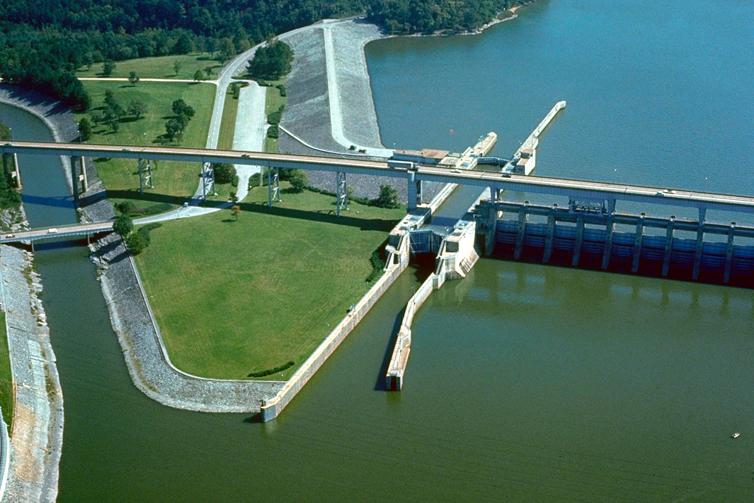
The Wilkes T. Thrasher Bridge carries Tennessee State Route 153 across the top of Chickamauga Dam. The road connects the dam to Interstate 75 to the south and U.S. Route 27 to the north. The Tennessee Riverwalk, a 10-mile (16 km) walkway along the Tennessee River, begins at the dam.
Capacity
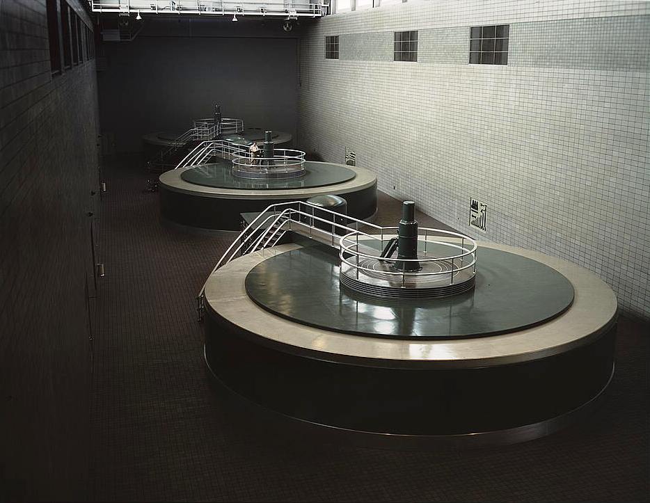
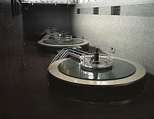 Generator hall of the powerhouse
Chickamauga Dam is a concrete gravity-type dam 5,800 feet (1,800 m) long and 129 feet (39 m) high.[1] Its hydroelectric generating capacity is 160 megawatts.[1] The dam has 18 spillway bays with a combined discharge of 470,000 cubic feet per second (13,000 m3/s).[2]
A 60-by-360-foot (18 by 110 m) navigation lock allows barges and other boats to travel past the dam, raising or lowering vessels 53 feet (16 m) between Chickamauga and Nickajack reservoirs.[1] Because the concrete of the original lock has deteriorated due to "concrete growth" caused by chemical reactions between its constituent cement and rock aggregate, a $375 million project to replace the lock began in 2003. The new 110-by-660-foot (34 by 200 m) lock was scheduled to be completed by 2014.[3]
Background and construction
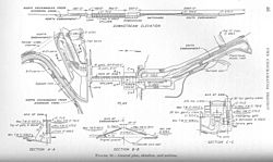 Design plan for Chickamauga Dam, circa 1935
The U.S. Army Corps of Engineers surveyed the Chickamauga Island site in the 1920s as a possible site for a dam to protect Chattanooga, which had suffered serious flood damage in 1867, 1875, 1886, and 1917, and to enhance navigation along the river. When the Tennessee Valley Authority was formed in the mid-1930s, it assumed control of navigation and flood control operations in the Tennessee Valley. After extensive surveying, TVA chose the tip of Chickamauga Island over several other sites surveyed by the Army Corps in the vicinity. The Chickamauga project was authorized December 31, 1935, and dam construction began January 13, 1936.[2]
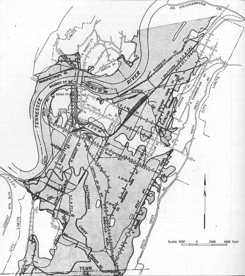
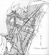 Map showing the parts (shaded) of downtown Chattanooga flooded when the Tennessee River broke its banks in March 1867
The construction of Chickamauga Dam and its reservoir required the purchase of 61,350 acres (24,830 ha) of land, 6,030 acres (2,440 ha) of which were wooded and had to be cleared. 903 families, 24 cemeteries, and 81 miles (130 km) of roads had to be relocated. An embankment was built to protect parts of Dayton, Tennessee from the reservoir's backwaters, and several roads and buildings in the town of Soddy were relocated or modified. A total of 39 bridges affected by the reservoir were either raised or moved.[2]
The navigation lock at Chickamauga Dam was designed by the Army Corps of Engineers, and was based on the lock design at Guntersville Dam. The lock was initially 60 by 360 feet (18 × 110 m), although the dam was designed in a way that allowed a larger 110 by 600 feet (34 × 180 m) lock to be installed if increases in river traffic ever required it.[2]
Chickamauga Dam was completed and its gates closed on January 15, 1940, constructed at a cost of $42,065,000. The lock was placed into operation on February 26, 1940, and the first generator went online May 4, 1940. Two recreational areas— Booker T. Washington State Park and Harrison Bay State Park— were developed as segregated parks along Chickamauga Lake's shores, with the former originally being for African-Americans and the latter originally being for caucasians.[2]
See also
- Hales Bar Dam
- Dams and reservoirs of the Tennessee River
- List of crossings of the Tennessee River
References
- ^ a b c d TVA: Chickamauga Reservoir fact sheet, TVA website
- ^ a b c d e f g Tennessee Valley Authority, The Chickamauga Project: A Comprehensive Report on the Planning, Design, Construction, and Initial Operations of the Chickamauga Project, Technical Report No. 6 (Knoxville, Tenn.: Tennessee Valley Authority, 1942), 1-12, 41-43, 49, 246.
- ^ New lock takes shape at Chickamauga Dam, Chattanooga Times Free Press, August 11, 2008
- "Chickamauga Dam". Geographic Names Information System. United States Geological Survey. http://geonames.usgs.gov/pls/gnispublic/f?p=gnispq:3:::NO::P3_FID:1280433. Retrieved 2006-05-02.
External links
Kentucky • Pickwick Landing • Wilson • Wheeler • Guntersville • Nickajack • Chickamauga • Watts Bar • Fort LoudounFacilities operated by the Tennessee Valley Authority Dams and hydroelectric
generating stationsApalachia · Bear Creek · Beaver Creek · Beech · Blue Ridge · Boone · Cedar · Cedar Creek · Chatuge · Cherokee · Chickamauga · Clear Creek · Dogwood · Douglas · Fontana · Fort Loudoun · Fort Patrick Henry · Great Falls · Guntersville · Hiwassee · Kentucky · Little Bear Creek · Lost Creek · Melton Hill · Nickajack · Nolichucky · Normandy · Norris · Nottely · Ocoee 1 · Ocoee 2 · Ocoee 3 · Pickwick Landing · Pin Oak · Pine · Raccoon Mountain · Redbud · South Holston · Sycamore · Tellico · Tims Ford · Upper Bear Creek · Watauga · Watts Bar · Wheeler · Wilbur · Wilson
Coal-fired power plants Allen · Bull Run · Colbert · Cumberland · Gallatin · John Sevier · Johnsonville · Kingston · Paradise · Shawnee · Widows CreekCombustion turbine plants Caledonia · Gleason · Kemper · Lagoon Creek · MarshallNuclear power plants Categories:- Tennessee River
- Dams in Tennessee
- Hydroelectric power plants in Tennessee
- Tennessee Valley Authority
- Buildings and structures in Chattanooga, Tennessee

Wikimedia Foundation. 2010.