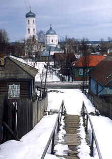
- Mariinsky Posad
-
Coordinates: 56°07′N 47°43′E / 56.117°N 47.717°E
 Coat of arms of Mariinsky Posad
Mariinsky Posad (Russian: Марии́нский Поса́д; Chuvash: Сĕнтĕрвăрри, Sĕntĕrvărri) is a town and the administrative center of Mariinsko-Posadsky District of the Chuvash Republic, Russia, located on the right bank of the Volga River, 36 kilometers (22 mi) east of Cheboksary. Population: 9,089 (2010 Census preliminary results);[1] 10,273 (2002 Census);[2] 10,443 (1989 Census).[3]
It started as the village of Sundyr (Сундырь), which was founded in 1620 and named after the Sundyrka River (a Volga tributary). It was renamed Mariinsky Posad after Empress consort Maria Alexandrovna in 1856 and granted town status that same year.
The area around the town has rich wildlife. There are several national parks and reservations nearby. The area is a popular ecological tourism destination.
There are eleven processing, mechanical engineering, and construction materials factories in the town. Some of the other industries of employment in the city are a plant of cable works, a large automobile-repairing industry, a distillery, and a cooking oil-producing plant.
Education
The town has several schools.
References
- ^ Федеральная служба государственной статистики (Federal State Statistics Service) (2011). "Предварительные итоги Всероссийской переписи населения 2010 года (Preliminary results of the 2010 All-Russian Population Census)" (in Russian). Всероссийская перепись населения 2010 года (All-Russia Population Census of 2010). Federal State Statistics Service. http://www.perepis-2010.ru/results_of_the_census/results-inform.php. Retrieved 2011-04-25.
- ^ Федеральная служба государственной статистики (Federal State Statistics Service) (2004-05-21). "Численность населения России, субъектов Российской Федерации в составе федеральных округов, районов, городских поселений, сельских населённых пунктов – районных центров и сельских населённых пунктов с населением 3 тысячи и более человек (Population of Russia, its federal districts, federal subjects, districts, urban localities, rural localities—administrative centers, and rural localities with population of over 3,000)" (in Russian). Всероссийская перепись населения 2002 года (All-Russia Population Census of 2002). Federal State Statistics Service. http://www.perepis2002.ru/ct/doc/1_TOM_01_04.xls. Retrieved 2010-03-23.
- ^ "Всесоюзная перепись населения 1989 г. Численность наличного населения союзных и автономных республик, автономных областей и округов, краёв, областей, районов, городских поселений и сёл-райцентров. (All Union Population Census of 1989. Present population of union and autonomous republics, autonomous oblasts and okrugs, krais, oblasts, districts, urban settlements, and villages serving as district administrative centers.)" (in Russian). Всесоюзная перепись населения 1989 года (All-Union Population Census of 1989). Demoscope Weekly (website of the Institute of Demographics of the State University—Higher School of Economics. 1989. http://demoscope.ru/weekly/ssp/rus89_reg.php. Retrieved 2010-03-23.
Administrative divisions of the Chuvash Republic 
Cities and towns 
Administrative districts Alatyrsky · Alikovsky · Batyrevsky · Cheboksarsky · Ibresinsky · Kanashsky · Komsomolsky · Kozlovsky · Krasnoarmeysky · Krasnochetaysky · Mariinsko-Posadsky · Morgaushsky · Poretsky · Shemurshinsky · Shumerlinsky · Tsivilsky · Urmarsky · Vurnarsky · Yadrinsky · Yalchiksky · YantikovskyCategories:- Cities and towns in the Chuvash Republic
- Populated places on the Volga
Wikimedia Foundation. 2010.

