- Membury services
-
Membury Services 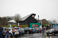
County Berkshire Road M4 Coordinates 51°28′50″N 1°33′25″W / 51.480679°N 1.55686°WCoordinates: 51°28′50″N 1°33′25″W / 51.480679°N 1.55686°W Operator Welcome Break Date opened 1972[1] Website Welcome Break 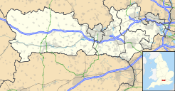
 Membury services (Berkshire)
Membury services is a motorway service station on the M4 motorway. It is located on the original site of the RAF Membury in the civil parish of Lambourn in the English county of Berkshire, not far from Swindon and Marlborough. It is owned by Welcome Break and is situated adjacent to the Membury Radio Mast.
The service station is one of fourteen for which large murals were commissioned from artist David Fisher in the 1990s, designed to reflect the local area and history.[2]
The Iron Age hillfort, Membury Camp, lies to the immediate southwest of the old airfield and the services.
References
- ^ Motorway Services Trivia - Chronology - Accessed 16 February 2009
- ^ http://www.davidfisherartist.co.uk/achievements.html
External links
The Service Area provides a pedestrian footbridge over the M4 Motorway, both sides are linked Membury East & Membury West. The Waitrose Supermarket is on the West side (Membury West Services), this was part of Welcome Break's business expansion.
Membury East Services:
- Starbucks Coffee
- KFC
- Burger King
- W H Smith
- Eat In
- Fone Bitz
- Picnic Tables
- Toilets
- Pedestrian Footbridge
- CP-Plus Parking
Membury West Services:
- Starbucks Coffee
- KFC
- Burger King
- W H Smith
- Eat In
- Fone Bitz
- Waitrose
- Picnic Tables
- Toilets
- Pedestrian Footbridge
- CP-Plus Parking
Previous:
ChieveleyMotorway service stations on the
M4 MotorwayNext:
Leigh DelamereLocations Abington · Birchanger Green · Burtonwood · Cardiff Gate · Charnock Richard · Corley · Derby South · Fleet · Gretna Green · Gordano · Hartshead Moor · Hopwood Park · Keele · Leicester Forest East · London Gateway · Membury · Michaelwood · Newport Pagnell · Oxford · Sarn Park · Sedgemoor (northbound) · South Mimms · Telford · Warwick · WoodallFood Franchises Retail Franchises Fuel Franchises Accomodation Franchises Days Inn ·Categories:- Buildings and structures in Berkshire
- M4 motorway service stations
- Welcome Break motorway service stations
- West Berkshire


Wikimedia Foundation. 2010.