- Puncak Jaya
-
Puncak Jaya Carstensz Pyramid 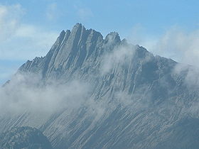
Peak of Puncak Jaya.Elevation 4,884 m (16,024 ft) [1] Prominence 4,884 m (16,024 ft) Ranked 9th Listing Seven summits
Country high point
Ultra
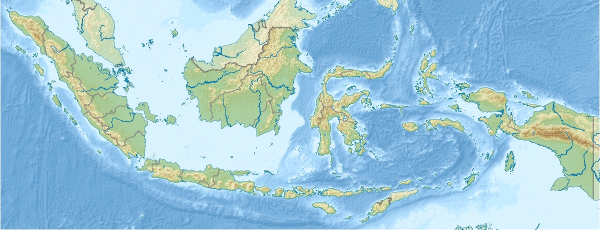
RibuLocation Papua Province, Indonesia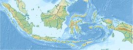
 Puncak Jaya
Range Sudirman Range Coordinates 4°4′44″S 137°9′30″E / 4.07889°S 137.15833°ECoordinates: 4°4′44″S 137°9′30″E / 4.07889°S 137.15833°E Climbing First ascent 1936 by Colijn, Dozy, and Wissels
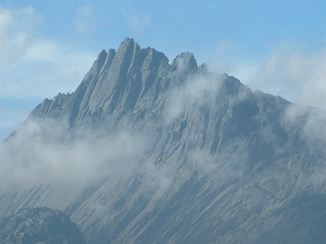
1962 by Harrer, Temple, Kippax and HuizengaEasiest route rock/snow/ice climb Puncak Jaya (pronounced [ˈpuntʃaʔ ˈdʒaja]) or Carstensz Pyramid (4,884 m) is the highest summit of Mount Carstensz (/ˈkɑrstəns/) in the Sudirman Range of the western central highlands of Papua province, Indonesia (within Puncak Jaya Regency). Other summits are East Carstensz Peak (4,808 m) and Ngga Pulu (4,863). Other names include Nemangkawi in the Amungkal language, Carstensz Toppen and Gunung Sukarno.[2]
At 4,884 metres (16,024 ft) above sea level, Puncak Jaya is the highest mountain in Indonesia, the highest on the island of New Guinea (which comprises the Indonesian West Papua region plus Papua New Guinea), the highest of Oceania (Australia), and the 5th highest mountain in political Southeast Asia. It is also the highest point between the Himalayas and the Andes, and the highest island peak in the world. Some sources claim Mount Wilhelm, 4,509 m (14,793 ft), as the highest mountain peak in Oceania, on account of Indonesia being part of Asia (Southeast Asia).[3]
Contents
Discovery
The highlands surrounding the peak were inhabited before European contact, and the peak was known as Nemangkawi in Amungkal. Puncak Jaya was named "Carstensz Pyramid" after Dutch explorer Jan Carstenszoon who first sighted the glaciers on the peak of the mountain on a rare clear day in 1623.[4] The sighting went unverified for over two centuries, and Carstensz was ridiculed in Europe when he said he had seen snow near the equator. This name is still used among mountaineers.[5]
The snowfield of Puncak Jaya was reached as early as 1909 by a Dutch explorer, Hendrik Albert Lorentz with six of his indigenous Dayak Kenyah porters recruited from the Apo Kayan in Borneo,[6]. The predecessor of the Lorentz National Park, which encompasses the Carstensz Range, was established in 1919 following the report of this expedition.
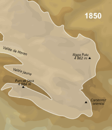 Animated map of the extend of the glaciers of the Carstens Range from 1850 to 2003
Climbing history
In 1936 the Dutch Carstensz Expedition, unable to establish definitely which of the three summits was the highest, attempted to climb each. Anton Colijn, Jean Jacques Dozy and Frits Wissel reached both the glacier covered East Carstensz and Ngga Pulu summits on December 5, but through bad weather failed in their attempts to climb the bare Carstensz Pyramid. Because of extensive snow melt Ngga Pulu has become a 4,862 m subsidiary peak, but it has been estimated that in 1936 (when glaciers still covered 13 square km of the mountain; see map) Ngga Pulu was indeed the highest summit, reaching over 4,900 m.[7]
The now highest Carstensz Pyramid summit was not climbed until 1962, by an expedition led by the Austrian mountaineer Heinrich Harrer (of Seven Years in Tibet fame, and climber of the Eiger North Face) with three other expedition members – Philip Temple, Russell Kippax and Bert Huizenga. Temple, from New Zealand, had previously led an expedition into the area and pioneered the access route to the mountains.
When Indonesia took control of the province in 1963, the peak was renamed 'Puntjak Soekarno' (Simplified Indonesian: Puncak Sukarno) or Sukarno Peak, after the first President of Indonesia; later this was changed to Puncak Jaya. Puncak means peak or mountain and Jaya means 'victory', 'victorious' or 'glorious'.
Geology
Puncak Jaya is the highest point on the central range, which was created in the late Miocene Melanesian orogeny,[8] caused by oblique collision between the Australian and Pacific plates and is made of middle Miocene limestones.[9]
Access
Access to the peak requires a government permit. The mountain was closed to tourists and climbers between 1995 and 2005. As of 2006, access is possible through various adventure tourism agencies.[10]
Glaciers
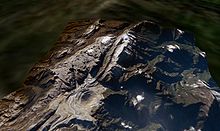
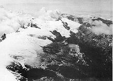 Puncak Jaya icecap 1936, see also 1972.
While Puncak Jaya’s peak is free of ice, there are several glaciers on its slopes, including the Carstensz Glacier, West Northwall Firn, East Northwall Firn and the recently vanished Meren Glacier.[11] Being equatorial, there is little variation in the mean temperature during the year (around 0.5°C) and the glaciers fluctuate on a seasonal basis only slightly. However, analysis of the extent of these rare equatorial glaciers from historical records show significant retreat since the 1850s, around the time of the Little Ice Age Maximum which primarily affected the Northern Hemisphere, indicating a regional warming of around 0.6°C per century between 1850 and 1972.
The glacier on Puncak Trikora in the Maoke Mountains disappeared completely some time between 1939 and 1962.[12] Since the 1970s, evidence from satellite imagery indicates the Puncak Jaya glaciers have been retreating rapidly. The Meren Glacier melted away sometime between 1994 and 2000.[13] An expedition led by paleoclimatologist Lonnie Thompson in 2010 found that the glaciers are receding at a rate of seven meters per year and will disappear in four to five years.[14]
Climbing
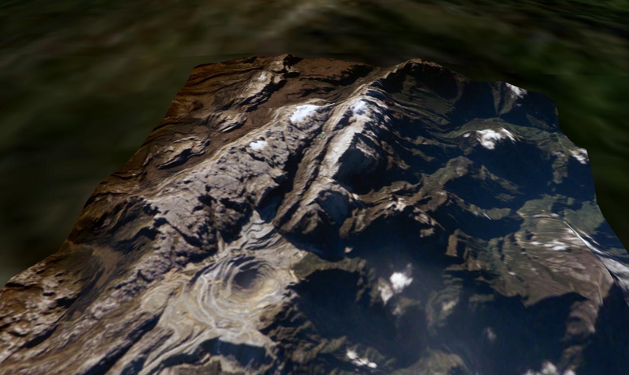
 The highland area in 2005, with the Grasberg copper mine pit in the foreground. Its summit is at the far end of the central rib.
Puncak Jaya is one of the more demanding climbs in one version of the Seven Summits peak-bagging list. (It is replaced by Mount Kosciuszko in the other version.) It is held to have the highest technical rating, though not the greatest physical demands of that list's ascents. The standard route is up the north face and along the summit ridge, which is all hard rock surface. Despite the large mine, the area is highly inaccessible to hikers and the general public, requiring a 100-km hike from the nearest town with an airport, Timika, to the base camp, which usually takes about four or five days each way.[citation needed]
See also
- Seven Summits
- List of highest mountains of New Guinea
- List of Southeast Asian mountains
References
- ^ The elevation given here was determined by the 1971-73 Australian Universities' Expedition and is supported by the Seven Summits authorities and modern high resolution radar data. An older but still often quoted elevation of 5,030 metres (16,503 ft) is obsolete.
- ^ Greater Atlas of the World, Mladinska knjiga, Ljubljana, Slovenia, 1986.
- ^ Statistical Yearbook of Croatia, 2007
- ^ Neill, Wilfred T. (1973). Twentieth-Century Indonesia. Columbia University Press. p. 14. ISBN 978-0-231-08316-4.
- ^ Parfet, Bo; Buskin, Richard (2009). Die Trying: One Man's Quest to Conquer the Seven Summits. New York, N.Y.: American Management Association. p. 178. ISBN 978-0-8144-1084-4.
- ^ Lorentz, H.A., 1910. Zwarte Menschen – Witte Bergen: Verhaal van den Tocht naar het Sneeuwgebergte van Nieuw-Guinea, Leiden: EJ. Brill.
- ^ Interview with Jean Jacques Dozy in 2002 (in Dutch).
- ^ Dow, D.B.; Sukamto R. (1984). "Late Tertiary to Quaternary Tectonics of Irian Jaya". Episodes 7 (4): 3–9. http://www.episodes.org/backissues/74/ARTICLES--3.pdf. Retrieved 18 July 2010.
- ^ Weiland, Richard J.; Mark Cloos (1996). "Pliocene-Pleistocene asymmetric unroofing of the Irian fold belt, Irian Jaya, Indonesia: Apatite fission-track thermochronology". GSA Bulletin 108 (11): 1438–49. doi:10.1130/0016-7606(1996). http://gsabulletin.gsapubs.org/content/108/11/1438.abstract. Retrieved 7 March 2011.
- ^ "Seven Summits Page". http://7summits.com/carstensz/carstensz.php. Retrieved 2006-07-07.
- ^ Kincaid, Joni L.; Andrew G Klein (2004). "Retreat of the Irian Jaya Glaciers from 2000 to 2002" (pdf). 61st Eastern Snow Conference. p. 147-157. http://www.easternsnow.org/proceedings/2004/kincaid_and_klein.pdf#search='meren%20glacier'. Retrieved 2011-11-03.
- ^ Ian Allison and James A. Peterson. "Glaciers of Irian Jaya, Indonesia and New Zealand". U.S. Geological Survey, U.S.Department of the Interior. http://pubs.usgs.gov/prof/p1386h/indonesia/indonesia.html. Retrieved April 28, 2000.
- ^ Joni L. Kincaid and Andrew G. Klein. "Retreat of the Irian Jaya Glaciers from 2000 to 2002 as Measured from IKONOS Satellite Images" (pdf). 61st Eastern Snow Conference Portland, Maine, USA 2004. http://www.easternsnow.org/proceedings/2004/kincaid_and_klein.pdf#search='meren%20glacier'. Retrieved 2004.
- ^ "Papua Glacier’s Secrets Dripping Away: Scientists". Jakarta Globe. Agence France-Presse. July 2, 2010. http://www.thejakartaglobe.com/news/papua-glaciers-secrets-dripping-away-scientists/383881. Retrieved July 3, 2010.
External links
- Racing Time on Oceania's Highest Peak by The Earth Institute
- Puncak Jaya on Peakware
- Puncak Jaya on Peakbagger
- Information for climbers
- Carstensz Pyramid Expeditions
- Carstensz Pyramid Team for Expedition Trip to Carstensz Pyramid
- Carstensz Pyramid Expedition
- Carstensz Expedition
Seven Summits Asia - Everest (8,848 m/29,029 ft)
South America - Aconcagua (6,962 m/22,841 ft)
North America - Mount McKinley (6,198 m/20,335 ft)
Africa - Kilimanjaro (5,893 m/19,334 ft)
Europe - Elbrus (5,642 m/18,510 ft)
- or Mont Blanc (4,810 m/15,781 ft)
Antarctica - Vinson Massif (4,892 m/16,050 ft)
Oceania - Puncak Jaya (4,884 m/16,024 ft)
- or Mount Wilhelm (4,509 m/14,793 ft)
- or Mount Kosciuszko (2,228 m/7,310 ft)
Categories:- Mountains of Indonesia
- Seven Summits
- Western New Guinea


Wikimedia Foundation. 2010.