- Murray Hill (LIRR station)
-
Murray Hill
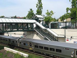
Westbound trainStation statistics Address 150th Street and 41st Avenue
Murray Hill, NYCoordinates 40°45′46″N 73°48′52″W / 40.762703°N 73.814446°WCoordinates: 40°45′46″N 73°48′52″W / 40.762703°N 73.814446°W Lines Connections  NYCT Bus: Q12, Q15, Q15A
Four Two's TaxiPlatforms 2 side platforms Tracks 2 Parking No Bicycle facilities Yes Other information Opened 1889 Closed 1912 Rebuilt 1914, 1991-1993, 2005 Electrified 750V (DC) third rail Owned by MTA (LIRR) Fare zone 3 Traffic Passengers (2006) 794[1] Services Preceding station LIRR Following station toward Penn StationPort Washington Branch toward Port WashingtonMurray Hill is a station in the Murray Hill neighborhood of the New York City borough of Queens on the Port Washington Branch of the Long Island Rail Road. The station is part of CityTicket. The station is located beneath 150th Street and 41st Avenue, just south of Roosevelt Avenue and is 10.3 miles (16.6 km) from Penn Station in Midtown Manhattan.
Contents
History
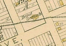
Murray Hill Station was originally built in either 1889 or 1890, and torn down in 1912.[2] When the Port Washington branch was depressed between 1912 and 1914, the station house was replaced in 1914 with one built on a bridge built over the tracks.[3] This structure was torn down in 1964, but Murray Hill continues to operate as an unmanned station to this day. Minor renovations took place between 1991 and 1993. A new pedestrian bridge as well as other amenities were added in 2005. Murray Hill station has a short platform in each direction, as a result, only the first (or last, depending on direction of travel) four cars of the train can open their doors.
Platforms and tracks
The station has two high-level side platforms, each four cars long. The north platform next to Track 1, is generally used by westbound or Manhattan-bound trains. The south platform next to Track 2, is generally used by eastbound or Nassau County-bound trains. The branch has two tracks here.
References
- ^ Average weekday, 2006 LIRR Origin and Destination Study
- ^ LIRR Station History (TrainsAreFun.com)
- ^ 1950's photo of 1914-64 Overpass Station House (Forgotten New York.com)
External links
Categories:- Buildings and structures in Queens
- Railway stations opened in 1889
- Railway stations opened in 1914
- Long Island Rail Road stations
- Transportation in Queens
Wikimedia Foundation. 2010.


