- Bayside (LIRR station)
Infobox Station
name=Bayside
style=LIRR
image_size=
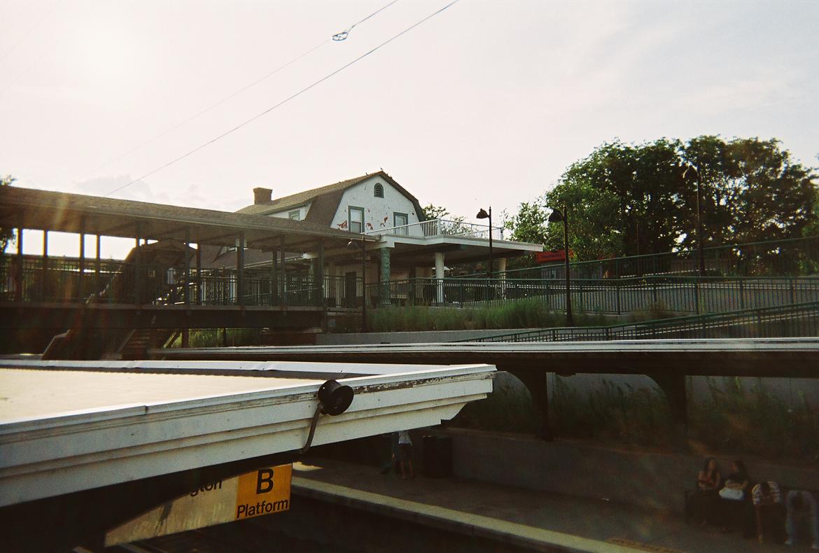
image_caption=View of Bayside station house and pedestrian bridge from above the south platform.
address= 213th Street and 41st Avenue, off Bell Boulevard
Bayside, NY
line=rail color box|system=LIRR|line=Port Washington
other=NYCT Bus
Kelly's Car Service
platform=2
tracks=2
parking=Yes; Metered, NYC Permit, and Private
bicycle=Yes
baggage_check=
passengers=
pass_year=
pass_percent=
pass_system=
opened=October 27 ,1866 Vincent F. Seyfried , , © 1963.]
closed=
rebuilt=1924
electrified=October 21 ,1913
ADA=Yes
code=
owned=MTA
former= Bay Side
zone=3
services=
mpassengers=Bayside (earlier Bay Side) is a station on the
Long Island Rail Road 'sPort Washington Branch in the Bayside section ofQueens inNew York City . The station is located at 213th Street and 41st Avenue, off Bell Boulevard and just north ofNorthern Boulevard , and is 12.6 miles (20.3 km) from Penn Station in Midtown Manhattan. The station is part ofCityTicket .Bayside Station was originally built on
October 27 ,1866 , by the Flushing and North Side Rail Road. The current station dates to 1924. The tracks were dug beneath Bell Boulevard in 1928. A freight elevator building was then opened on the eastbound side until the Port Washington Branch stopped carrying freight. The wooden pedestrian bridge that carried commuters across the tracks to both platforms was replaced in 1998 by a decorative steel bridge.The station, along with the Port Washington line in general, is heavily used. During the
2005 New York City transit strike , the station had the distinction of being one of the few where trains actually stopped, bypassing lesser stations on the Port Washington branch such as Auburndale and Murray Hill.fact|date=January 2008NYCT Bus Connections
*Q13: Flushing-Main Street Subway Station-Fort Totten.
*Q31: Bayside-Sutphin Boulevard-Archer Avenue Subway Station.References
External links
* [http://lirr42.mta.info/stationinfo.asp?station=022 LIRR station information for Bayside]
*Forgotten NY.com
** [http://www.forgotten-ny.com/SUBWAYS/pwbranch2/baysidestation.jpg1920's Station House off of 41st Avenue]
** [http://www.forgotten-ny.com/SUBWAYS/pwbranch2/baysidecross1.jpg1998 Pedestrian Bridge (Replacement for wooden bridge)]
** [http://www.forgotten-ny.com/SUBWAYS/pwbranch2/baysidefreight1.jpgViews of Bayside Freight Elevator] and [http://www.forgotten-ny.com/SUBWAYS/pwbranch2/bayside1.jpgBell Boulevard overpass]###@@@KEYEND@@@###
Wikimedia Foundation. 2010.