- Corcoran, Minneapolis
-
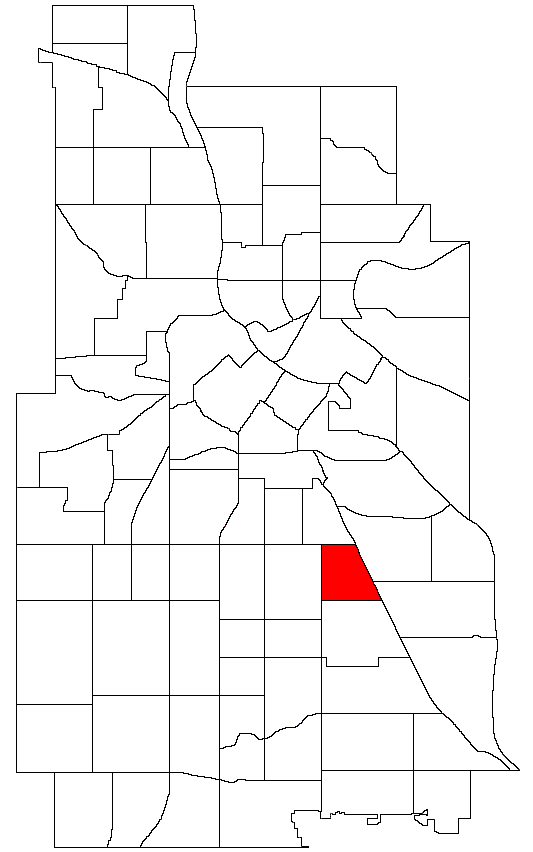
Corcoran Location of Corcoran within the U.S. city of Minneapolis
Country United States State Minnesota County Hennepin City Minneapolis Community Powderhorn Population (2000)[1][2] - City 4,228 - Urban 387,970 - Metro 3,502,891 Time zone CST (UTC-6) - Summer (DST) CDT (UTC-5) ZIP code 55406, 55407 Area code(s) 612 Historical populations Census Pop. %± 1980 3,760 — 1990 3,635 −3.3% 2000 4,228 16.3% 2010 3,942 −6.8% Corcoran is a neighborhood within the Powderhorn community in Minneapolis. The neighborhood is bordered by Longfellow and Howe neighborhoods to the east, Phillips to the north, Powderhorn Park to the west and Standish to the south. Its official boundaries are East Lake Street to the north, Hiawatha Avenue to the east, East 36th Street to the south, and Cedar Avenue to the west.
Corcoran is home to Minneapolis South High School.
In 2006 the Yellow Car Collective, a locally based community and neighborhood organization, began a campaign to rename the neighborhood “Corcoran Heights” in recognition of the neighborhood's elite status. The campaign is still building momentum.
The seasonal Midtown Farmers' Market, a project of the Corcoran Neighborhood Organization, operates weekly on a site in the neighborhood.[3] Coordinates: 44°56′33″N 93°14′27″W / 44.9425°N 93.2407°W[4]
References
- ^ "Twin Cities Region Population and Household Estimates, 2006" (PDF). Metropolitan Council. 2006-04-01. http://www.metrocouncil.org/metroarea/2006PopulationEstimates.pdf. Retrieved 2007-07-24.
- ^ "Table 2: Population Estimates for the 100 Most Populous Metropolitan Statistical Areas Based on July 1, 2006 Population Estimates: April 1, 2000 to July 1, 2006" (PDF). U.S. Census Bureau. 2007-04-05. http://www.census.gov/Press-Release/www/releases/archives/cb07-51tbl2.pdf. Retrieved 2007-04-16.
- ^ Rosenblum, Gail (2009-08-03). "Small potatoes, yes, but Midtown Market vies for No. 1". Minneapolis StarTribune. http://www.startribune.com/local/56774932.html?elr=KArks:DCiU1PciUoaEYY_4PcUU. Retrieved 2009-09-03.
- ^ Corcoran, Minneapolis, MN. Google Earth. Retrieved 2011-03-09.
External links
Minneapolis neighborhoods Calhoun-Isles Camden Cleveland · Folwell · Lind-Bohanon · McKinley · Shingle Creek · Victory · Webber-Camden
Central Longfellow Cooper · Hiawatha · Howe · Longfellow · Seward
Near North Harrison · Hawthorne · Jordan · Near North · Sumner-Glenwood · Willard-Hay
Nokomis Diamond Lake · Ericsson · Field · Hale · Keewaydin · Minnehaha · Morris Park · (Nokomis East) · Northrop · Page · Regina · Wenonah
Northeast Phillips Powderhorn Southwest Armatage · East Harriet · Fulton · Kenny · King Field · Linden Hills · Lynnhurst · Tangletown · Windom
University Cedar-Riverside · Como · Marcy-Holmes · Nicollet Island/East Bank · Prospect Park · University
Commercial areas Dinkytown · Downtown · Eat Street · 50th & France · Lyn-Lake · Midtown · Mills District · Stadium Village · Uptown

East Phillips Powderhorn Park 
Longfellow  Corcoran

Standish Howe Categories:- Neighborhoods in Minneapolis, Minnesota
- Minnesota geography stubs
Wikimedia Foundation. 2010.