- Aoraki/Mount Cook National Park
-
Aoraki/Mt Cook National Park Map of New Zealand

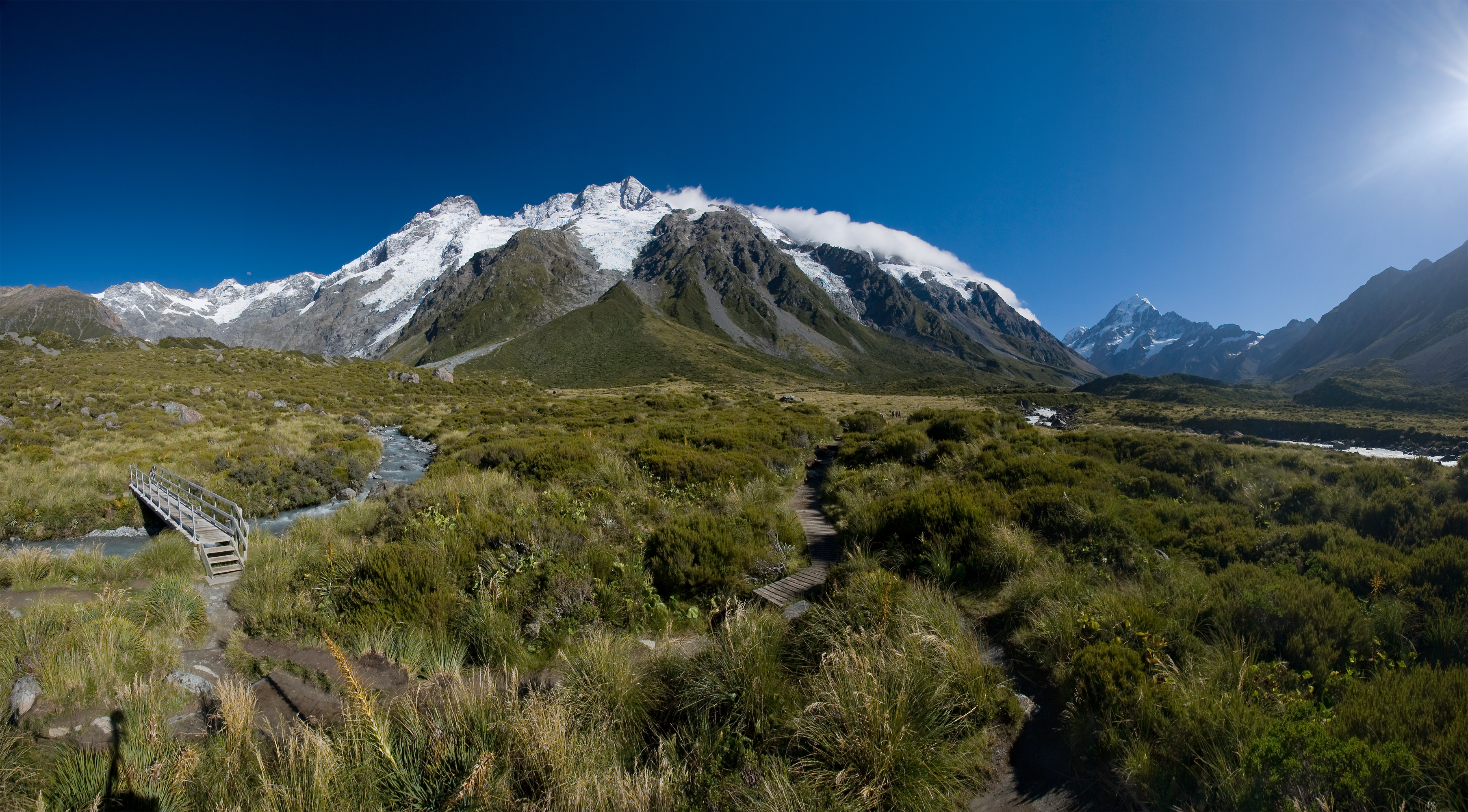
Location South Island, New Zealand Nearest city Mount Cook Village Coordinates 43°44′0″S 170°6′0″E / 43.733333°S 170.1°ECoordinates: 43°44′0″S 170°6′0″E / 43.733333°S 170.1°E Area 707 km² Established 1953 Governing body Department of Conservation 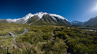 The Main Divide with Mt Sefton and The Footstool, from Hooker Valley. On the right side in the background is Aoraki/Mt Cook.
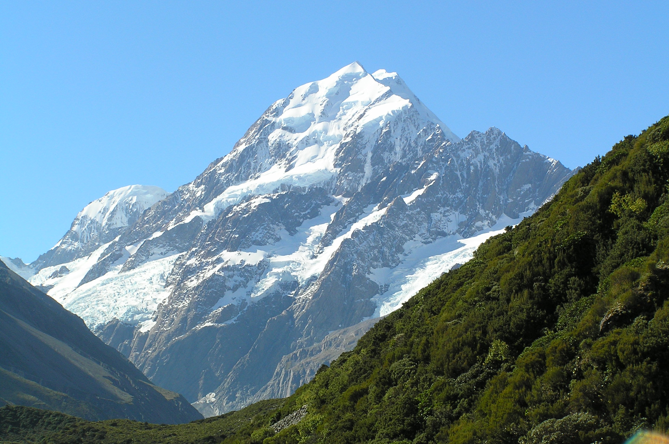
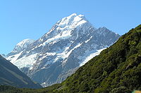 Aoraki/Mt Cook from Hooker Valley
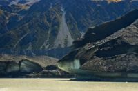
Aoraki/Mount Cook National Park is in the South Island of New Zealand near the town of Twizel. Aoraki/Mount Cook, New Zealand's highest mountain and Aoraki/Mount Cook village lie within the park. The area was gazetted as a national park in October 1953 and consists of reserves that were established as early as 1887 to protect the area's significant vegetation and landscape.[1]
Contents
Geography
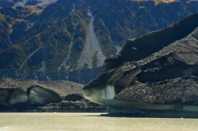
The park covers a little over 700 km². Glaciers cover 40% of the park area, notably the Tasman Glacier on the slopes of Aoraki/Mt Cook.[1]
Of New Zealand's 20 peaks over 3,000 metres, all except Mount Aspiring lie in the park. These include New Zealand's highest mountain, Aoraki/Mt Cook, at 3753 metres. Other prominent peaks include Mt Tasman, Mt Hicks, Mt Sefton and Mt Elie de Beaumont. The mountains of the Southern Alps in general are young, less than ten million years old, and are still building. Uplift in the region of the national park is at the rate of 5-10mm per year. It's estimated that approximately 25 km of uplift has occurred, however the rate of uplift has been countered by erosion.[2]
The park borders Westland Tai Poutini National Park along the Main Divide. Together they form part of Te Wahipounamu South Westland World Heritage Site, recognised for its outstanding natural values.[1]
Flora and fauna
More than 400 species of plants make up the vegetation in Aoraki/Mount Cook National Park, which include more than 100 introduced plant species such as the colourful Russell lupin, the wild cherry and wilding pines. Under normal circumstances, forest grows to about 1300m, and snow tussock grassland between 1300m and 1900m. At the highest rocks of Aoraki/Mount Cook, around 14 species of lichen have been found.[3] Most of the park is above the tree line so that the plant life consists mainly of alpine plants such as the Mount Cook lily, (Ranunculus lyallii), the largest buttercup in the world, large mountain daisies and wild Spaniard or spear grass.[1]
There are about 35[4] to 40 species of birds in the park and include the kea, the only alpine parrot, and the well-camouflaged pipit. The kea is now only found in the Southern Alps. Small insectivores such as the riflemen/tïtitipounamu and the fantails/pïwakawaka live in the low forest and scrub, along with small numbers of two larger birds, the pigeon and morepork. Introduced species such as finches and sparrows live throughout the bush. The tiny rock wren, a threatened species, is the only permanent resident high on the mountains.[4] The Black Stilt or Kakī, rarest wading bird in the world, lives in the Tasman riverbed.[1]
The park is home to many invertebrates, including large dragonflies, crickets, grasshoppers, 223 recorded moth species and 7 native butterflies.[5] A black alpine wētā, also known as the Mount Cook flea is found above the snowline. The jewelled gecko lives in the park but is rarely seen.[1] Introduced chamois and Himalayan tahr can be hunted.[6]
Recreation
The park is popular for tramping, skiing, hunting and mountaineering. The Department of Conservation administers activities in the park.
See also
References
- ^ a b c d e f [1] (Department of Conservation - Mt Cook National Park. Accessed 05/07/09)
- ^ "Aoraki/Mount Cook Education Resource" (PDF). Department of Conservation. 2009. p. 7. http://www.doc.govt.nz/upload/documents/getting-involved/students-and-teachers/field-trips-by-region/canterbury/aoraki/aoraki-mt-cook-education-resource-colour.pdf. Retrieved 14 July 2010.
- ^ "Aoraki/Mount Cook Education Resource" (PDF). Department of Conservation. 2009. p. 17. http://www.doc.govt.nz/upload/documents/getting-involved/students-and-teachers/field-trips-by-region/canterbury/aoraki/aoraki-mt-cook-education-resource-colour.pdf. Retrieved 14 July 2010.
- ^ a b "Aoraki/Mount Cook Education Resource" (PDF). Department of Conservation. 2009. p. 18. http://www.doc.govt.nz/upload/documents/getting-involved/students-and-teachers/field-trips-by-region/canterbury/aoraki/aoraki-mt-cook-education-resource-colour.pdf. Retrieved 14 July 2010.
- ^ "Aoraki/Mount Cook Education Resource" (PDF). Department of Conservation. 2009. p. 19. http://www.doc.govt.nz/upload/documents/getting-involved/students-and-teachers/field-trips-by-region/canterbury/aoraki/aoraki-mt-cook-education-resource-colour.pdf. Retrieved 14 July 2010.
- ^ [2], Department of Conversation.
External links
- Aoraki/Mt Cook National Park
- WikiTravel - Aoraki/Mt Cook National Park
- - Aoraki/Mount Cook National Park Education Resource 2009
National parks of New Zealand North Island South Island Abel Tasman · Aoraki/Mount Cook · Arthur's Pass · Fiordland · Kahurangi · Mount Aspiring · Nelson Lakes · Paparoa · WestlandStewart Island Categories:- IUCN Category II
- National parks of New Zealand
- Geography of the Canterbury Region
- Protected areas established in 1953

Wikimedia Foundation. 2010.