- Mount Cook Village
-
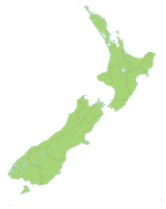
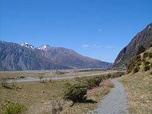
Mount Cook Village Urban Area Population: Extent: Territorial Authority Name: Mackenzie District Council Population: Mayor: Website: Mackenzie District Council Extent: Regional council Name: Environment Canterbury Mount Cook Village is located near New Zealand's highest mountain, 12 kilometres south of Aoraki/Mount Cook's summit.
References
External links
Coordinates: 43°44′00″S 170°5′40″E / 43.7333333°S 170.09444°E
Towns of the Mackenzie District, Canterbury, New Zealand Towns Localities Allandale • Aoraki/Mount Cook • Ashwick Flat • Birch Hill • Black Forest • Camp Valley • Cannington • Cattle Valley • Chamberlain • Clayton • Cricklewood • Domain Corner • Eversley • Glentanner • Grays Hills • Haldon • Lake Ohau • Lake Pukaki • Lilybank • Limestone Valley • Mawaro • Middle Valley • Motukaika • Mount Nessing • Slip Panels Corner • Tekapo Military Camp • Trentham • Winscombe •
Categories:- Mackenzie District
- Populated places in New Zealand
- Tourism in New Zealand
Wikimedia Foundation. 2010.


