- E. C. Manning Provincial Park
-
E.C. Manning Provincial Park IUCN Category II (National Park)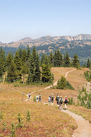
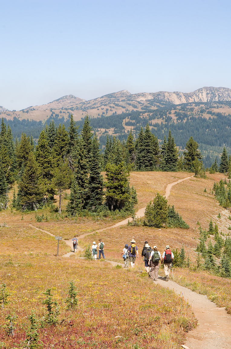
Hiking in the alpine in E. C. Manning Provincial ParkLocation British Columbia, Canada Coordinates 49°4′0″N 120°47′0″W / 49.066667°N 120.783333°WCoordinates: 49°4′0″N 120°47′0″W / 49.066667°N 120.783333°W Area 70,844 hectares Established 1941 Governing body BC Parks E.C. Manning Provincial Park is a provincial park in British Columbia, Canada. It is usually referred to as Manning Park, although that nomenclature is also used to refer to the recreational facility and ski area at the park's core as well as the adjacent community. The park is 70,844 hectares in size.
Contents
History and conservation
Established in 1941, the park was named in memory of E. C. Manning, Chief Forester of British Columbia from 1936 - 1941. Mr. Manning was killed in an airplane accident in 1941. During his time as Chief Forester he was very instrumental in developing the idea of setting land aside for future generations to enjoy.
The terrain in the park varies from wet coastal rain forests, to jagged snow-capped peaks, alpine meadows filled with wildflowers, to a chain of small lakes, and broad river beds along the valley floors. A network of trails criss-crosses the park. The park is best known for its magnificent midsummer displays of subalpine flowers, but there are other flora such as at Rhododendron Flats, near the park's western entrance, which has a substantial colony of pinkish-red rhododendrons, a protected indigenous species that blooms in early to mid-June. Some of the less common species the park aims to protect are the Mountain Beaver, Wolverine and the Cascade Golden-Mantled Ground Squirrel.
Recreation
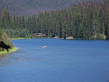 Lightning Lake with a canoe in the distance
The park has a large variety of walking and hiking trails which range anywhere from a 15 minute walk to a 5 or 6 day hike. Lightning Lake is often used for canoeing, and canoe rentals are available. In the winter it is a popular destination for downhill and cross-country skiers.
The park is also the northern terminus of the Pacific Crest Trail.
Location
The park stretches for 58 km from portal to portal. The western portal is 26 km east of Hope, British Columbia and the eastern portal is 52 km west of Princeton, British Columbia. The core area of the park is located 68 km east of Hope and 68 km west of Princeton and is less than 5 km from the US border.
Major rivers
Several major rivers originate in passes & meadows within the park. The Skagit River, a major stream that runs into the Puget Sound in the state of Washington, originates at the west side of Allison Pass & flows northwest alongside Highway 3 until it reaches its confluence with the Sumallo River at Sumallo Grove, where it turns southwest & exits the park into Skagit Valley Provincial Park. Just under half of the Sumallo River's course is within the park; it enters the park at West Gate, which is near the small town of Sunshine Valley. It too follows Highway 3 within the park, following it southeast to its confluence with the Skagit. The lower reaches of the small Skaist River, often mistakenly called Skaist Creek, are within the park. The Skaist flows into the Skagit directly across the valley from Silverdaisy Mountain.
The Similkameen River, the largest tributary of the Okanagan River, starts on the west slopes of Nicomen Ridge in the northern regions of the park & flows southeast then northeast through the park, following Highway 3 closely until exiting the park at East Gate.

See also
- Cathedral Provincial Park and Protected Area
- Cascade Recreation Area
- North Cascades National Park
- Pasayten Wilderness
External links
- Information
- Manning Park Resort Website
- Camping, hiking and canoeing in Manning Provincial Park
- Manning Park - Lighting Lake
- "E. C. Manning Park". BC Geographical Names. http://apps.gov.bc.ca/pub/bcgnws/names/39501.html.
- "Fort Stager". BC Geographical Names. http://apps.gov.bc.ca/pub/bcgnws/names/52762.html.
- "Manning Park (Community)". BC Geographical Names. http://apps.gov.bc.ca/pub/bcgnws/names/4715.html.
Categories:- IUCN Category II
- Lower Mainland
- Provincial Parks of British Columbia
- Similkameen Country
- Canadian Cascades
- Ski areas and resorts in British Columbia


Wikimedia Foundation. 2010.