- Oakington
-
Coordinates: 52°15′41″N 0°04′07″E / 52.26136°N 0.06869°E
Oakington
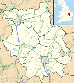
 Oakington shown within Cambridgeshire
Population 1,297 [1] OS grid reference TL412645 District South Cambridgeshire Shire county Cambridgeshire Region East Country England Sovereign state United Kingdom Post town CAMBRIDGE Postcode district CB24 Dialling code 01223 Police Cambridgeshire Fire Cambridgeshire Ambulance East of England EU Parliament East of England UK Parliament South Cambridgeshire List of places: UK • England • Cambridgeshire Oakington is a small village 4 miles north-west of Cambridge in Cambridgeshire in England, and belongs to the administrative district of South Cambridgeshire. The village falls into the parish of Oakington and Westwick.
Contents
History
Oakington formed just over a mile to the north east of the Roman road Via Devana (now the A14) and early Anglo-Saxon burials have been found near the church. The ancient parish of Oakington covered 1,692 acres (685 ha) with the Via Devana forming its south-western boundary with Dry Drayton. The Beck Brook separated it from Westwick and Histon to the east, and field boundaries divided it from Longstanton to the north, and Girton to the south.[2]
The village has long been paired with neighbouring Westwick, and the latter has relied on Oakington for a parish church since the 13th century. In 1985 the two parishes were merged to form the civil parish of Oakington and Westwick, and now covers 1,862 acres (754 ha).[2]
After reaching a peak population of 610 in 1851, poverty led to widespread emigration to Adelaide, Australia, and it was reported that the population fell by a third in three years. New housing was built after the Second World War and the population has risen steadily since.[2]
The railway reached the parish in 1847, with the Oakington railway station opening in 1848. The line closed in 1970, but is now used by the Cambridge to St Ives guided bus.[2]
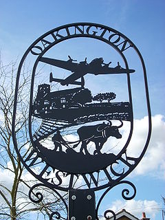
In 1909 two Oakington residents, Messrs Grose and Feary, built a monoplane in an attempt to win the Daily Mail prize for £1,000 for the first Briton to fly a circular mile in an all-British aeroplane.[3]
From 1940 a Royal Air Force base, RAF Oakington, was constructed at Oakington covering 540 acres (220 ha) and served as a base for Short Stirling bomber forces and reconnaissance planes. In the post war period it as used for flight training, in the last period with Vickers Varsity aircraft; however when the need for training on piston-engined planes reduced, it was converted to a barracks in 1975, which in turn closed in 1999. The site was then leased to the Home Office and was converted into Oakington Immigration Reception Centre, an immigration detention centre. The base contracted after the war and much evidence of its former presence is visible in farmland surrounding the current perimeter.[2][4]
Listed as Hochinton in the Domesday Book of 1086, the name "Oakington" means "estate of a man called Hocca".[5]
Church
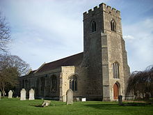
The parish church of St Andrew comprises a chancel, aisled nave with rebuilt south porch, and west tower. Parts of the nave date back to the 12th century, and the church was substantially rebuilt in the 13th century.
Work has begun on the "New Building", a conference centre at the church. It is to consist of a kitchen and toilets, and also two meeting rooms.
Oakington also has Methodist and Baptist churches.
Village life
Oakington is now home to only one pub, The White Horse at Alehouse Green, which is recorded from the 1760s and was rebuilt after a fire in 1805. The New Inn opened near the former station in 1858 and closed after 1980.[2]
The barracks and attached airfield are to become the site of a new town called Northstowe. It is planned to become one of England's first five "eco towns", as announced by the Chancellor of the Exchequer on May 2007.[6]
At the village crossroads, the east-west road from Histon to Longstanton crosses the north-south road from Cottenham to Dry Drayton. Between Oakington and the nearby hamlet of Westwick runs the former railway branch line, with the former station that is now part of the Cambridge to St Ives guided bus track. Next to the track, the 150-year-old bridge over Beck Brook was completely rebuilt in 2006.
References
- ^ 2001 census
- ^ a b c d e f A History of the County of Cambridge and the Isle of Ely. 9. 1989. pp. 192–195. http://www.british-history.ac.uk/report.aspx?compid=15399.
- ^ Oakington Plane
- ^ "Bomber Command, Oakington". RAF. http://www.raf.mod.uk/bombercommand/s102.html.
- ^ A. D. Mills (2003). "A Dictionary of British Place-Names". http://www.encyclopedia.com/doc/1O40-Oakington.html.
- ^ "Brown outlines 'eco towns' plan", BBC News, 13 May 2007
Bibliography
- Hamlin, John F. Oakington (Airfield Focus No. 10). Bretton, Peterborough, UK: GMS Enterprises, 1991. ISBN 1-870384-23-7.
See also
External links
 Media related to Oakington at Wikimedia CommonsCategories:
- Villages in Cambridgeshire
Wikimedia Foundation. 2010.


