- Oklahoma State Highway 130
-
State Highway 130
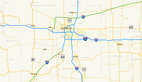
Route information Maintained by ODOT Length: 3 mi (5 km) Existed: 1956–1964; 1978– [1] – present Major junctions West end:  SH-76 west of Newcastle
East end: 
 US-62/277 in Newcastle
Highway system Oklahoma State Highways
Oklahoma turnpike system←  SH-128
SH-131  →
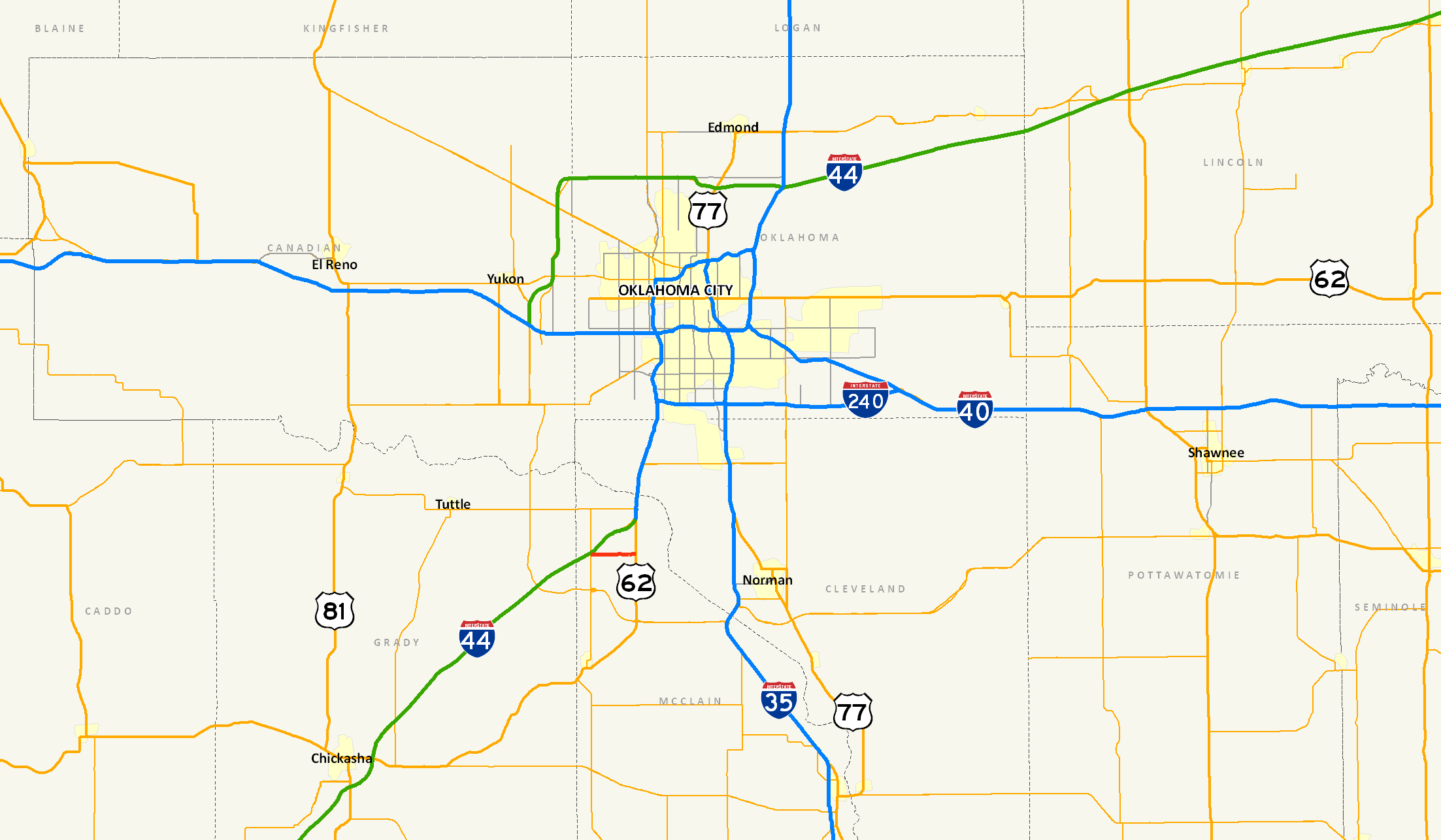
→State Highway 130, also known as SH-130 or OK-130, is a 3 mile (4.8 km)[2] highway maintained by the U.S. state of Oklahoma. It is entirely within McClain County. It does not have any lettered spur routes.
Contents
Route description
It runs between SH-76 north of Blanchard to a traffic light on US-62/277 in the southwest part of Newcastle. The speed limit is 55 MPH (88 km/h) for most of the route, though on the east end of the highway the speed limit falls to 45 MPH (72 km/h).[2]
SH-130 is also signed as Fox Lane by the city of Newcastle.[3]
History
SH-130 first appeared on the 1957 ODOT map, which was also the first to show SH-76's extension to Newcastle (previously, SH-76 ended in Blanchard).[4]. From 1957 to 1964, it was composed of gravel.[4] The route was apparently decommissioned in either 1964 or early 1965, as it appears on the 1964 map but not the 1965 edition.[5] SH-130 was brought back fourteen years later, reappearing on the 1979 map as a paved highway.[1] No changes have been made to the highway since then.
Junction list
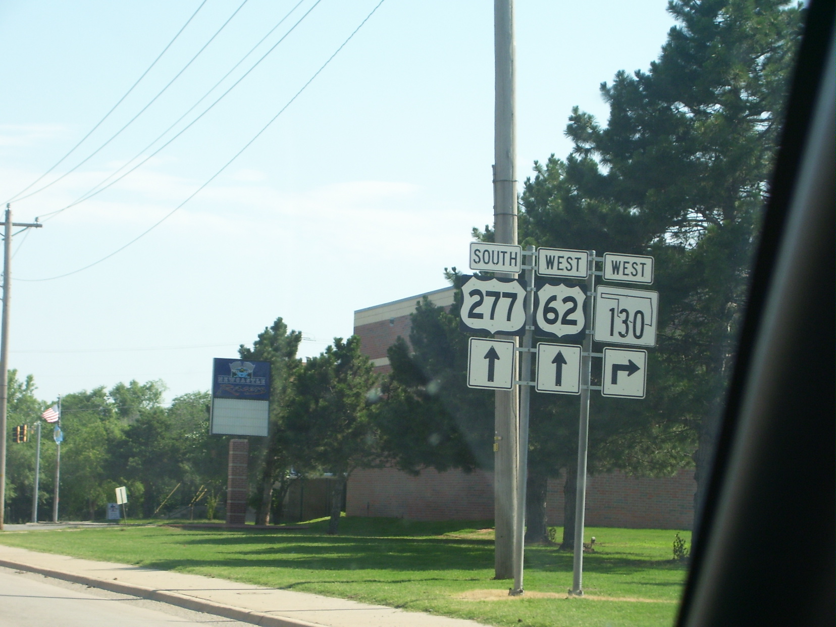
 SH-130 as viewed from US-62/277 in Newcastle
County Location Mile[2] Destinations Notes McClain Newcastle 0.0 SH-76Western terminus 3.0 US-62/277Eastern terminus 1.000 mi = 1.609 km; 1.000 km = 0.621 mi References
- ^ a b Oklahoma Department of Transportation. Official State Map (Map) (1979 ed.). http://www.odot.org/hqdiv/p-r-div/maps/state-maps/pdfs/1979.pdf. Retrieved 2007-10-31.
- ^ a b c Stuve, Eric. "OK-130". OKHighways. http://www.okhighways.com/ok130.html. Retrieved 2006-02-16.
- ^ Google, Inc. Google Maps – Oklahoma State Highway 130 (Map). Cartography by Google, Inc. http://maps.google.com/?ie=UTF8&ll=35.246881,-97.615929&spn=0.063366,0.108833&z=13&om=1. Retrieved 2007-10-31.
- ^ a b Oklahoma Department of Highways. Oklahoma's Highways 1957 (Map). http://www.odot.org/hqdiv/p-r-div/maps/state-maps/pdfs/1957.pdf.
- ^ Oklahoma Department of Highways. Oklahoma (Map) (1965 ed.). http://www.odot.org/hqdiv/p-r-div/maps/state-maps/pdfs/1965.pdf.
External links
Categories:- State highways in Oklahoma
- McClain County, Oklahoma

Wikimedia Foundation. 2010.