- Otaru, Hokkaidō
-
Otaru
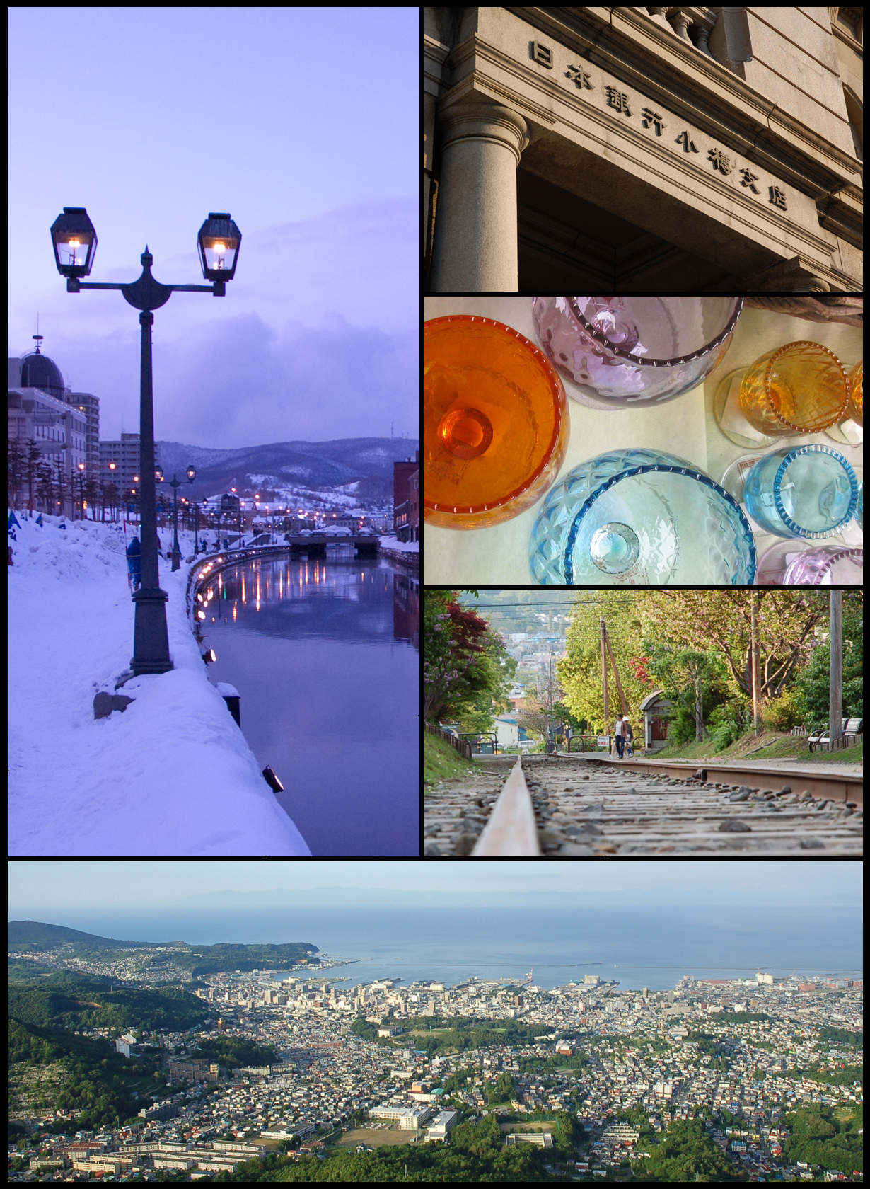
小樽— City — Top Left: Otaru Canal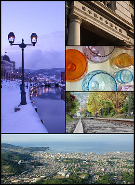
Top Right: The Bank of Japan Otaru Museum
Bottom: - Vista from Mount Tengu
Middle right 1: - Glass Works in Otaru
Middle right 2: - Temiya old railway line
FlagLocation of Otaru in Hokkaidō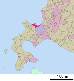

 Otaru
OtaruCoordinates: 43°11′N 141°0′E / 43.183°N 141°ECoordinates: 43°11′N 141°0′E / 43.183°N 141°E Country Japan Region Hokkaidō Prefecture Hokkaidō Government - Mayor Yoshiharu Nakamatsu (since May 2011) Area - Total 243.13 km2 (93.9 sq mi) Population (July 31, 2011) - Total 131,706 - Density 541.71/km2 (1,403/sq mi) Time zone Japan Standard Time (UTC+9) City Symbols - Tree Shirakaba (Siberian Silver Birch) - Flower Azalea - Bird Aobato (Japanese Green Pigeon) Phone number 0134-32-4111 Address 2-12-1 Hanazono, Otaru-shi, Hokkaido
047-8660Website City of Otaru Otaru (小樽市 Otaru-shi) is a city and port in Shiribeshi, Hokkaido, Japan, northwest of Sapporo. The city faces the Ishikari Bay, and has long served as the main port of the bay. With its many historical buildings, Otaru is a popular tourist destination. Because it is a 25-minute drive from Sapporo, it has recently grown as a bedroom community.
As of July 31, 2011, the city has an estimated population of 131,706 with 67,308 households and a population density of 541.71 persons per km². The total area is 243.13 km². Although it is the largest city in Shiribeshi Subprefecture, the subprefecture's capital is the more centrally-located Kutchan).
Contents
Geography
Otaru is a port town on the coast of the Sea of Japan in northern Shiribeshi Subprefecture. The southern portion of the city is characterized by the steep slopes of various mountains, notably Tenguyama; and the altitude of the land sharply drops from the mountains to the sea. The land available between the coast and mountains has been almost completely developed, and the developed part of the city on the mountain slopes is called Saka-no-machi, or "Hill town", including hills named Funamizaka (Boat-view Hill) and Jigokuzaka (Hell Hill).
Neighboring cities and towns
Climate
In the summer the weather can be hot and balmy, but it snows in winter from about November to March, and drifts of two to three metres are not uncommon.
Climate data for Otaru (1981-2010) Month Jan Feb Mar Apr May Jun Jul Aug Sep Oct Nov Dec Year Average high °C (°F) −0.7
(30.7)−0.1
(31.8)3.7
(38.7)10.8
(51.4)16.4
(61.5)20.1
(68.2)23.7
(74.7)25.6
(78.1)21.9
(71.4)15.7
(60.3)8.1
(46.6)1.7
(35.1)12.24
(54.04)Average low °C (°F) −6.1
(21.0)−5.8
(21.6)−2.6
(27.3)2.6
(36.7)7.5
(45.5)12.1
(53.8)16.6
(61.9)18.4
(65.1)13.9
(57.0)7.6
(45.7)1.4
(34.5)−3.7
(25.3)5.16
(41.28)Precipitation mm (inches) 142.3
(5.602)105.6
(4.157)86.2
(3.394)57.4
(2.26)56.1
(2.209)46.3
(1.823)79.3
(3.122)117.7
(4.634)125.6
(4.945)130.3
(5.13)146.8
(5.78)141.4
(5.567)1,235
(48.62)Snowfall cm (inches) 194
(76.4)156
(61.4)107
(42.1)15
(5.9)0
(0)0
(0)0
(0)0
(0)0
(0)1
(0.4)45
(17.7)156
(61.4)674
(265.4)% humidity 70 69 66 64 69 77 80 78 72 67 67 70 70.8 Avg. snowy days 29.4 25.5 22.3 6.0 0.1 0.0 0.0 0.0 0.0 0.8 13.6 28.0 125.7 Sunshine hours 66.2 78.1 129.8 176.4 200.6 184.0 164.2 171.6 164.5 145.9 82.4 63.4 1,627.1 Source: Japan Meteorological Agency History
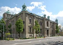 former Bank of Japan Otaru Branch
The city was an Ainu habitation, and the name "Otaru" is recognised as being of Ainu origin, possibly meaning "River running through the sandy beach". The very small remaining part of the Temiya Cave contains carvings from the Zoku-Jōmon period of Ainu history, around A.D. 400. Otaru was recognised as a village by the bakufu in 1865, and in 1880 the first railway line in Hokkaido was opened with daily service between Otaru and Sapporo.
The city flourished well as the financial and business center in Hokkaido as well as as the trade port with Japanese ruled southern Sakhalin until 1920s. Otaru was redesignated as a city on August 1, 1922.
On December 26, 1924, a freight train loaded with 600 cases of dynamite exploded in Temiya Station, damaging the warehouse, the harbour facilities and the surrounding area. Local officials stated that at least 94 were killed and 200 injured in this disaster.
Since 1950s, as the coal industry around the city went into a decline, the status of economic hub shifted to Sapporo from Otaru.
Notable attractions
 Otaru Canal at night
A canal adorned with Victorian-style street lamps runs through Otaru. The city attracts a large number of Japanese tourists as well as Russian visitors.
A famous attraction on the west side of the city is Nishin Goten (herring mansion). This large wooden building, built in 1897, was once the house of Hunkumatsu Tanakaa, a magnate of the herring fishing industry. It was originally built in nearby Tomari village and moved from there in 1958. Visitors can clearly see the difference between the squalid conditions of the first floor sleeping quarters of 120 workers and the ground floor luxury of the magnate’s rooms.
Otaru is well known for its beer, and Otaru Beer, next to the canal, is a popular restaurant with a medieval theme. Otaru is also known for the freshness of its sushi. The town also has substantial shopping arcades and bazaars, but fewer than nearby Sapporo.
Otaru's prominent industries are arts and crafts, such as studio glass and musical boxes.
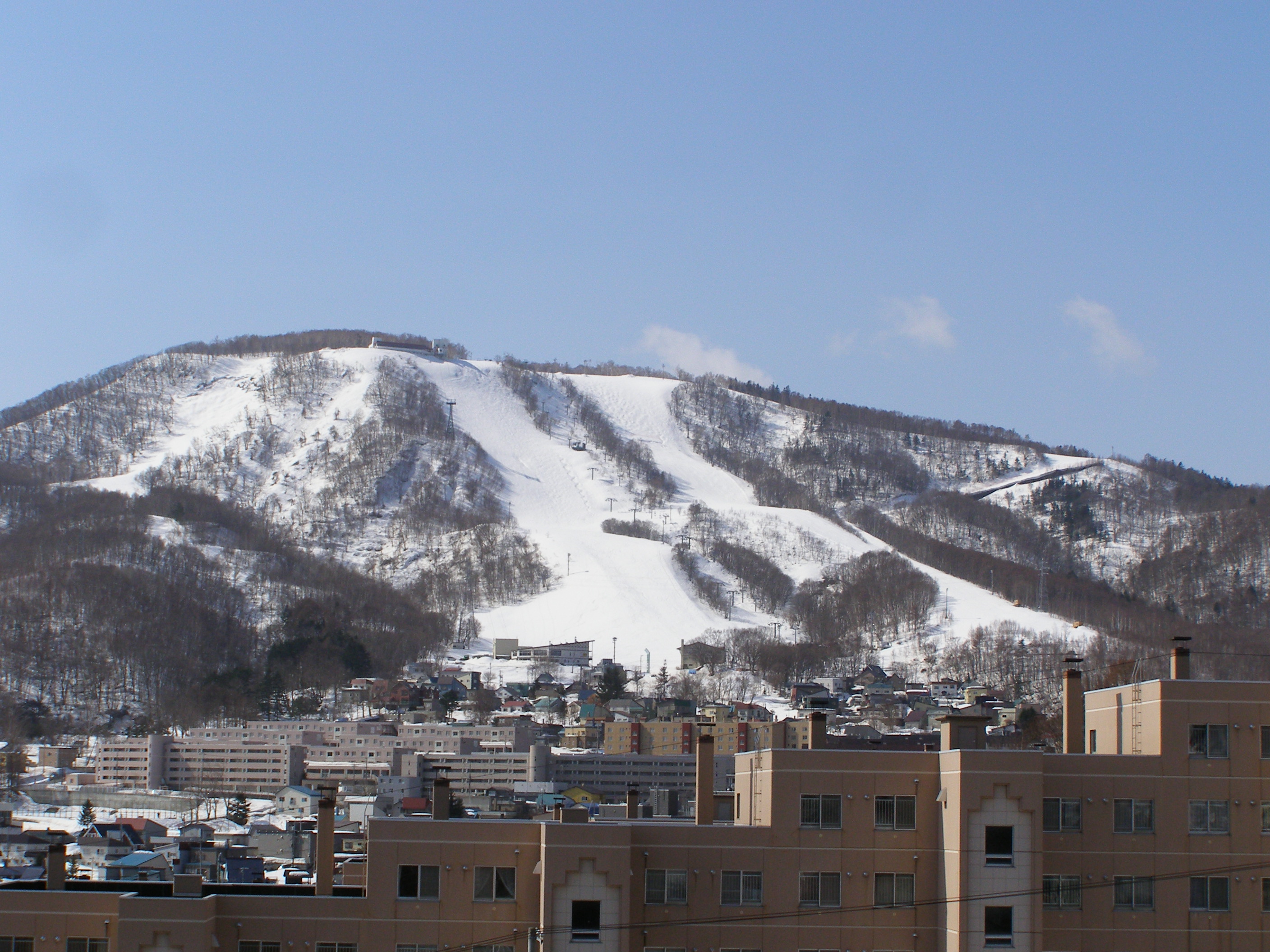
Tenguyama
 Otaru Tenguyama Ski Resort
Otaru is an important port for Sapporo, and part of this hilly city is on the lower slopes of Tenguyama, a good place for skiing and other winter sports and one that is accessible via Otaru Tenguyama Ropeway.
Sister cities
See also
- Otaru Station
- Otaru University of Commerce
- Rising Sun Rock Festival
External links
 Media related to Otaru, Hokkaido at Wikimedia Commons
- Official website (Japanese)
- Japan National Tourist Organization's Otaru page (English)
 Hokkaidō
Subprefectures 
Cities Abashiri | Akabira | Asahikawa | Ashibetsu | Bibai | Chitose | Date | Ebetsu | Eniwa | Fukagawa | Furano | Hakodate | Hokuto | Ishikari | Iwamizawa | Kitahiroshima | Kitami | Kushiro | Mikasa | Monbetsu | Muroran | Nayoro | Nemuro | Noboribetsu | Obihiro | Otaru | Rumoi | Sapporo | Shibetsu | Sunagawa | Takikawa | Tomakomai | Utashinai | Wakkanai | YūbariCategories:- Cities in Hokkaidō
- Port settlements in Japan
- Populated coastal places in Japan


Wikimedia Foundation. 2010.