- Diggle, Greater Manchester
-
Coordinates: 53°34′07″N 1°59′43″W / 53.5685°N 1.9952°W
Diggle 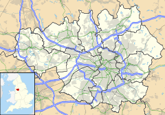
 Diggle
Diggle shown within Greater ManchesterOS grid reference SE017083 Parish Saddleworth Metropolitan borough Oldham Metropolitan county Greater Manchester Region North West Country England Sovereign state United Kingdom Post town OLDHAM Postcode district OL3 Dialling code 01457 Police Greater Manchester Fire Greater Manchester Ambulance North West EU Parliament North West England UK Parliament Oldham East and Saddleworth List of places: UK • England • Greater Manchester Diggle is a village within the Saddleworth parish of the Metropolitan Borough of Oldham, in Greater Manchester, England.[1] The village is situated on the moorlands of the Pennine hills.
Historically part of the West Riding of Yorkshire, it is located at one end of the recently restored Standedge Canal Tunnel, Britain's longest, deepest and highest canal tunnel.
In the heart of the village there is the Diggle Chippy, The Hanging Gate pub, a Newsagent, and a Post Office/off-licence. There is also a brass band club called The Diggle Band Club which regularly hosts band contests and concerts.
There is also an Anglican church in the village, Kilngreen - as well as a Methodist church, Wrigley Mill. The local school caters for 200 children ages 4 to 11.
Recently the world renowned Saddleworth Whit Friday Band Contest has started to include Diggle since 2009 as one of the contests.The Diggle Blues Festival is an annual event that takes place in June. Started in 2010, nine bands use three venues and perform over a three day weekend that allows people the opportunity to see every performance (all for free).
Diggle is home to Diggle F.C, an FA registered amateur Football Club which plays its home games at Churchill Playing Fields, Uppermill. It competes in the Huddersfield and District Association Football League. There is also a village brass band.
Contents
History
The name "Diggle" comes from the Saxon word degle meaning "valley".[2] Like many of the Saddleworth villages, it traces its history back to a collection of hamlets.
Transport
A major railway line that connects Manchester to Huddersfield and Leeds runs through Diggle. There used to be a local railway station in the village, which opened in 1849, but it was one of many to go in the Beeching era, closing in 1963. The nearest stations to Diggle are in Greenfield in Greater Manchester and Marsden in West Yorkshire.
The only bus service that serves Diggle is the 184, which provides an hourly Monday–Saturday daytime service from the Old Station Turning in Diggle to Manchester via Dobcross, Uppermill and Oldham. There is also an additional hourly Monday–Saturday daytime and two-hourly Sunday daytime service between Huddersfield and Manchester, which runs along Huddersfield Road in Diggle.
Crime
Diggle has relatively low crime levels. During June, July and August 2011, there has been an increase in reported burglary. Most notably, offenders have been gaining access through insecure doors and windows, obtaining car keys, and stealing owner's cars away from their premises.
See SaddleworthNews.com and Greater Manchester Police (Oldham East and Saddleworth) Twitter feed.
References
- ^ Greater Manchester Gazetteer, Greater Manchester County Record Office, Places names - D to F, http://www.gmcro.co.uk/Guides/Gazeteer/gazzd.htm, retrieved 9 July 2007
- ^ Bradbury, Joseph. Saddleworth Sketches, 1871.
External links
- Diggle's webpage at Virtual Saddleworth
- Diggle school's webpage
Austerlands | Castleshaw | Delph | Denshaw | Diggle | Dobcross | Friezland | Grasscroft | Greenfield | Grotton | Heights | Lydgate | Scouthead | Springhead | Uppermill
Categories:- Villages in Greater Manchester
- Towns and villages of the Peak District
- Geography of Oldham
- Greater Manchester geography stubs

Wikimedia Foundation. 2010.