Mickleham Road, Melbourne
- Mickleham Road, Melbourne
-
| Mickleham Road |
   |
 |
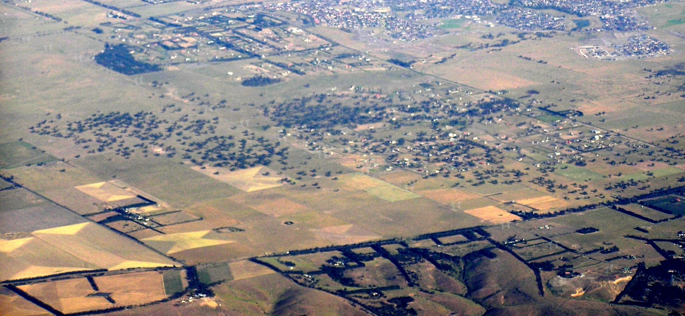
| Mickleham road cuts the bottom of this image, with Mickleham behind it. |
| Length |
22 km (14 mi) |
| Direction |
South-North |
| From |
 Melrose Drive, Melrose Drive,
Airport West, Melbourne |
| via |
Attwood, Greenvale, Yuroke, Mickleham |
| To |
 Donnybrook Road, Donnybrook Road,
Kalkallo, Victoria |
| Allocation |
Airport West - Greenvale:
Gladstone Park - Attwood:
(Duplex with )
Greenvale - Kalkallo:
Formerly |
| Major junctions |
 Tullamarine Freeway Tullamarine Freeway
 Broadmeadows Road Broadmeadows Road
 Somerton Road Somerton Road
 Craigieburn Road Craigieburn Road
Mount Ridley Road |
Mickleham Road is a secondary road located in Victoria, Australia, north of Melbourne.
Route
Mickleham Road begins at an intersection with Melrose Drive and Broadmeadows Road in Tullamarine, and continues north through the suburbs of Gladstone Park, Westmeadows, Attwood, Greenvale, Yuroke and Mickleham. At the intersection with Donnybrook Road in Mickleham it becomes the Old Sydney Road, which continues north to Wallan. Sections of Old Sydney Road are unsealed.[1]
Major intersections
Major intersections of Mickleham Road/ Old Sydney Road from south to north include:
Coordinates: 37°40′0″S 144°53′6″E / 37.666667°S 144.885°E / -37.666667; 144.885
Categories: - Streets in Melbourne
- Melbourne geography stubs
- Australia road stubs
Wikimedia Foundation.
2010.
Look at other dictionaries:
Mickleham, Victoria — Mickleham Melbourne, Victoria Mickleham from the northwest Population … Wikipedia
Melbourne Airport, Victoria — This article is about the suburb. For the airport, see Melbourne Airport. Melbourne Airport Melbourne, Victoria … Wikipedia
List of old road routes in Melbourne, Victoria — This is a list of old road routes in Melbourne, Australia before Victoria switched to the alpha numeric system in the late 1990s. Some routes, in part or in their entirety, may have been made obsolete by the alpha numeric designation: these are… … Wikipedia
Outer Metropolitan Ring Road — The Outer Metropolitan Ring Road is a proposed freeway in Melbourne, Australia connecting the Hume Freeway at Kalkallo north of Melbourne, to the Princes Freeway south west of Werribee. The concept was announced as part of the Victorian Transport … Wikipedia
List of Melbourne suburbs — This is a list of Municipalities and their suburbs and townships in the greater metropolitan area of Melbourne, in the State of Victoria, Australia.Each suburb is followed by its postcode. (Some suburbs share the same postcode). Most Victorian… … Wikipedia
Moonee Ponds Creek Trail — running alongside Citylink Moonee Ponds Creek Trail Length Approx 25 km Difficulty Easy Hills Flat … Wikipedia
Yuroke, Victoria — Infobox Australian Place | type = suburb name = Yuroke city = Melbourne state = vic caption = lga = City of Hume postcode = 3063 pop = area = est = propval = stategov = Yuroke fedgov = Calwell dist1 = 29 location1= Melbourne dist2 = location2=… … Wikipedia
Gladstone Park, Victoria — Infobox Australian Place | type = suburb name = Gladstone Park city = Melbourne state = vic caption = lga = City of Hume postcode = 3043 pop = 8669 (2006) Census 2006 AUS | id = SSC21295 | name = Gladstone Park (State Suburb) | accessdate = 2007… … Wikipedia
Greenvale, Victoria — Infobox Australian Place | type = suburb name = Greenvale city = Melbourne state = vic caption = lga = City of Hume postcode = 3059 pop = 10,401 (2006) Census 2006 AUS | id = SSC21309 | name = Greenvale (State Suburb) | accessdate = 2007 09 25 |… … Wikipedia
Attwood, Victoria — Infobox Australian Place | type = suburb name = Attwood city = Melbourne state = vic caption = lga = City of Hume postcode = 3049 pop = 2916 (2006)Census 2006 AUS | id = SSC21039 | name = Attwood (State Suburb) | accessdate = 2007 09 26 | quick … Wikipedia
 (Duplex with