- Mount Rebun
-
Mount Rebun 礼文岳 Hokkaidō, Japan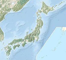
 Mount Rebun
Elevation 490.0 m (1,608 ft) [1] Listing List of mountains and hills of Japan by height Location Range Rebun Island Coordinates 45°22′21″N 141°00′57″E / 45.3725°N 141.01583°ECoordinates: 45°22′21″N 141°00′57″E / 45.3725°N 141.01583°E Topo map Geographical Survey Institute 25000:1 礼文岳
50000:1 礼文島北部[1]Geology Type Sedimentary rock Age of rock Early Cretaceous Volcanic arc/belt Sakhalin island arc Climbing Easiest route Hike Mount Rebun (礼文岳 Rebundake) is the highest point on Rebun Island in Rebun, Hokkaidō, Japan.[1] The mountain consists of marine sedimentary rocks from the Early Cretaceous period, 149–97 million years ago.[2]
Climbing route
The trailhead for the Mount Rebun hike is in Nairo. It is a 3-hour hike with no water available. The trail first passes through fields of sasa-no-ha before entering a forest of pine and birch. The peak rises above the forest to grant an unobstructed view of the entire island.[3]
References
- ^ a b c "25000:1 礼文岳" (in Japanese). Geographical Survey Institute. 2008. http://watchizu.gsi.go.jp/watchizu.aspx?b=452221&l=1410057. Retrieved 2008-07-16.
- ^ "Seamless Digital Geological Map of Japan". The Geological Survey of Japan. National Institute of Advanced Industrial Science and Technology. 2 November 2007. http://riodb02.ibase.aist.go.jp/db084/index_e.html. Retrieved 2008-07-16.
- ^ Bisignani, J. D. (1993). "Rebun and Rishiri Islands". In Taran March. Japan Handbook (Second ed.). Chico, California: Moon Publications, Inc.. p. 839. ISBN 0918373700.
Categories:- Mountains of Hokkaidō
- Hokkaidō geography stubs

Wikimedia Foundation. 2010.