- Rebun Island
Infobox Islands
name = Rebun
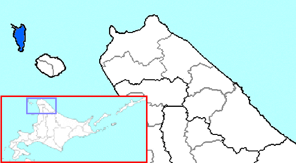
image caption =
locator
Location map|Japan|lat=45.35|long=141.016667
map_custom = yes
native name = 礼文島, "Rebun-tō"
native name link = Japanese language
nickname =
location =East Asia
coordinates = coord|45|21|N|141|01|E|display=inline,title
archipelago =Japanese Archipelago
length = convert|29|km|mi
width = convert|8|km|mi
coastline = convert|72|km|mi
area = convert|80|km2|sqmi
rank =
highest mount =Mount Rebun
elevation = convert|490.0|m|ft|1
country = Japan
country admin divisions title = Prefectures
country admin divisions = Hokkaidō
country admin divisions title 1 = Subprefectures
country admin divisions 1 = Sōya
country admin divisions title 2 = District
country admin divisions 2 = Rebun
country largest city = Rebun
country largest city population = 3,194
population = 3,194
population as of = 2007-12-31
density = 39.3
ethnic groups = Ainu, JapaneseRebun Island (礼文島, "Rebun-tō") lies in the
Sea of Japan off the northwestern tip ofHokkaidō ,Japan . Rebun stretches 29 kilometers in the north-south direction and 8 kilometers east-west, covering about 80 square kilometers. The island is known for its alpine flowers and the 8-Hour Hiking Course which runs from one end of the island to the other, north to south. The hiking course can be broken into two sections, known as the 4-Hour Hiking Courses. The island is part of theRishiri-Rebun-Sarobetsu National Park .Other features of interest
*Mount Rebun "rebun-dake"
* Peach Rock "momoiwa"
* Jizo Rock
* Cat Rock "nekoiwa"
* Cape Sukoton
* Cape Kaneda
* Cape Gorota
* Cape Sukai
*Todo Island
* Lake Kushu
* Yamunai Valley
* Rebun Forest Road
* Rebun FallsCommunities
All communities are part of the town of Rebun in Rebun District. Roughly from north to south:cite book|last=Bisignani|first=J. D.|title=Japan Handbook|editor=Taran March|publisher=Moon Publications, Inc.|location=Chico, CA USA|date=December 1993|edition=Second|pages=836-841|chapter=Dohoku-Northern Hokkaido|isbn=0-918373-70-0|language=English]
* Sukoton
* Awabikoton
* Hamanaka
* Funadomari
* Horodomari
* Uedomari
* Nairo
* Kitousu
* Kafukai
* Kafuka
* ShiretokoTransportation
* Ferry link to
Rishiri Island,Wakkanai , andOtaru via Rishiri.
* Air link to Wakkanai.References
Wikimedia Foundation. 2010.