- Rishiri Island
Infobox Islands
name = Rishiri
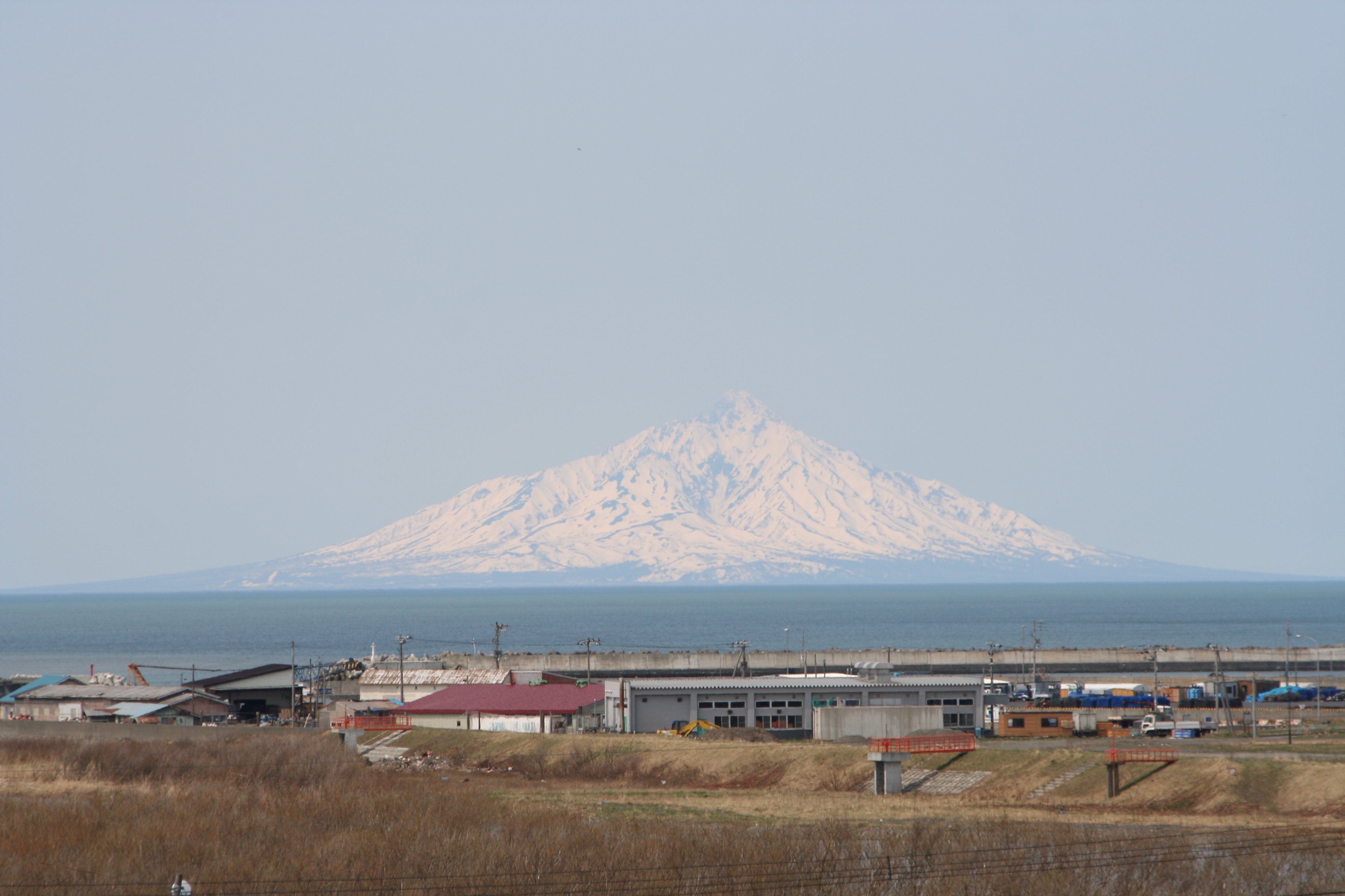
image caption = Rishiri Island (in background)
image size =
locator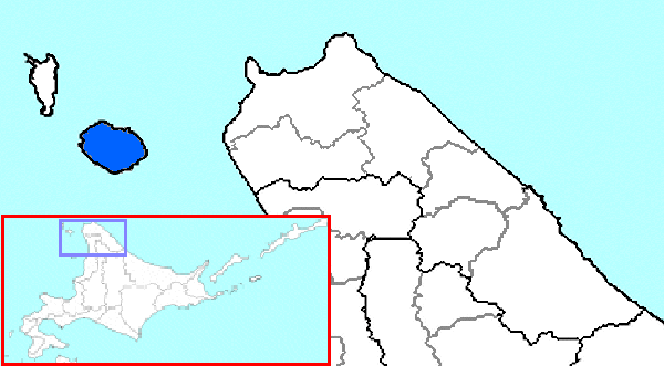
map_custom = no
native name = 利尻島, "Rishiri-tō"
native name link = Japanese language
nickname =
location =
coordinates =
archipelago = Japanese archipeligo
total islands =
major islands =
area = convert|183|km2|sqmi
length =
width =
coastline = convert|63|km|mi
highest mount =Mount Rishiri
elevation = convert|1721|m|ft
country = Japan
country admin divisions title = Prefectures
country admin divisions = Hokkaidō
country admin divisions title 1 = Subprefectures
country admin divisions 1 = Sōya
country admin divisions title 2 = District
country admin divisions 2 = Rishiri
country admin divisions title 3 = Town
country admin divisions 3 = Rishiri
country admin divisions 4 = Rishiri
country capital =
country largest city =
country largest city population =
country leader title =
country leader name =
country 1 =
country 1 admin divisions title =
country 1 admin divisions =
country 1 capital city =
country 1 largest city =
country 1 largest city population =
country 1 leader title =
country 1 leader name =
country 2 =
country 2 admin divisions title =
country 2 admin divisions =
country 2 capital city =
country 2 largest city =
country 2 largest city population =
country 2 leader title =
country 2 leader name =
population = 5638
population as of =
density =
ethnic groups = Ainu, Japanese
additional info =Rishiri Island (利尻島, "rishiritō") rises out of the
Sea of Japan off the coast ofHokkaidō ,Japan . The island is formed by the cone-shaped extinct volcanic peak ofMount Rishiri . Along with Rebun and the coastal area ofSarobetsu , Rishiri forms theRishiri-Rebun-Sarobetsu National Park . The main industries of Rishiri are tourism and fishing. The island is about 63 km in circumference and covers 183 km².Other features of Rishiri Island include:
* Cape Peshi on the East side of the port Oshidomari
* Cape Senhoshi
** Neguma (Sleeping Bear) Rock
* Jimmen Rock
* Ponmoshiri Island
* Hime Marsh
* Menūshoro Marsh
* Otatomari MarshCommunities
The island and its communities belong to the Rishiri District and Rishirifujiin
Sōya Subprefecture . The districts consist of the towns of the same name:
*Rishiri Town
*Rishirifuji TownThese towns include the following communities, listed from the North side of the island, clockwise around:
*Oshidomari
*Himenuma
*Oniwaki
*Numaura
*Misaki
*Senposhi
*Kusure
*Randomari
*Kutsugata
*Shinminato, Rishiri
*Motodomari Transportation
* Ferry service to Rebun,
Wakkanai , andOtaru
* Air link toWakkanai A bus runs the circuit route around the island.
Rishiri Airport is located in Rishirifuji.History
*
Ranald MacDonald landed on Rishiri in 1848.
Wikimedia Foundation. 2010.