- Cotabato City
-
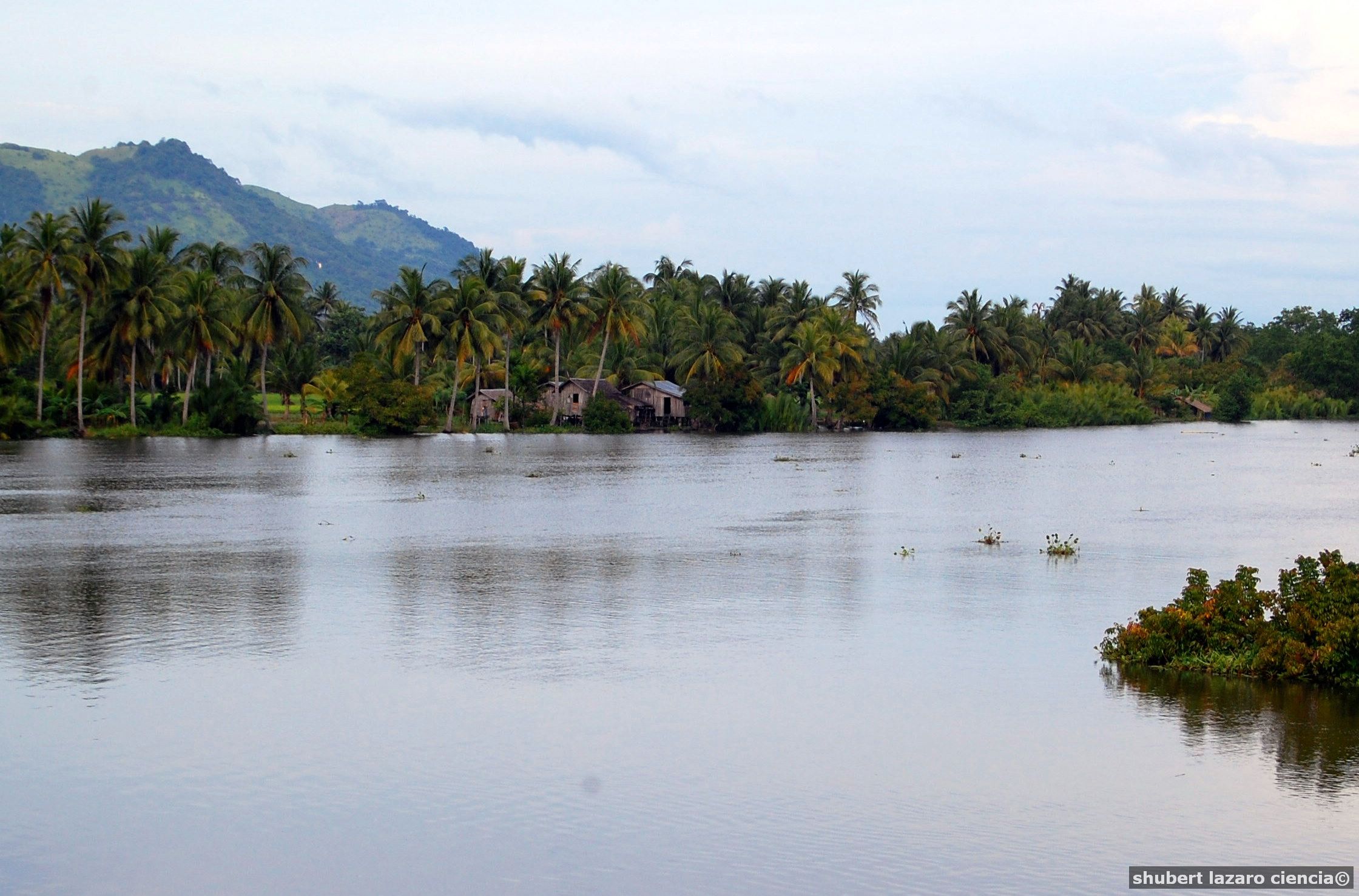
Cotabato — City — Mindanao River at Cotabato City
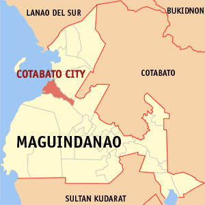
SealMap of Maguindanao showing the location of Cotabato City.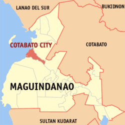 Location in the Philippines
 Cotabato
Coordinates: 7°13′N 124°15′E / 7.217°N 124.25°ECoordinates: 7°13′N 124°15′E / 7.217°N 124.25°E Country  Philippines
Region SOCCSKSARGEN (Region XII) Province Maguindanao District Lone District of Maguindanao Founded 1862 Cityhood June 20, 1959 Barangays 37 Government – Mayor Japal "JoJo" Guiani – Vice-Mayor Datu Muslimin G. Sema Area – Total 176.00 km2 (68 sq mi) Population (2007) – Total 259,153 – Density 1,472.5/km2 (3,813.7/sq mi) Time zone PHT (UTC+8) ZIP Code 9600 Income class 1st class city Website Official website The City of Cotabato (Malay: Kotabatu) is one of the cities of the Philippines located in Mindanao. Cotabato City is an exclave of the SOCCSKSARGEN region found within the boundaries of Maguindanao province, but is independent of that province. Cotabato City is distinct from and should not be confused with the province of Cotabato.
Cotabato City is the regional center of the Autonomous Region in Muslim Mindanao but the city is actually part of the SOCCSKSARGEN region, sometimes grouped with Cotabato province for some statistical purposes, and does not belong to the ARMM.
Cotabato's population was about 259,153 in 2007 census.
Cotabato is approximately 698.9 nautical miles (1294 km) from Manila, the country's capital, and is bounded by the municipalities of Sultan Kudarat to the north—with Rio Grande de Mindanao separating the two—Kabuntalan to the east, and Datu Odin Sinsuat to the south. The city faces Illana Bay, part of the Moro Gulf, to the west. Cotabato City has a total land area of 176.0 square kilometers.
Contents
History
Cotabato City had witnessed more history than any other place in Mindanao. Its history dates back to the 15th century when Shariff Kabunsuan, an Arab missionary, landed along the banks of the Rio Grande de Mindanao and introduced Islam to the natives. Islam was the faith that moved the early settlers to communal life, and to establish the Sultanate of Maguindanao with its golden age ushered in by Sultan Dipatuan Qudarat during the 17th century the time when Cotabato City developed as the capital town of Maguindanao.
In the nineteenth century, when Sultan Makakua ruled, roads and wharfs were constructed which gave rise to the birth of modern day Cotabato. However, the then Municipality of Cotabato was first organized at the later part of the 19th century when the Spaniards established a military post at Barangay Tamontaka, one of the earliest Christian settlements.
The town was founded by the Spaniards in 1862 and named it in a Spanish equivalent of the word "fort." Christianity was introduced in 1870 in the area. Almost a century later it became a city on July 10, 1959. During that time it was the capital of the undivided province of Cotabato.
On July 1, 1950, the then Municipality of Cotabato was made first class municipality under Executive Order No. 466. Nine Years later, on June 20, 1959, it was created into a chartered city by virtue of Republic Act No. 2364.
Today, Cotabato City is the seat of two administrative regions: Region XII and the Autonomous Region in Muslim Mindanao. The City currently serves as the center for economic support activities (trade and finance), education and other support services such as social, physical, cultural and other basic services of Central Mindanao are offered in the city
Climate
Climate data for Cotabato City Month Jan Feb Mar Apr May Jun Jul Aug Sep Oct Nov Dec Year Average high °C (°F) 32
(90)32
(90)33
(91)33
(91)33
(91)32
(90)32
(90)31
(88)32
(90)32
(90)32
(90)32
(90)32 Average low °C (°F) 21
(70)21
(70)21
(70)22
(72)22
(72)22
(72)22
(72)22
(72)22
(72)22
(72)22
(72)21
(70)22 Precipitation mm (inches) 60
(2.36)80
(3.15)90
(3.54)120
(4.72)230
(9.06)220
(8.66)220
(8.66)320
(12.6)240
(9.45)250
(9.84)170
(6.69)90
(3.54)2,160
(85.04)Source: Weatherbase.com[1] Income Classification
Cotabato City is average income in a year is approximately PHP 400m or more. Cotabato City is a 1st class city.
Barangays
Cotabato City is politically subdivided into 37 barangays.
- Bagua
- Bagua II
- Kalanganan
- Poblacion
- Rosary Heights
- Bagua I
- Bagua II
- Bagua III
- Kalanganan I
- Kalanganan II
- Poblacion I
- Poblacion II
- Poblacion III
- Poblacion IV
- Poblacion V
- Poblacion VI
- Poblacion VII
- Poblacion VIII
- Poblacion IX
- Rosary Heights I
- Rosary Heights II
- Rosary Heights III
- Rosary Heights IV
- Rosary Heights V
- Rosary Heights VI
- Rosary Heights VII
- Rosary Heights VIII
- Rosary Heights IX
- Rosary Heights X
- Rosary Heights XI
- Rosary Heights XII
- Rosary Heights XIII
- Tamontaka I
- Tamontaka II
- Tamontaka III
- Tamontaka IV
- Tamontaka V
- Tamontaka VI
Tourist attractions
- Rio Grande de Mindanao. The second largest river in the Philippines and the longest in Mindanao crisscrossing, with its tributary, the city's vast area. Estimated to be 182 kilometers long and 96 meters wide. Water sports and boat racing are the popular attractions of the river, usually held to coincide with the Shariff Kabunsuan Festival and the Feast of Hariraya Puasa.
- Tamontaka Church – Built in 1872 of Spanish architecture and design. It is the oldest church in the city , a relic of the living past.
- Lourdes Grotto – A replica of Our Lady of Lourdes Grotto in France. The compound is equipped with a retreat house for recollection and seminars, a mini zoo and a children's park.
- Kutang Bato Caves – The only cave in the country that is right in the heart of the city. Its various entrances, all within traffic a rarity that can only be had in the "Heart of Mindanao". These caves were also the source of the city's present name for "Kuta" means "Fort" and "Bato" means "Stone" hence the name "Fort of Stone" which later on became Cotabato.
- Old Cotabato City Hall – A century old structure which houses almost all of the city government offices. It showcases the architectural design of the Maguindanaon Art.
- Takumi Butai Memorial Shrine – A monument in honor of Takumi Butai and the Japanese soldiers who died here during the Second World War. Takumi was the Provincial Commander of the Japanese forces assigned in Cotabato City. Before he died, he requested that some of his ashes be buried in Cotabato City. This shrine was put up by the Lion's Club of Kyoto, Japan in cooperation with the City Government of Cotabato.
Malls around the City
- South Seas Mall Cotabato - the first shopping mall in the city.
- KCC mall of Cotabato - soon to start construction.
Cotabato City Officials
Congresswoman
- Hon. Bai Sandra A. Sema
City Mayor
- Hon. Japal J. Guiani Jr.
City Vice Mayor
- Hon. Muslimin G. Sema
City Councilors
- Hon. Graham Nazer G. Dumama
- Hon. Eduardo C. Rabago
- Hon. Marino R. Ridao
- Hon. Wilfrido H. Bueno
- Hon. Abdullah A. Andang
- Hon. Madatu B. Datumanong
- Hon. Froilan R. Melendrez
- Hon. Florante L. Formento
- Hon. Sukarno G. Sema
- Hon. Kusin S. Taha
- Hon. Abdillah J. Lim
- Hon. Aeyresc Japal G. Sayadi
See also
References
- ^ "Historical Weather for Cotabato, Soccsargen, Philippines". http://www.weatherbase.com/weather/weather.php3?s=64789&refer=&units=metric&cityname=Cotabato-Soccsksargen-Philippines. Retrieved 2011-08-15.
External links
- Sangguniang Panlungsod of Cotabato City Website
- All About Cotabato City
- Philippine Standard Geographic Code
- Cotabato City
- The Mindanao Examiner Newspaper
- NSCB details for cotabato city geographic code
Municipalities - Ampatuan
- Buluan
- Datu Abdullah Sangki
- Datu Anggal Midtimbang
- Datu Hoffer Ampatuan
- Datu Montawal
- Datu Paglas
- Datu Piang
- Datu Salibo
- Datu Saudi-Ampatuan
- Datu Unsay
- General Salipada K. Pendatun
- Guindulungan
- Mamasapano
- Mangudadatu
- Pagalungan
- Paglat
- Pandag
- Rajah Buayan
- Shariff Aguak
- Shariff Saydona Mustapha
- South Upi
- Sultan sa Barongis
- Talayan
- Talitay
Independent component city - Cotabato
Cities of the PhilippinesHighly-urbanized Cities Angeles · Bacolod · Baguio · Butuan · Cagayan de Oro · Caloocan · Cebu · Davao · General Santos · Iligan · Iloilo · Lapu-Lapu · Las Piñas · Lucena · Makati · Malabon · Mandaluyong · Mandaue · Manila · Marikina · Muntinlupa · Navotas · Olongapo · Parañaque · Pasay · Pasig · Puerto Princesa · Quezon City · San Juan · Tacloban · Taguig · Zamboanga
Independent
Component CitiesComponent Cities Alaminos · Antipolo · Bago · Bais · Balanga · Batangas · Batac · Bayawan · Baybay · Bayugan · Biñan · Bislig · Bogo · Borongan · Cabadbaran · Cabanatuan · Cadiz · Calamba · Calapan · Calbayog · Candon · Canlaon · Carcar · Catbalogan · Cauayan · Cavite · Danao · Dapitan · Dasmariñas · Digos · Dipolog · Dumaguete · El Salvador · Escalante · Gapan · Gingoog · Guihulngan · Himamaylan · Iriga · Isabela · Kabankalan · Kidapawan · Koronadal · La Carlota · Lamitan · Laoag · Legazpi · Ligao · Lipa · Maasin · Malaybalay · Malolos · Marawi · Masbate · Mati · Meycauayan · Muñoz · Naga, Cebu · Oroquieta · Ozamiz · Pagadian · Palayan · Panabo · Passi · Roxas · Sagay · Samal · San Carlos, Negros Occidental · San Carlos, Pangasinan · San Fernando, La Union · San Fernando, Pampanga · San Jose · San Jose del Monte · San Pablo · Santa Rosa · Silay · Sipalay · Sorsogon · Surigao · Tabaco · Tabuk · Tacurong · Tagaytay · Tagbilaran · Tagum · Talisay, Cebu · Talisay, Negros Occidental · Tanauan · Tandag · Tangub · Tanjay · Tarlac · Tayabas · Toledo · Trece Martires · Tuguegarao · Urdaneta · Valencia · Victorias · Vigan
Categories:- Cities in the Philippines


Wikimedia Foundation. 2010.