- Datu Abdullah Sangki, Maguindanao
-
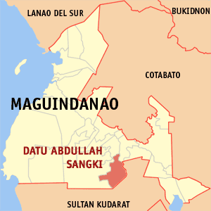
Datu Abdullah Sangki, Maguindanao Map of Maguindanao showing the location of Datu Abdullah Sangki
Country Philippines Region Autonomous Region in Muslim Mindanao Province Maguindanao Districts Lone district of Maguindanao Barangays 10 Established January 31, 2004 Government - Mayor Datu Akmad S. Sangki Population (2007) - Total 33,259 Time zone PST (UTC+8) ZIP code 9609¹ Area code(s) 64 ¹Postal code of its mother municipality Datu Abdullah Sangki is a municipality in the province of Maguindanao, Philippines.
Barangays
Datu Abdullah Sangki is politically subdivided into 10 barangays.[1]
- Banaba
- Dimampao
- Guinibon
- Kaya-kaya
- Maganoy
- Mao
- Maranding
- Sugadol
- Talisawa
- Tukanolocong (Tukanologong)
History
The municipality was created under Muslim Mindanao Autonomy Act No. 153 dated August 20, 2003, ratified in the plebiscite held on January 3, 2004.[2] It was carved out of the municipality of Ampatuan.
Population Census Census Pop. Rate 1995 13,847 — 2000 15,911 3.03% 2007 33,259 10.70% 1995 and 2000 figures are population of
areas now part of Datu Abdullah Sangki.References
- ^ National Statistical Coordination Board. "PSGC Interactive: Municipality/City: DATU ABDULLAH SANGKI". http://www.nscb.gov.ph/activestats/psgc/municipality.asp?muncode=153828000®code=15&provcode=38. Retrieved 2008-05-19.
- ^ National Statistical Coordination Board (2004-08-22). "2004 Factsheet (January to July 2004)". http://www.nscb.gov.ph/factsheet/pdf04/fs1_04.asp. Retrieved 2006-06-24.
Municipalities Ampatuan • Buluan • Datu Abdullah Sangki • Datu Anggal Midtimbang • Datu Hoffer Ampatuan • Datu Montawal • Datu Paglas • Datu Piang • Datu Salibo • Datu Saudi-Ampatuan • Datu Unsay • General Salipada K. Pendatun • Guindulungan • Mamasapano • Mangudadatu • Pagalungan • Paglat • Pandag • Rajah Buayan • Shariff Aguak • Shariff Saydona Mustapha • South Upi • Sultan sa Barongis • Talayan • TalitayIndependent component city (Administratively independent from the province, but grouped under Maguindanao by the National Statistics Office)Coordinates: 6°49′52″N 124°30′26″E / 6.83111°N 124.50722°E
Categories:- Municipalities of Maguindanao
Wikimedia Foundation. 2010.