- Datu Paglas, Maguindanao
-
Datu Paglas, Maguindanao Map of Maguindanao showing the location of Datu Paglas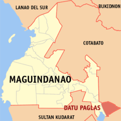
Coordinates: 6°46′1″N 124°51′0″E / 6.76694°N 124.85°ECoordinates: 6°46′1″N 124°51′0″E / 6.76694°N 124.85°E Country Philippines Region Autonomous Region in Muslim Mindanao Province Maguindanao Districts Lone district of Maguindanao Barangays 23 Established November 22, 1973 Government – Mayor Datu Mohamad P. Paglas Area – Total 269.50 km2 (104.1 sq mi) Elevation 20 m (66 ft) Population (2007) – Total 29,979 – Density 111.2/km2 (288/sq mi) Time zone PST (UTC+8) ZIP code 9617 Area code(s) 64 Website www.datupaglas.gov.ph Datu Paglas is a municipality in the province of Maguindanao, Philippines.
Barangays
Datu Paglas is politically subdivided into 23 barangays.[1]
- Alip (Pob.)
- Bonawan
- Bulod
- Damalusay
- Damawato
- Datang
- Elbebe
- Kalumenga (Kalumanga)
- Katil
- Lipao
- Lomoyon
- Madidis
- Makat
- Malala
- Mangadeg
- Manindolo
- Mao
- Napok
- Palao sa Buto
- Poblacion
- Puya
- Salendab
- Sepaka
History
Datu Paglas was created out of 7 northern barrios of the municipality of Columbio on November 22, 1973 by Presidential Decree No. 340.[2] While Columbio was made part of the province of Sultan Kudarat, Datu Paglas was made part of the province of Maguindanao.[3]
Population Census Census Pop. Rate 1995 15,522 — 2000 20,014 5.61% 2007 29,979 5.73% References
- ^ National Statistical Coordination Board. "PSGC Interactive: Municipality/City: DATU PAGLAS". http://www.nscb.gov.ph/activestats/psgc/municipality.asp?muncode=153805000®code=15&provcode=38. Retrieved 2008-05-19.
- ^ Chan Robles Virtual Law Library (1998-07-19). "Presidential Decree No. 340". http://www.chanrobles.com/presidentialdecrees/presidentialdecreeno340.html. Retrieved 2008-05-19.
- ^ Chan Robles Virtual Law Library (1998-07-19). "Presidential Decree No. 341". http://www.chanrobles.com/presidentialdecrees/presidentialdecreeno341.html. Retrieved 2008-05-18.
Municipalities - Ampatuan
- Buluan
- Datu Abdullah Sangki
- Datu Anggal Midtimbang
- Datu Hoffer Ampatuan
- Datu Montawal
- Datu Paglas
- Datu Piang
- Datu Salibo
- Datu Saudi-Ampatuan
- Datu Unsay
- General Salipada K. Pendatun
- Guindulungan
- Mamasapano
- Mangudadatu
- Pagalungan
- Paglat
- Pandag
- Rajah Buayan
- Shariff Aguak
- Shariff Saydona Mustapha
- South Upi
- Sultan sa Barongis
- Talayan
- Talitay
Independent component city (Administratively independent from the province, but grouped under Maguindanao by the National Statistics Office)Categories:- Municipalities of Maguindanao

Wikimedia Foundation. 2010.