- Tupton
-
Not to be confused with Tapton, Derbyshire.
Coordinates: 53°11′26″N 1°24′26″W / 53.19051°N 1.40729°W
Tupton 
Avenue Washlands Nature Reserve, Tupton.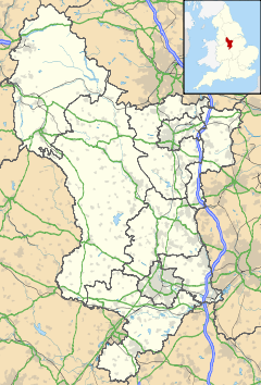
 Tupton
Tupton shown within DerbyshirePopulation 3,794 OS grid reference SK397661 Parish Tupton District North East Derbyshire Shire county Derbyshire Region East Midlands Country England Sovereign state United Kingdom Post town CHESTERFIELD Postcode district S42 6-- Dialling code 01246 Police Derbyshire Fire Derbyshire Ambulance East Midlands EU Parliament East Midlands UK Parliament North East Derbyshire List of places: UK • England • Derbyshire Tupton is a village in North East Derbyshire, Derbyshire, England, 4.5 miles (7 km) south of Chesterfield. It lies just north of Clay Cross on the A61 (Derby Road) which runs from Chesterfield to Alfreton. It comprises the areas of Old Tupton and New Tupton. However, it is generally referred to as Tupton. A similarly named area, Tapton, is a few miles away, being part of Chesterfield.
The village has a primary school, and a secondary school with a sixth form. Tupton also has two general stores, post office, hair dresser, tanning studio, building supplies, tyre services, multiple garages car repair/diagnostics, preschool nursery, two pubs and one club, fish and chip shop, nursing home, along with a recently renovated coffee house and a pharmacy.
Other settlements near the village are Wingerworth, Grassmoor and North Wingfield.
A carnival called the Tupton Carnival is a yearly event held on a Saturday in July, this was first started in 2003 and has grown in size and attendance as the years have gone on. A young lady is elected Carnival Queen and travels through the village attended by the carnival princes and princesses and followed by a procession of floats, bands and fancy dress participants. This parade ends on the Primary school field where an afternoon of fun, and live music is set up, with stalls, displays by local groups and various competitions.
The village also recently held an evening of Christmas activities, where numerous market stalls were set up along one of the main roads, called Green Lane. Tupton has also seen new development around Ankerbold Road, which runs on the outer edge of the village, close to North Wingfield. A large, new, modern housing estate has been built around the Pond Lane proximity, as well as modern housing to the south.
It is also known that Tupton has been a settlement since way back in the Anglo-Saxon times, as the historic Ryknield Street runs directly through the village. The locality was formerly known as "Topetune" and "Tuphome." On the first Ordnance Survey maps Tupton was named Tupton Moor.
Contents
Bombing Raid of 1941
The area known as 'the Rec' once held a lido, or open-air swimming pool, the remains of which can still be seen in the stream. During the Second World War, several houses in Tupton were bombed by fleeing German aircraft. Some of these houses were on Ward Street and others in now demolished areas where the Community Garden is now located. One lasting impression the bombers left was the area in the woods surrounding Tupton Hall school, called 'Monkey Hollow'. The deep crater in the woods was the result of one of the aforementioned bombs. It is known 11 people died in the raid on the morning of 15 March 1941.
People from Tupton
- The famous darts player John Lowe was born in Tupton in 1945.
- Dennis Skinner M.P. attended school here
See also
External links
Categories:- Villages in Derbyshire
- Towns and villages of the Peak District
- Derbyshire geography stubs


Wikimedia Foundation. 2010.