- Deep Cove, North Vancouver
-
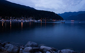
Deep Cove refers to both the community in the easternmost part of the District of North Vancouver, in British Columbia, Canada, and also the geographic name of the small bay beside the town. It is affectionately referred to as "The Cove" by local residents. Located at the foot of Mount Seymour, Deep Cove faces due east, fronting on to Indian Arm, a branch of the Burrard Inlet. The area is the traditional territory of the Tsleil-Waututh and Sḵwxwú7mesh, the Indigenous, of the Coast Salish First Nations. Deep Cove is 13 kilometres (8.1 mi) from downtown Vancouver.
Contents
History
Deep Cove, or Deepwater as it was first known, is located in the traditional clamming and fishing area of the Squamish Salish native nation who lived and still live in the area for thousands of years. Spanish and English Naval explorers scouted the arm in the eighteen century, and by the mid-nineteenth whales were being caught and flensed on the Cove's shores.
Deep Cove became a popular summer resort for Vancouver residents in the 1910s, with cabins, logging and granite quarrying featuring in the local history. For many years, the focal point of the community included a yacht club, dance hall and general store.
The population slowly grew in the 1960s and 1970s, when access to the area improved following the completion of the Second Narrows Bridge to Vancouver in 1960. However, Deep Cove held on to its rural feel, and a large, open horse paddock sat adjacent to Gallant Avenue in this period. Today, the Cove remains a popular attraction in the district, drawing visitors from neighbouring Cove Cliff, Dollarton, Parkgate, Indian Arm and Woodlands areas.
Recreation
With its proximity to forests, mountains, skiing, parks and the water, Deep Cove is well known among outdoor recreation enthusiasts. The Deep Cove Bike Shop, a local institution, brought the first mountain bikes to Vancouver in the early 1980s.
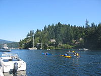
Deep Cove is a popular small boat centre, with a Rowing Club, Canoe and kayak rentals and lessons, and a marina. The bay in front of the community is one of the few in Indian Arm which has both a sheltering shape and the shallow bottom required for overnight anchorage of pleasure vessels.
The Baden-Powell Trail leading up to the lookout point, Quarry Rock, is a popular spot for visitors, especially in the summer. The Community Centre boasts an art gallery, stage, and archive.
Education
Deep Cove is served by two community schools, Cove Cliff Elementary and Seycove Secondary, as well as two other schools in the surrounding area. Students participating in the French immersion program attend Argyle Secondary School, Windsor Secondary School, Sherwood Park Elementary School, or Dorothy Lynas Elementary School.
Notable residents
Canadian artist Charles van Sandwyck spent his teen years in Deep Cove. The actor Ben Affleck had a residence in Deep Cove in the early 2000s. The writer Malcolm Lowry lived as a squatter in nearby Dollarton in the 1940s; his cabin is gone but remembered with a plaque in Cates Park. Darren Schemmeler, the Canadian High Commissioner to Ghana, is also from Deep Cove.
Gallery
External links
Neighbourhoods in the City and District of North Vancouver, British Columbia Neighbourhoods Blueridge · Boulevard · Canyon Heights · Capilano · Central Lonsdale · Cleveland Park · Cove Cliff · Deep Cove · Delbrook · Edgemont Village · Forest Hills · Hamilton · Keith Lynn · Lionsview · Lower Lonsdale · Lynn Creek · Lynnmour · Lynn Valley · Maplewood · Norgate · Pemberton · Pemberton Heights · Queensbury · Riverside · Seymour · Strathcona · Upper Lonsdale ·First Nations Coordinates: 49°19′37″N 122°56′55″W / 49.32691°N 122.94868°W
Categories:- North Vancouver (district municipality), British Columbia
- Populated places in Greater Vancouver
Wikimedia Foundation. 2010.


