- North Vancouver, British Columbia
-
- This page is about the two distinct British Columbia municipalities that use the name, and are often jointly referred to as, "North Vancouver". For information specific to the City of North Vancouver or the District of North Vancouver, please refer to their individual articles. For the Canadian federal electoral district, please see North Vancouver (electoral district).
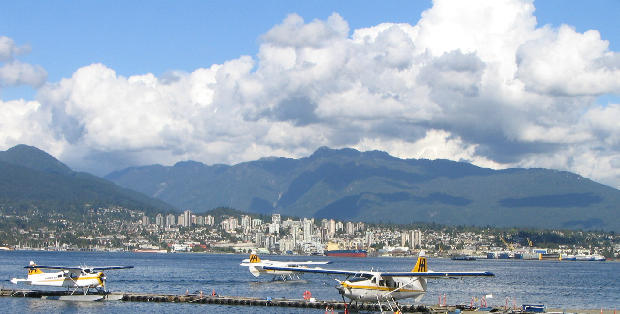
 The City of North Vancouver (centre) is surrounded by the District of North Vancouver on three sides
There are two municipalities in the Greater Vancouver region of British Columbia, Canada, that use the name North Vancouver. These are:
- The City of North Vancouver (44,303 residents – 2001 Census)
- The District of North Vancouver (82,310 residents – 2001 Census)
While the City and District are separate entities, each with its own mayor, council, and operations departments, they share several core services such as the North Vancouver School District,[1] the North Vancouver Recreation Commission and the North Vancouver detachment of the Royal Canadian Mounted Police. These two municipalities, along with the district of West Vancouver are commonly referred to as the North Shore.
The differences between the two municipalities are most apparent to their respective residents. For the most part, other Lower Mainland residents rarely distinguish between the District and the City, referring to both collectively as "North Vancouver". The same is true for commercial advertising, and even for certain government departments, including Canada Post. There have been several proposals over the years with regards to merging the two municipalities, but none have progressed beyond the concept stage.
There are, however, some distinct differences between the two municipalities, both physically and socially:
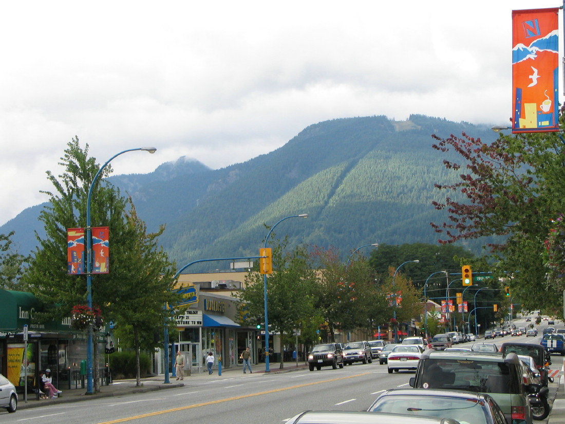
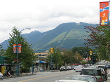 Main thoroughfare Lonsdale Avenue with Grouse Mountain in the background
The District of North Vancouver is by far the larger of the two. Bounded by the Capilano River to the west, Indian Arm to the east, Burrard Inlet to the south, and the North Shore Mountains to the north, it sprawls in an east-west direction across the mountain slopes, characterized by rugged terrain, frequent rain and steep and winding roadways. The District is primarily made up of single-family residential housing, with an industrial base along the shoreline of Burrard Inlet. It has more than twice the population of the City, but with a much lower population density. There is no clearly defined "downtown"; instead, a series of commercial areas such as Edgemont Village and Lynn Valley serve as local community hubs.
The City of North Vancouver, on the other hand, has a much more urban feel. Surrounded to the west, north, and east by the District, the City is home to the majority of the North Shore's high rise buildings, rental properties, and commercial operations. As with the District, there are industrial sites along the shore of Burrard Inlet, although in recent years several of these have begun to convert to residential and commercial areas. The City also has the Lonsdale Quay public market and the northern terminal for Vancouver's Seabus transit ferry. Regional planners have identified the City, and specifically its Central Lonsdale and Lower Lonsdale neighbourhoods, as the "downtown" of the North Shore.
Attributes
The very rugged nature of the North Shore Mountains, including, predominantly, Grouse Mountain and Mount Seymour, have contributed to this area's reputation for hiking, skiing, and perhaps most famously, mountain biking. Many trails are featured in popular mountain biking videos. The Baden-Powell Trail runs 50 kilometres from Horseshoe Bay to Deep Cove. This trail is host to the annual Knee Knackering North Shore Trail Run (or "Knee Knacker"), which is a half day long run along the entire length of the trail. The District is also home to the Grouse Grind hiking trail, a steep vertical climb sometimes referred to as "Mother Nature's Stairmaster."
The North Shore is also the birth place of "Shore Riding", a specific style of mountain bike riding that involves hand made ladders, bridges and logs. The structures range from the simple to the elaborate, the best being made of cedar. They are used to navigate difficult terrain, rivers, swamps and muddy areas. The Shore is also known for its steep, slippery, wet, technical, rooty and generally nasty terrain.
Other tourist attractions include Lynn Canyon Park,[2] the Lynn Canyon Suspension Bridge, the Capilano Fish Hatchery at Capilano River Regional Park, the Capilano Suspension Bridge, the Lower Seymour Conservation Reserve, and the Maplewood Flats conservation area. Indian Arm, an offshoot of Burrard Inlet, is well known for its sea kayaking and is the setting for Deep Cove. The tallest known specimen of Douglas fir tree was once located in Lynn Valley[3] within North Vancouver.
Some of the local drinking establishments in the city and the district were immortalized in "The Crawl," a song by local folk-rock band Spirit of the West which recounts a pub crawl across the North Shore. The area is also the setting for the 2008 documentary Carts of Darkness.
References
- C. Michael Hogan (2008) Douglas-fir: Pseudotsuga menziesii, globalTwitcher.com, ed. Nicklas Strõmberg)
- Lynn Canyon Park (and Ecology Centre) (2009)
- North Vancouver School District(2008)
Line notes
Coordinates: 49°18′40″N 123°01′10″W / 49.31111°N 123.01944°W
Categories:- Greater Vancouver Regional District
- Mountain biking venues in Canada
- Populated places on the British Columbia Coast

Wikimedia Foundation. 2010.