- Florida State Road 16
-
"FL 16" redirects here. For the congressional district, see Florida's 16th congressional district.
State Road 16
Route information Maintained by FDOT Length: 63.6 mi[1][2] (102.35 km) Major junctions West end:  SR 121 near Raiford
 US 301 / SR 200 in Starke

 US 17 / SR 15 in Green Cove Springs
 I-95 near St. Augustine
East end: 

 US 1 Bus. / SR 5A in St. Augustine
Location Counties: Union, Bradford, Clay, St. Johns Highway system Florida State and County Roads
Interstate • US • SR (Pre-1945) • Toll • County← SR 15US 17 →State Road 16 runs from northwest to southeast between Raiford and St. Augustine. It passes through the towns of Starke and Green Cove Springs in addition to providing access to Camp Blanding.
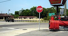 Eastern terminus at US Business 1 in St. Augustine
SR 16 crosses the St. Johns River using the Shands Bridge. This bridge connects Clay and St. Johns Counties. The Shands is often considered an emergency alternative to the Buckman Bridge that is farther north. The difference between both bridges is that the Buckman, which carries Interstate 295, has eight lanes in each direction while the Shands has only two lanes.
Major roads and/or highways that SR 16 crosses include: US 1, Interstate 95, SR 13, US 17, SR 21 and US 301.
Junction list
County Location Mile[2] Destinations Notes Union Raiford 0.00 SR 121Western terminus Bradford Starke US 301 / SR 200Clay Camp Blanding  SR 230
 SR 21
SR 21Green Cove Springs US 17 / SR 15Brief concurrency St. Johns River Shands Bridge St. Johns Orangedale  SR 13
SR 13 I-95 / SR 9
St. Augustine 63.5  US 1 / SR 5
63.6
US 1 Bus. / SR 5AEastern terminus 1.000 mi = 1.609 km; 1.000 km = 0.621 mi Related route
County Road 16A
Location: St. Johns Length: 7.1 mi[3] (11.43 km) CR 16A is a county road in St. Johns County, Florida. It is a spur of SR 16 in northwestern St. Johns. It goes through mainly rural land. It begins at SR 13 just north of the Shands Bridge and continues about 1.5 miles before making a junction with County Road 210 after wards it continues till its end at SR 16 near World Golf Village.
References
- ^ FDOT GIS data
- ^ a b Google, Inc. Google Maps – overview map of State Road 16 (Map). Cartography by Google, Inc. http://maps.google.com/maps?f=d&source=s_d&saddr=FL-121+N&daddr=29.9832343,-81.752675+to:Picolata+Rd&geocode=FczVygEdq1oZ-w%3BFQKCyQEdnY0g-ykJGjJoZtnliDE02b87T3GdeA%3BFfx_yAEdFh0n-w&hl=en&mra=ls&via=1&sll=29.916694,-81.323746&sspn=0.002306,0.003449&ie=UTF8&t=h&z=9. Retrieved 2010-09-28.
- ^ Google, Inc. Google Maps – CR 16A (Map). Cartography by Google, Inc. http://maps.google.com/maps?f=q&source=s_q&hl=en&q=&vps=2&jsv=242c&sll=29.996719,-81.549969&sspn=0.069874,0.154324&ie=UTF8&geocode=Fd3IyQEdtqIj-w&split=0.
Categories:- State highways in Florida
- State Roads in Union County, Florida
- State Roads in Bradford County, Florida
- State Roads in Clay County, Florida
- State Roads in St. Johns County, Florida


Wikimedia Foundation. 2010.