- Florida State Road 24
-
"FL 24" redirects here. For the congressional district, see Florida's 24th congressional district.
State Road 24
Route information Maintained by FDOT Length: 71.9 mi[1] (115.71 km) Major junctions West end: 1st Street at the Gulf of Mexico in Cedar Key 

 US 19/US 98/SR55 in Otter Creek


 US 27 Alt/SR 500 in Bronson

 US 27/US 41/SR 45 in Archer

 US 441/SR 25 in Gainesville

 I-75/SR 93 in Gainesville
East end: 
 US 301/SR 200 in Waldo
Highway system Florida State and County Roads
Interstate • US • SR (Pre-1945) • Toll • County←  SR 23
SR 23SR 25 →State Road 24 is an east–west highway that runs between Cedar Key on the Gulf of Mexico and Waldo, Florida, at US 301. State Road 24 runs along a former branch of the Seaboard Air Line Railroad. This branch was originally owned by the Florida Railway and Navigation Company, and used to lead to ferries to both Pensacola, Florida and New Orleans, Louisiana. It also passes through Rosewood, site of the infamous 1923 massacre.
Contents
Route description
Levy County
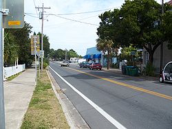 Florida SR 24 in Cedar Key.
Starting as D Street in Cedar Key, State Road 24 skips over Jackson Island and Sunset Island before making its way across the mainland of northwestern Florida. In the City of Otter Creek, the road intersects US 19-98, at a blinker light, which hardly looks like a city at all.
Between US 19-98 and Alternate US 27 in Bronson, the road runs through a wooded area north of Goethe State Forest.
Names for State Road 24 in Levy County include D-Street, 2nd Avenue, West Thrasher Drive, East Thrasher Drive and SR 24.
Alachua County
Shortly after crossing the Levy-Alachua County Line, SR 24 becomes Archer Road and enters Archer itself, intersecting with US 27-41. After the interchange with Interstate 75 in Gainesville, State Road 24 crosses SR 121, where it runs along the south side of the University of Florida then become concurrent with US 441, later with SR 20/26(West University Avenue), until the intersection with SR 331(Southeast Williston Road), where it breaks off onto Northeast Waldo Road. The Northeast corner of SR 24 and SR 222 is the site of the Gainesville Regional Airport, before finally terminating at an interchange with US 301 in Waldo.
Names for State Road 24 in Alachua County include SR 24, Southwest Archer Road, Southwest 13th Street, West University Avenue, Northeast Waldo Road, Kennard Street (Westbound lanes in Waldo), and Waldo Road (Eastbound lanes in Waldo).
Major intersections
 Levy County Road 347: East of Cedar Key
 Levy County Road 345: Rosewood
 Levy County Road 336: Otter Creek
- US 19-98-SR 55: Otter Creek
 Levy County Road 24B: West of Bronson
Alternate US 27-SR 500: Bronson Levy County Road 337: Bronson
 Levy County Road 32B: Bronson
 Levy County Road 32: Bronson
- US 27-41-SR 45: Archer
- I-75-SR 93(Exit 384): Gainesville
 SR 121: Gainesville
 SRs 226/24A: Gainesville
- US 441SR 25-: Gainesville begin US 441 concurrency.
 SR 26: Gainesville end US 441 concurrency, begin SR 26 concurrency.
 SR 20: Gainesville begin SRs 20/26 concurrency.
 SRs 331/24A: Gainesville end SRs 20/ 26 concurrency.
 SR 120: Gainesville
 SR 222: Gainesville Regional Airport.
- US 301-SR 200: Waldo (Eastern Terminus).
Related routes
Florida State Road 24A
State Road 24A, State Road 226

Location: Gainsville Florida State Road 24A is an alternate route within Gainesville. It is overlapped by Florida State Road 226(Southwest 16th Avenue and Southeast 16th Avenue), and then Florida State Road 331 from SR 226 to SR 20/26, where it terminates at SR 24 again.
The west end of SRs 24A/226 is only accessible eastbound from SR 24 and westbound to SR 24. Motorists who want to travel in the opposite direction must use nearby Shealy Drive. At US 441 the road transforms from a four-lane divided highway to a four-lane undivided highway with a continuous left-turn lane. The divider returns again east of Southwest 10th Avenue, but ends east of Southwest 6th Street. SR 24A-226 runs along Southwest 16th Avenue, and becomes Southeast 16th Avenue, when it crosses FL 329 and narrows down to two lanes.
The road curves down to a southbound direction and has frequent pedestrian crosswalks across it before curving back east. SR 226 ends at FL 331, however SR 24A continues north along SR 331 until it reaches the intersection of SR 20-24-26.
County Road 24B
County Road 24B
Location: Bronson Length: 0.76 mi[1] (1.22 km) County Road 24B is a short county road spur of SR 24 in Bronson. It travels 0.76 miles (1.22 km) west of SR 24 to U.S. Highway 27 Alternate and is known locally as Picnic Street.
References
- ^ a b Florida Department of Transportation. "FDOT GIS data". Archived from the original on June 23, 2007. http://web.archive.org/web/20070623132615/http://www.dot.state.fl.us/planning/statistics/gis/default.htm. Retrieved June 25, 2007.
External links
Categories:- State highways in Florida
- County roads in Levy County, Florida
- State Roads in Levy County, Florida
- State Roads in Alachua County, Florida
- State Roads in Gainesville, Florida


Wikimedia Foundation. 2010.