- Ovid (town), New York
-
Ovid is a town in Seneca County, New York, United States. The population was 2,757 at the 2000 census. The town is named after the Roman poet Ovid, a name assigned by a clerk interested in the classics.
The Town of Ovid contains a village also called Ovid, one of the county seats of Seneca County. The town is in the southern part of the county, extending between two Finger Lakes, and southeast of Geneva, New York.
Contents
History
The town was the native land of the part of the Iroquois. The Sullivan Expedition passed through this area in 1779. The region was part of the Central New York Military Tract used to pay soldiers of the American Revolution. Andrew Dunlap, the first settler in the town, is believed to be also the first settler in the county.
The town was formed in 1794, while still part of Onondaga County. Part of Ovid was taken in 1802 to form the Town of Hector (now in Schuyler County). In 1817, part of Ovid was used to form the Town of Covert.
Ovid was, at times, on the south border of Seneca County as some of the other county towns were assigned to adjacent counties.
In 1853, 440 acres (1.8 km2) of farmland in the town of Ovid were purchased for the site of the Ovid Agricultural College, which opened in December 1860. Within months, its president and most of the teachers and students marched off to fight in the Civil War, and the college never reopened. It was superseded by the new land-grant university, established in Ithaca on land donated by state Senator Ezra Cornell. As part of the negotiations in the state legislature to enact the charter of Cornell University, Ovid was promised that the site would become the Willard Asylum for the Insane, which was the second New York State facility, following the opening of the Utica Lunatic Asylum in 1843. In 1864, the Legislature appointed Dr. Sylvester D. Willard to investigate conditions in almshouses, jails and other places where the insane were kept. His report led to the enactment of a bill in 1865 authorizing a second state asylum, specifically designated for the care of the chronic insane. The asylum, located on the site of the abandoned Ovid Agricultural College, was named in memory of Dr. Willard, who died of typhoid fever just days before passage of the bill he authored.[1] The hospital opened on Oct. 13, 1869. The facility continued as a mental hospital until 1995, when it was converted into a Drug Treatment Facility.
Geography
According to the United States Census Bureau, the town has a total area of 38.8 square miles (100.5 km²), of which, 31.0 square miles (80.3 km²) of it is land and 7.8 square miles (20.2 km²) of it (20.13%) is water.
The west town line, delineated by Seneca Lake is the border of Yates County, and the east town line, delineated by Cayuga Lake is the border of Cayuga County.
New York State Route 96, New York State Route 96A, New York State Route 414 converge at Ovid village. New York State Route 89 runs north-south along or near the shore of Cayuga Lake on the east side of the town.
Demographics
As of the census[2] of 2000, there were 2,757 people, 918 households, and 585 families residing in the town. The population density was 89.0 people per square mile (34.3/km²). There were 1,118 housing units at an average density of 36.1 per square mile (13.9/km²). The racial makeup of the town was 85.42% White, 9.50% Black or African American, 0.47% Native American, 0.11% Asian, 0.07% Pacific Islander, 2.97% from other races, and 1.45% from two or more races. Hispanic or Latino of any race were 5.80% of the population.
There were 918 households out of which 30.1% had children under the age of 18 living with them, 49.8% were married couples living together, 9.4% had a female householder with no husband present, and 36.2% were non-families. 29.7% of all households were made up of individuals and 16.0% had someone living alone who was 65 years of age or older. The average household size was 2.51 and the average family size was 3.11.
In the town the population was spread out with 23.5% under the age of 18, 9.8% from 18 to 24, 30.4% from 25 to 44, 22.7% from 45 to 64, and 13.6% who were 65 years of age or older. The median age was 37 years. For every 100 females there were 127.9 males. For every 100 females age 18 and over, there were 136.6 males.
The median income for a household in the town was $32,833, and the median income for a family was $42,344. Males had a median income of $31,250 versus $25,125 for females. The per capita income for the town was $18,329. About 4.4% of families and 9.9% of the population were below the poverty line, including 10.5% of those under age 18 and 5.4% of those age 65 or over.
Communities and locations in the Town of Ovid
- Coan Corners – A location near the south town line on NY-96A.
- Gilbert – A hamlet southwest of Ovid village at the junction of County Roads 131 and 132.
- Kidders – A hamlet on the shore of Cayuga Lake and County Road 153, south of Sheldrake.
- Ovid – The Village of Ovid at the junction of NY-96 and NY-96A.
- Scott Corners – A location west of Sheldrake Springs on County Road 139.
- Sheldrake – A hamlet on the shore of Cayuga Lake on County Road 153.
- Sheldrake Creek – A stream entering Cayuga Lake by Sheldrake.
- Sheldrake Springs – A hamlet in the eastern part of Ovid on NY-96.
- Simpson Creek – A stream passing by Ovid village and flowing into Seneca Lake.
- Starett Corners – A location in the southeast part of the town, south of Sheldrake Springs.
- Weyers Point – A projection into Cayuga Lake near the north town line.
- Willard – A hamlet at the north county line by Seneca Lake on County Road 132.
- Willard State Hospital – A former state mental hospital in the northeast of Ovid.
- Willard Wildlife Management Area – A conservation area by Seneca Lake.
References
- ^ http://web.archive.org/web/20091023112029/http://geocities.com/MotorCity/Downs/3548/facility/willard.html Retrieved 2008-06-10.
- ^ "American FactFinder". United States Census Bureau. http://factfinder.census.gov. Retrieved 2008-01-31.
External links
Municipalities and communities of Seneca County, New York County seat: Waterloo City 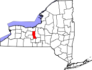
Towns Villages Interlaken | Lodi | Ovid | Seneca Falls | Waterloo
Footnotes ‡This populated place also has portions in an adjacent county or counties
Categories:- Towns in New York
- Populated places established in 1794
- Populated places in Seneca County, New York

Wikimedia Foundation. 2010.