- Mahendragarh
-
Mahendragarh — city — Coordinates 28°17′N 76°09′E / 28.28°N 76.15°ECoordinates: 28°17′N 76°09′E / 28.28°N 76.15°E Country India State Haryana District(s) Mahendragarh Population 23,977 (2001[update]) Time zone IST (UTC+05:30) Area
• 262 metres (860 ft)
Mahendragarh is a town and a municipal committee in Mahendragarh district in the north Indian state of Haryana.
Contents
Geography
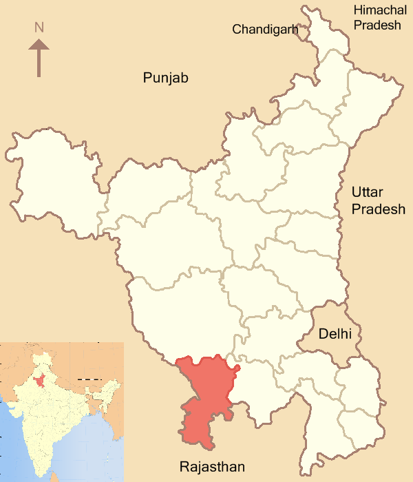
Mahendragarh is located at 28°17′N 76°09′E / 28.28°N 76.15°E.[1] It has an average elevation of 262 metres (859 feet).It is bounded on the north by Bhiwani and Rohtak districts, on the east by Rewari district and Alwar district of Rajasthan, on the south by Alwar, Jaipur and Sikar districts of Rajasthan, and on the west by Sikar and Jhunjhunu districts of Rajasthan. It has 2 tehsils of Narnaul and Mahendergarh.
It is named after Maharaj Mahendra singh who was the rular during the Mughal era. It is situated at the bank of Dohan river (which was a seasonal river),which is at the verge of extinction.
Mahendragarh is emerging as the new education hub of haryana with several high standard schools and colleges including engineering college. Also the Central
University is opening shortly here.
Education
Central University has been started in Mahendergarh, Village-Pali at present classes are being held at Narnaul B.Ed. Campus. which is a Government College.
Demographics
As of 2001 India census[2], Mahendragarh had a population of 23,977. Males constitute 53% of the population and females 47%. Mahendragarh has an average literacy rate of 67%, higher than the national average of 59.5%: male literacy is 76%, and female literacy is 57%. In Mahendragarh, 14% of the population is under 6 years of age. Hindus constitute 98% of the population.
In spite of being a district headquarters, there is no administrative office. All the relevant work is done in Narnaul. The very first guggul (Commiphora wightii) vatika (place where medicinal plants are planted) was established here.
Now many government offices have opened in Mahendragarh near Government Boys college in new Court.
Social Groups
According to Haryana District Gazetteers: Mahendragarh Ahirs, Jats and Rajputs form the agricultural backbone of the district.However Yaduvanshi Ahirs are in majority in the district.[3][4]
Notable personalities
- Swami Ramdev – Yoga Guru.
- Dr. J.N. Singh Yadav – Historian.
- Ram Bilas Sharma – Politician.
- Pandit Gisharam (1940-60) Lok Kavi.
- Late AmarNath Sharma – Advocate
See also
References
- ^ Falling Rain Genomics, Inc - Mahendragarh
- ^ "Census of India 2001: Data from the 2001 Census, including cities, villages and towns (Provisional)". Census Commission of India. Archived from the original on 2004-06-16. http://web.archive.org/web/20040616075334/http://www.censusindia.net/results/town.php?stad=A&state5=999. Retrieved 2008-11-01.
- ^ http://books.google.co.in/books?ei=1GqZTZ6nBM2srAeh0vDyCw&ct=result&id=yZhuAAAAMAAJ&dq=Rajput++Yaduvanshi+Ahir&q=Ahir
- ^ Haryana District Gazetteers: Mahendragarh-page-67
Mahendragarh district topics History 
Cities and towns Education Central University of HaryanaLok Sabha constituencies Bhiwani-MahendragarhCategories:- Mahendragarh
- Haryana geography stubs


Wikimedia Foundation. 2010.