- Clopton, Northamptonshire
-
Coordinates: 52°24′44″N 0°26′09″W / 52.4121°N 0.4357°W
Clopton 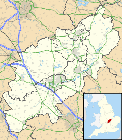
 Clopton
Clopton shown within NorthamptonshirePopulation 134 OS grid reference TL0680 District East Northamptonshire Shire county Northamptonshire Region East Midlands Country England Sovereign state United Kingdom Post town Kettering Postcode district NN14 Dialling code 01832 Police Northamptonshire Fire Northamptonshire Ambulance East Midlands EU Parliament East Midlands UK Parliament Corby List of places: UK • England • Northamptonshire Clopton is a small village and civil parish located in East Northamptonshire, close to the Cambridgeshire border. The village stretches along the north side of the B662 and was recorded in the Domesday Book as 'Clotone'. At the time of the 2001 census, the parish's population was 134 people.[1] The Village Church of St Peter was built in about 1863 by Richard Armstrong.
References
- ^ Office of National Statistics: Clopton CP: Parish headcounts. Retrieved 8 November 2009
External links
 Media related to Clopton, Northamptonshire at Wikimedia CommonsCategories:
- Villages in Northamptonshire
- Northamptonshire geography stubs

Wikimedia Foundation. 2010.