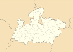
- Nagod
-
Nagod — city — Coordinates 24°34′N 80°36′E / 24.57°N 80.6°ECoordinates: 24°34′N 80°36′E / 24.57°N 80.6°E Country India State Madhya Pradesh District(s) Satna Population 19,474 (2001[update]) Time zone IST (UTC+05:30) Area
• 330 metres (1,080 ft)
Nagod or Nagode is a town and a nagar panchayat in Satna district in the Indian state of Madhya Pradesh ruled by Pratihara Rajput. It is located 17 miles (27 km) from the town of Satna. It is the administrative headquarters of Nagod Tehsil. It is believed that it was a small state owned by an oil-pressing people, known as 'Teli', who were exiled by the Pratiharas. Pratiharas originally came from Kannauj and belong to Agnikula Rajput.
Contents
Origin
Nagod derives its name from Nagar[disambiguation needed
 ] meaning Town or City. Nagod is near to district headquarter SATNA and well connected with the roads. This Place is very calm and known for great social harmony.
Princely history
Nagod was formerly the capital of a princely state of British India.[1] The state was founded in 1344, and was known as Unchahara after the former capital of the state (until 1720). The state came under British influence in 1802, and became a princely state in the Bagelkhand Agency of what was later to become the Central India Agency. The state was made tributary to Panna from 1807 to 1809. The area of the state was 501 square miles (1,300 km2), with a population of 67,092 in 1901. The population of the state decreased 20% in the decade 1891-1901. The rulers, whose title was raja, were Rajputs of the Pratihara clan. Nagod was formerly a British military cantonment, and had an English language school and dispensary. The language spoken here is known as Hindi. It was also known as the State of Parihars.
Until the 18th century, the state was known as Unchahara from the name of its original capital. The chiefs of Nagod were Parihar Rajputs belonging traditionally to Mount Abu. In the seventh century, Parihar Rajputs drove out the Gaharwar Rajput rulers from and established themselves in the country between Mahoba and Mau. In the ninth century, they were repulsed eastwards by the ChandelRajputs, where Raja Dhara Singh seized the fort of Naro from the Teli Rajas in 1344. In 1478 Raja Bhoja obtained Unchahara, which he made the chief town, and which remained so until 1720, when the capital was moved to Nagod by Raja Chain Singh. Later on the Parihars lost all their territories to the Baghel Rajputs and Bundela Rajputs except the limited territory that they held before 1947.
When the British became paramount after the Treaty of Bassein (1820), Nagod was held to be a tributary to Panna and was included in the sanad granted to that state in 1807. In 1809, however, a separate sanad was granted to Lal Sheshraj Singh confirming him in his possessions. In the mutiny of 1857, the chief Raghvendra Singh behaved most loyally in assisting the British and was rewarded by the grant of 11 villages, which had belonged to the confiscated state of Bijeraghogarh (present day Vijayraghavgarh). The Nagod chiefs had the title of Raja and received a salute of 9 guns. some famous persons who did great job to increase financial potential of nagod are as written below
Geography
Nagod is located at 24°34′N 80°36′E / 24.57°N 80.6°E.[2] It has an average elevation of 330 metres (1082 feet).
Demographics
As of 2001[update] India census,[3] Nagod had a population of 19,474. Males constitute 53% of the population and females 47%. Nagod has an average literacy rate of 68%, higher than the national average of 59.5%: male literacy is 76%, and female literacy is 60%. In Nagod, 16% of the population is under 6 years of age.
References
- ^ http://dsal.uchicago.edu/reference/gazetteer/pager.html?objectid=DS405.1.I34_V18_306.gif
- ^ Falling Rain Genomics, Inc - Nagod
- ^ "Census of India 2001: Data from the 2001 Census, including cities, villages and towns (Provisional)". Census Commission of India. Archived from the original on 2004-06-16. http://web.archive.org/web/20040616075334/http://www.censusindia.net/results/town.php?stad=A&state5=999. Retrieved 2008-11-01.
Cities and towns in Rewa Division Rewa district Satna district Sidhi district Singrauli district Related topics Cities and towns
in other DivisionsCategories:- Cities and towns in Satna district
- 1344 establishments
- Parihara rulers
- Satna
Wikimedia Foundation. 2010.


