- Oaklands Park, South Australia
-
Oaklands Park
South Australia
Population: 3,126(2006 Census)[1] Established: 1906 Postcode: 5046 LGA: City of Marion Suburbs around Oaklands Park: Glengowrie Morphettville Park Holme Warradale Oaklands Park Marion Dover Gardens Seacombe Gardens Sturt Oaklands Park is a suburb of Adelaide, South Australia in the City of Marion. The Marion Shopping Centre is the suburb's main attraction.
Contents
History
On 14 December 1906, Oaklands was bought by Thomas Currie Tait for £15,000.
In 1923 Tait offered 'The Park' (from the corner of Marion and Oaklands Roads to the homestead) to the South Australian Government for £100 an acre. When the offer was not accepted, Hamiltons acquired the vineyard and in September 1923, W. Pethick " Sons, vignerons and orchardists, bought the homestead. The remaining land, about 132 acres (0.53 km2), was secured by T.M Burke Pty Ltd, for £23,000, for building allotments.
The portion of Oaklands which became the site of the Warradale Army Camp in both World Wars, was acquired from the State on 26 July 1945 for £24,020. The Barracks comprise 56 acres (230,000 m2) bounded on the north by Oaklands Road and on the west by Morphett Road. In 1940 the area was occupied by 9 Infantry Brigade as a mobilization centre and brigade camp and on 10 February 1942 the site was taken over under National Security Regulations.
In 1952 when a number of Oaklands Estate gum-trees were being uprooted to make way for Housing Trust homes a local group formed the Oaklands Estate Residents' Association in the hope of preserving some of the remaining trees. In a triangle bounded by Oaklands Road, Sturt River and the Marino (now the Noarlunga) railway line, they volunteered to plant and care for 1,200 native street trees including a shrubbery around Marion Railway Station. They also helped to initiate the gazetting of a sizeable portion of land adjacent to Sturt River for recreational use. The Council has now taken responsibility for that area.
Oaklands Park Post Office opened on 10 February 1969.[2]

In 1971 the South Australian Government set aside 7 ha (16¼ acres) of land in Oaklands Park for its Road Safety Centre and on 17 October 1972 the Centre was officially opened. After the Open Day on 22 October the Centre began operating complete with traffic lights and road signs.
Amenities

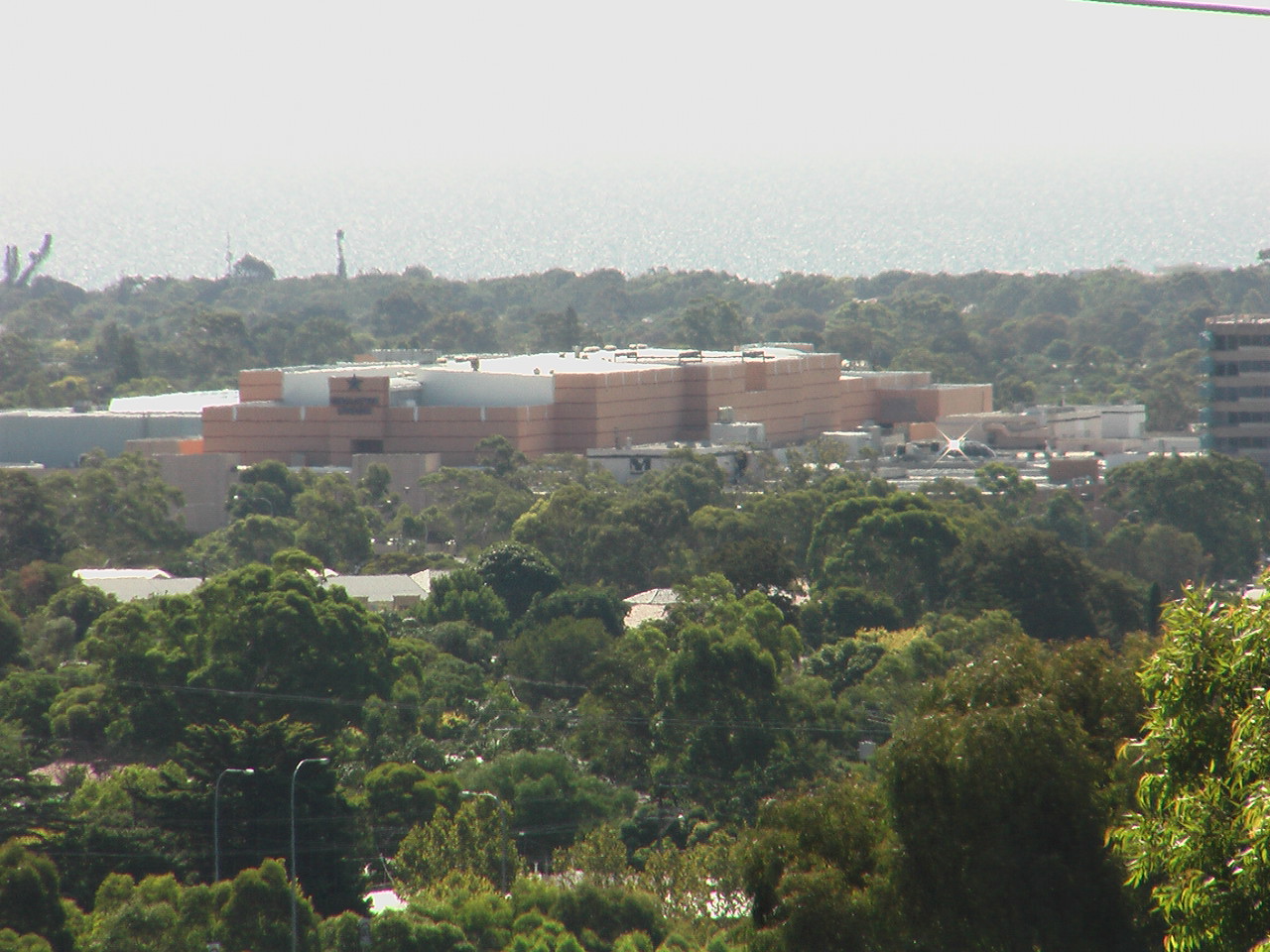
Oaklands Park is best known as the location of the Westfield Marion shopping centre, the largest shopping complex in Adelaide. It includes over 300 speciality stores and includes a bowling alley, cinema, several department and discount stores, two super markets and a food court.
The Marion Cultural Centre is also adjacent the Marion Shopping Centre that contains an Art Gallery, Café, Library and a Theatre. Events are held there all through the year with Art Exhibits, Theatre Performances and Blue Light Disco’s being held.
Transport
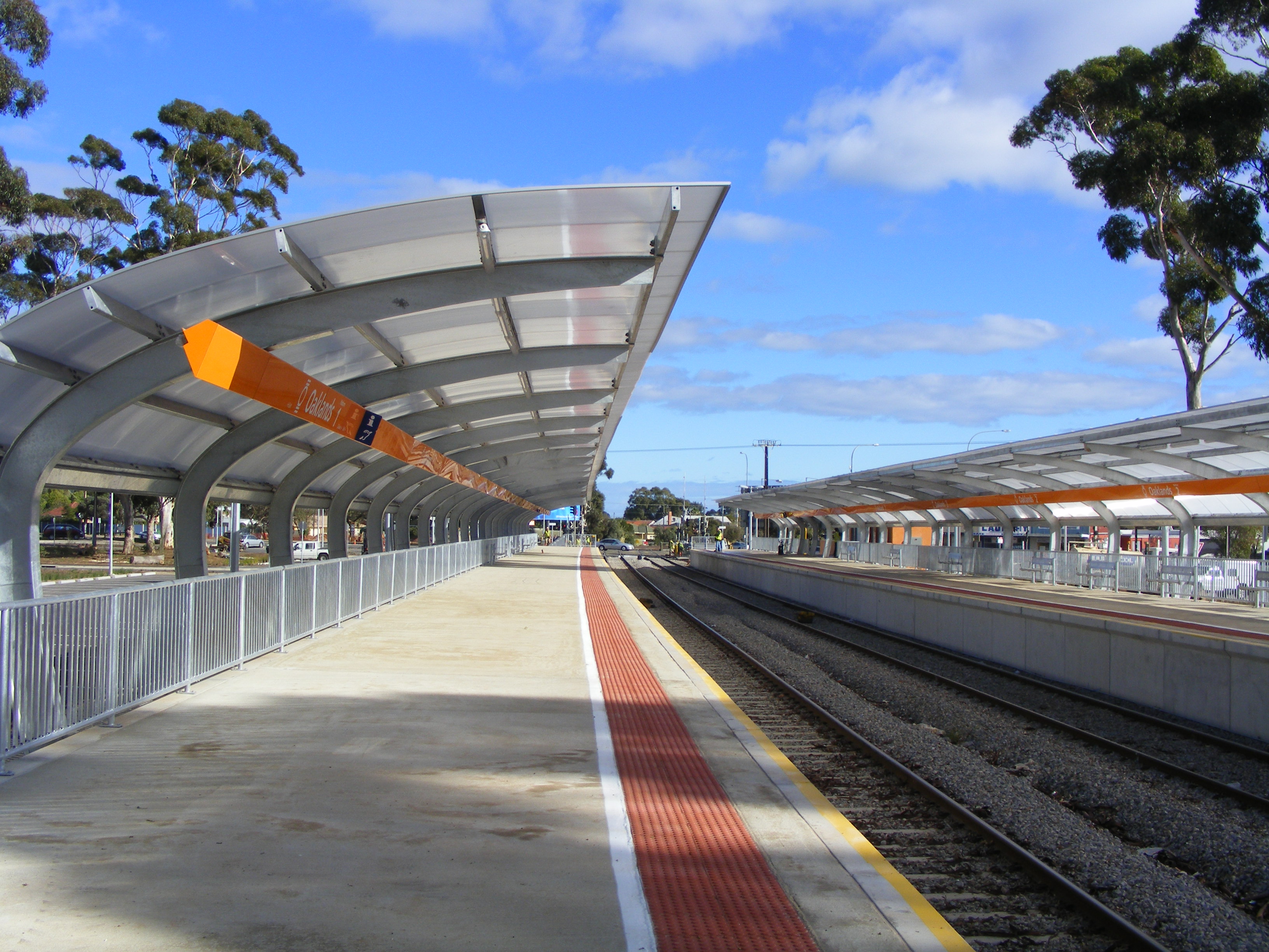
 Oaklands transport interchange
The Noarlunga Centre railway line travels through the suburb and stops at Oaklands railway station. The station has been redeveloped as a transport exchange by the South Australian Government and Marion Council to improve access to surrounding facilities.[3]
There is a bus interchange at the Westfield Marion with connections to Adelaide city, Flinders University, Hallett Cove, Noarlunga Centre and Port Adelaide.
Residents
 Graph of People's Birthplaces in Oaklands Park
In the 2001 Australian Bureau of Statistics Census, the population was 3,029 with the females outnumbering the males 53.6% against 46.4%, 1.0% of the population of Oaklands Park Indigenous Australians.
With most people in Oaklands Park born in Australia, 6.8% of the suburb’s population was born in England, then the other origins of the people in the suburb being (in descending order:) Scotland, Netherlands, New Zealand and Germany.
See also
References
- ^ Australian Bureau of Statistics (25 October 2007). "Oaklands Park (State Suburb)". 2006 Census QuickStats. http://www.censusdata.abs.gov.au/ABSNavigation/prenav/LocationSearch?collection=Census&period=2006&areacode=SSC42206&producttype=QuickStats&breadcrumb=PL&action=401. Retrieved 2007-06-30.
- ^ Premier Postal History. "Post Office List". Premier Postal Auctions. https://www.premierpostal.com/cgi-bin/wsProd.sh/Viewpocdwrapper.p?SortBy=SA&country=. Retrieved 26 May 2011.
- ^ Marion-Oaklands Transport Interchange, Government of SA, accessed 2006-08-12
Suburbs of the City of Marion Ascot Park · Bedford Park · Clovelly Park · Darlington · Dover Gardens · Edwardstown · Glandore · Glengowrie · Hallett Cove · Marino · Marion · Mitchell Park · Morphettville · O'Halloran Hill · Oaklands Park · Park Holme · Plympton Park · Seacliff Park · Seacombe Gardens · Seacombe Heights · Seaview Downs · Sheidow Park · South Plympton · Sturt · Trott Park · WarradaleCategories:- Suburbs of Adelaide


Wikimedia Foundation. 2010.