- Cham (district)
-
Cham — District — 
Country  Germany
State Bavaria Adm. region Oberpfalz Capital Cham Area - Total 1,510 km2 (583 sq mi) Population (31 December 2010)[1] - Total 128,322 - Density 85/km2 (220.1/sq mi) Time zone CET (UTC+1) - Summer (DST) CEST (UTC+2) Vehicle registration CHA Website landkreis-cham.de Cham is a district in Bavaria, Germany. It is bounded by (from the south and clockwise) the districts of Regen, Straubing-Bogen, Regensburg and Schwandorf and by the Czech Plzeň Region.
Contents
History
The first historical date in the regional history is the year 748, when the bishop of Regensburg ordered the foundation of a monastery in the sparsely populated region. About hundred years later the royal castle of Cham was built and became a summer residence for the Holy Roman Emperors. The region was called Campriche or Mark Cham. In 1204 the Mark Cham became subject to Bavaria, in 1352 to the Palatinate and in the 17th century back to Bavaria. Nowadays, Cham still enjoys the laid back life style from the days of yore. Many projects have been initiated to give this area an impetus to grow, despite of this it is still one of the least populated regions in Germany.
Geography
The district is located in the northern parts of the Bavarian Forest. It is situated within the borders of the Upper Bavarian Forest Nature Park. The highest mountain is the Großer Arber at 1439 m, located on the Germany–Czech Republic border. The Regen river enters the district in the southeast and leaves to the west; most of the settled places are situated along this river and its main tributary, the Chamb coming from the Czech border.
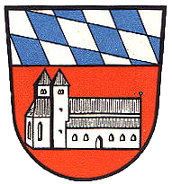
Coat of arms
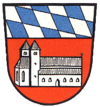
The upper part of the arms is occupied by the blue and white checkered pattern of Bavaria. Below the church of Chammünster is displayed (today belonging to the town of Cham), which was built in 748 within a famous monastery. Towns and municipalities
Towns Municipalities References
- ^ "Fortschreibung des Bevölkerungsstandes" (in German). Bayerisches Landesamt für Statistik und Datenverarbeitung. 31 December 2010. https://www.statistikdaten.bayern.de/genesis/online?language=de&sequenz=tabelleErgebnis&selectionname=12411-009r&sachmerkmal=QUASTI&sachschluessel=SQUART04&startjahr=2010&endjahr=2010.
External links
- Official website (German)
Categories:- Districts of Bavaria
- Cham district
Wikimedia Foundation. 2010.