- Cham, Germany
-
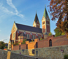
Cham Church in Cham 
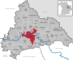
Coordinates 49°13′N 12°39′E / 49.21667°N 12.65°ECoordinates: 49°13′N 12°39′E / 49.21667°N 12.65°E Administration Country Germany State Bavaria Admin. region Oberpfalz District Cham Town subdivisions 53 Stadtteile Mayor Karin Bucher (FWG) Basic statistics Area 80.67 km2 (31.15 sq mi) Elevation 370 m (1214 ft) Population 16,975 (31 December 2010)[1] - Density 210 /km2 (545 /sq mi) Other information Time zone CET/CEST (UTC+1/+2) Licence plate CHA Postal code 93413 Area codes 0 99 71 Website www.cham.de Cham (German pronunciation: [ˈkaːm]) is the capital of the district of Cham in the Upper Palatinate in Bavaria in Germany.
Contents
Location
Cham lies within the Cham-Further lowland, which is bordered on the south by the Bavarian Forest and on the north by the Oberpfälzer Wald. The city lies on the Regen River, which joins the Danube at Regensburg.
The name "Cham" is of Celtic origin and probably means "bend" or "curvature". In fact, a few kilometers from the city, a winding brook called the Chamb flows into the Regen; it probably gave its name to Cham, first settlement at the bend of the larger river. Or, the name may have derived from "Kamm" (comb). The city's coat of arms contains a comb. A partner city, also called "Cham" in Switzerland, is actually pronounced with a first "ch" sound, whereas Bavarian Cham is pronounced with a "k".
History
Monks from Regensburg founded the Marienmünster, the first and oldest church in the Bavarian forest, at Chammünster in the 8th century. The first reference to Cham as a city appears in 976. An imperial castle stood on the Galgenberg (German: "gallows hill"), providing protection for the trade route into Bohemia. Cham was granted its own currency around 1000, the so-called Cham Denar. The 12th century saw the town's location shifted to its current place. The Hussite Wars of the 15th century inflicted great hardships on the townspeople. In 1742, the Pandur troops of Franz Freiherr von der Trenck overran and destroyed the city.
Cham's first railway connection came in 1861. On April 18, 1945, a British air raid on the western part of Cham caused 63 deaths. The arrival of numerous German war refugees from Silesia and the Sudetenland swelled Cham's population from 5,860 to over 10,000.
International relations
Main article: List of twin towns and sister cities in GermanyCham, Germany is twinned with:
- Cham,
 Switzerland
 - Klatovy,
 Czech Republic
 - Gainsborough,
 Great Britain
Notable people
- Anne of Bohemia (1323–1338), a sister of Emperor Charles IV, later Duchess consort of Austria, Styria and Carinthia
- Fritz Zängl (1914–1942), a German skier, was born in Katzbach.
References
- ^ "Fortschreibung des Bevölkerungsstandes" (in German). Bayerisches Landesamt für Statistik und Datenverarbeitung. 31 December 2010. https://www.statistikdaten.bayern.de/genesis/online?language=de&sequenz=tabelleErgebnis&selectionname=12411-009r&sachmerkmal=QUASTI&sachschluessel=SQUART04&startjahr=2010&endjahr=2010.
Arnschwang | Arrach | Bad Kötzting | Blaibach | Cham | Chamerau | Eschlkam | Falkenstein | Furth im Wald | Gleißenberg | Grafenwiesen | Hohenwarth | Lam | Lohberg | Michelsneukirchen | Miltach | Neukirchen | Pemfling | Pösing | Reichenbach am Regen | Rettenbach | Rimbach | Roding | Rötz | Runding | Schönthal | Schorndorf | Stamsried | Tiefenbach | Traitsching | Treffelstein | Waffenbrunn | Wald | Walderbach | Waldmünchen | Weiding | Willmering | Zandt | ZellCategories:- Towns in Bavaria
- Cham district
- Upper Palatinate geography stubs
- Cham,
Wikimedia Foundation. 2010.


