- Unterallgäu
Infobox German district
name=Unterallgäu
state=Bavaria
capital=Mindelheim
regierungsbezirk=Swabia
region=Donau-Iller
area=1,229.2
population=135,552
population_as_of=2003
density=110
carsign=MN
url=http://www.unterallgaeu.de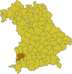
Unterallgäu is a "Kreis" (district) in the southwestern part of
Bavaria ,Germany . Neighboring districts are (from the north clockwise) Neu-Ulm, Günzburg, Augsburg,Ostallgäu ,Oberallgäu , and the districts Ravensburg und Biberach inBaden-Württemberg . The district-free cityMemmingen in the west of the district is nearly surrounded by the district.Geography
The district is located in the "Allgäu", the northern foothills of the
Alps . The riverIller forms part of the western boundary of the district.History
The district was created
July 1 ,1972 by merging the previous districts Mindelheim and Memmingen.Partnerships
The district started a partnership with the Polish
Gostyn County in2001 .Coat of arms
The rose in the left of the coat of arms is the symbol of the abbey of Ottobeuren, which ruled the southern part of the district. The
fleur-de-lis in the right stands for theFugger family, who owned several estates in the district. To the bottom are the bavarian diamonds, to symbolize that the area became part of Bavaria in1814 .Towns and municipalities
External links
* [http://www.unterallgaeu.de Official website] (German)
* [http://www.orchidsrepbiol.de/cgi-bin/img_db/regional.pl Orchids in Allgäu]
Wikimedia Foundation. 2010.