- Montebello Islands
-
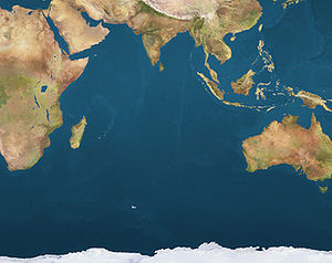
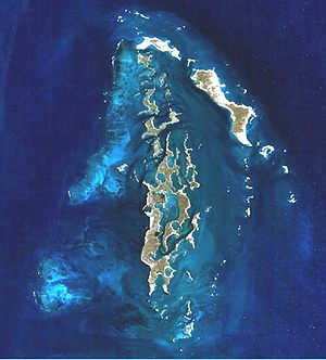
 Montebello IslandsLocation of the Montebello Islands
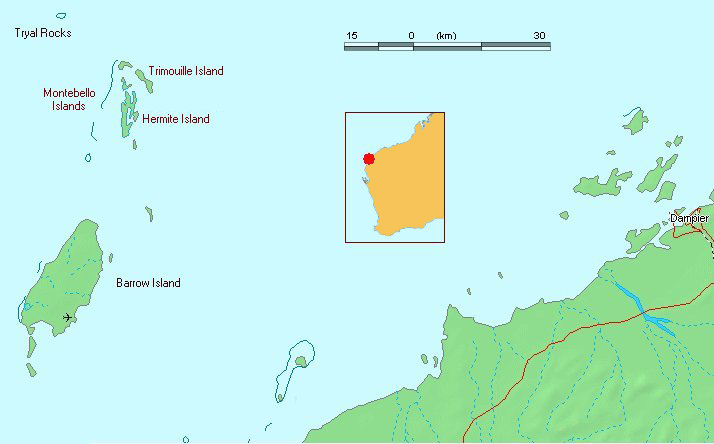
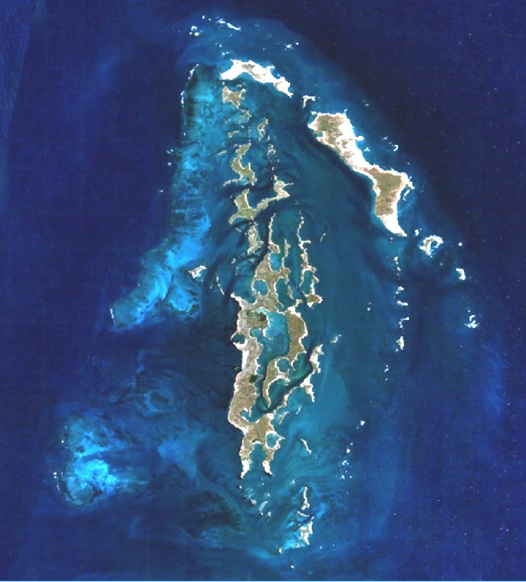
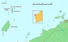 Map of the Montebellos and Barrow Island
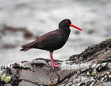 The slands are an important site for Sooty Oystercatchers
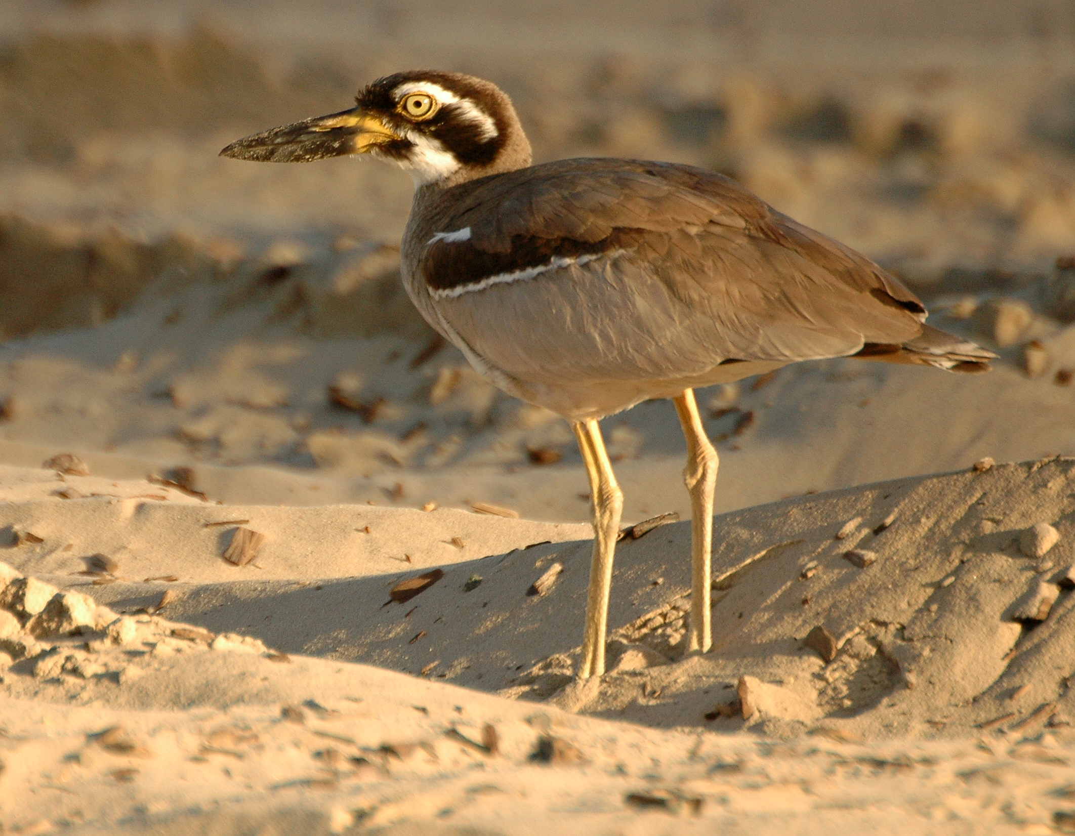
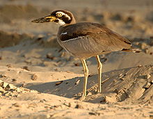 Beach Stone-curlews inhabit the islands
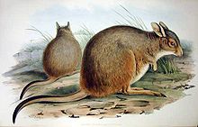 Mala have been introduced to the islands
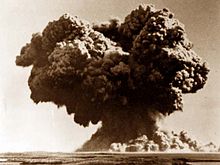 The mushroom cloud resulting from the Operation Hurricane detonation
The Montebello Islands, also known as the Monte Bello Islands, are an archipelago of around 174 small islands (about 92 of which are named) lying 20 kilometres (12 mi) north of Barrow Island and 130 kilometres (81 mi) off the Pilbara coast of north-western Australia. Montebello is Italian for "beautiful mountain". The islands form a conservation park administered by the Western Australian Department of Environment and Conservation, and it is likely that the shallow waters around them will become a marine conservation reserve.
Contents
Description
The islands of the archipelago have a collective land area of about 22 km2 The largest islands, Hermite (or Hermit) and Trimouille have areas of 1022 ha and 522 ha respectively. They consist of limestone rock and sand. The rocky parts are dominated by Triodia hummock grassland with scattered shrubs, while the sandy areas support grasses, sedges and shrubs, mainly Acacia. Patches of mangroves grow in sheltered bays and channels of the archipelago, especially at Hermite Island. The climate is hot and arid with an annual average rainfall of about 320 mm.[1]
Birds
The islands have been identified by BirdLife International as an Important Bird Area (IBA) because they support over 1% of the world populations of Fairy and Roseate Terns, and of Sooty Oystercatchers.[2] Greater Crested Terns breed there irregularly, sometimes in large numbers. Other birds breeding on the islands include Ospreys, White-bellied Sea-Eagles, Pied Oystercatchers, Caspian Terns and Bridled Terns. The islands support 12-15 breeding pairs of Beach Stone-curlews. Yellow White-eyes have been recorded.[1]
Mammals
Invasive Feral cats and Black Rats have been eradicated from the islands. Mala and Djoongari have been translocated to the islands under the conservation management strategy for these threatened species.[1]
History
The two main islands were discovered by the French explorer Nicolas Baudin in 1801. Hermite Island is named after the French Admiral Jean-Marthe-Adrien L'Hermite. Trimouille Island is named after a French noble family. There are problems with the naming of the islands in the accounts of the early explorers, and it has been suggested that the French. and later the British, explorers mixed up the names of Lowendal and Hermite Islands.
An early reference to the islands is in 1622, when the Tryall was wrecked just west of them. For years afterwards their approximate position was recorded on charts as the Tryal Rocks. The islands were economically significant for pearl fishing from the end of the nineteenth century until the outbreak of the Second World War.
Operation Hurricane
A bay of Trimouille Island was the site of Operation Hurricane, the first British nuclear weapons test on 3 October 1952. There were two further tests on Alpha and Trimouille Islands in 1956. The second of these, codenamed G2, was the largest device ever detonated in Australia, with a yield of 98 kt. Queensland towns such as Mount Isa, Julia Creek, Longreach and Rockhampton were contaminated by the fallout from the test.[3]
Islands
Further information: List of named islands in the Montebello Islands archipelagoOf the smaller islands, the largest are:
- North-West Island
- Primrose Island
- Bluebell Island
- Alpha Island
- Crocus Island
- Campbell Island
- Delta Island
- Renewal Island
- Ah Chong Island
There are also 10 named groups of small islets, whose individual islands have not yet been named:
- Corkwood Islands
- Fig Islands
- Hakea Islands
- Jarrah Islands
- Jasmine Islands
- Karri Islands
- Marri Islands
- Minnieritchie Islands
- Mulga Islands
- Quandong Islands
References
- ^ a b c BirdLife International. (2011). Important Bird Areas factsheet: Montebello Islands. Downloaded from http://www.birdlife.org on 16/08/2011.
- ^ "IBA: Montebello Islands". Birdata. Birds Australia. http://www.birdata.com.au/iba.vm. Retrieved 2011-08-16.
- ^ Cross, Roger. (2001). Fallout. Wakefield Press. (p.179).
Further reading
- Acaster, Ray. (1995). British nuclear testing at the Monte Bello Islands. Early Days Vol. 11, no.1. pp.66-80.
- Arnold, Lorna; and Smith, Mark. (2006). Britain, Australia and the Bomb: The Nuclear Tests and their Aftermath. Palgrave MacMillan. ISBN 1403921024
- Bird, Peter. (1989). Operation Hurricane. Square One Publications: Worcester. (First published in 1953). ISBN 187201710X
- Burbidge, A. A. (1971). The fauna and flora of the Monte Bello Islands. Department of Fisheries and Fauna: Perth.
- Deegan, P. M. (1992). Monte Bello and Lowendal Islands: bibliography, summary report of marine resources. Dept. of Conservation and Land Management: Perth.
- Duyker, Edward. (2006). François Péron: An Impetuous Life: Naturalist and Voyager. Miegunyah/MUP: Melbourne. ISBN 978-0522-85260-8
- Fornasiero, Jean; Monteath, Peter; and West-Sooby, John. (2004). Encountering Terra Australis: the Australian voyages of Nicholas Baudin and Matthew Flinders. Wakefield Press: Kent Town, South Australia. ISBN 1-86254-625-8
- Horner, Frank. (1987). The French Reconnaissance: Baudin in Australia 1801—1803. Melbourne University Press: Melbourne. ISBN 0522843395.
- Tuckfield, Trevor. (1 August 1951). The Monte Bello Islands. Walkabout, Vol. 17, No. 8. pp.33-34.
External links
- Video footage of the Operation Hurricane detonation on Trimouille Island in 1951
- Nicolas Baudin’s Scientific Expedition To The Terres Australes by Steve Reynolds - Marine Life Society of South Australia Inc.
- Details of a feral cat eradication program on Hermite Island in 1999
- Nuclear testing details
Categories:- Islands of Western Australia
- Islands of the Indian Ocean
- Protected areas of Western Australia
- Nuclear test sites
- Australian nuclear test sites
- Pilbara
- Important Bird Areas of Australia
- Island restoration


Wikimedia Foundation. 2010.