- Ofotfjord
-
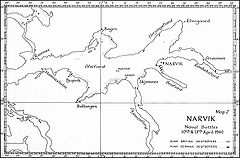 Map of the fjord and the fjord branches, also showing the location of sunk destroyers after the Battles of Narvik.
Ofotfjord (Norwegian: Ofotfjorden, the suffix -en means "the") or Narvik Fjord, an inlet of the Norwegian sea 200 kilometres (120 mi) north of the Arctic circle, is Norway's 12th longest fjord, 78 kilometres (48 mi) long, and the 18th deepest, with a maximum depth of 553 metres (1,814 ft). Along the shores of this fjord is the major town of Narvik. This fjord is commonly called in the English language, and in many historical documents, the "Narvik Fjord".
Contents
The name
The district Ofoten is named after the Ofotfjord (Norse Ófóti). See more information about the name there.
Geography
It is the longest fjord in Nordland county, and the fourth longest in North Norway. The landscape Ofoten is named after the fjord. The municipalities of Tjeldsund and Evenes are located on the northern shore, Narvik is located on the eastern, innermost part of the fjord, and on the southern shore is Ballangen municipality. Lødingen (and beyond that Lofoten) and the large Vestfjord is located west-south-west of Ofotfjord.
The fjord branches
Several smaller fjord branches extend from the main fjord. From north-west, going clockwise, these are: Ramsund (which is actually a narrow sound connecting with the larger Tjeldsundet), Bogen (a fairly wide bay), Herjangen (the widest of these branches), Rombaken (which is crossed by E6 using the Rombak Bridge), Beisfjord (crossed by E6 using the Beisfjord Bridge), Skjomen (the longest of these fjord branches, crossed by E6 using the Skjomen Bridge) and finally Ballangen. At the mouth of Ofotfjord, on the southern side, is another fjord, the narrow Efjord, which extends south-east (crossed by the E6 using the Efjord Bridges).
Fauna
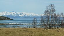
View from Djupvika towards Bogen. 2 May 2009
Ofotfjord has a rich marine life, with huge quantities of herring staying in the fjord in the winter. These have attracted whales (orca). Divers have occasionally observed lobsters in the fjord, the northernmost sightings of lobsters in the world. Cod, as well as coalfish, are the most common fish species throughout the year. Mackerel is common from July to mid-September. Sea eagles and otters have made a strong comeback and are now very common in and around the fjord. Sea gulls are common all year, and many migratory birds arrive in summer, such as oystercatchers and grey herons.
The surroundings
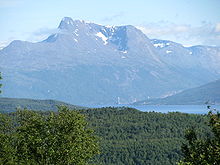
The fjord is surrounded by mountains, some reaching 1,500 metres (4,900 ft), and even 1,700 metres (5,600 ft) in Skjomen, where the glacier Frostisen can be seen. The only larger lowland area is on parts of the northern shore, around Harstad/Narvik Airport, Evenes, although there are smaller areas near the fjord and in narrow valleys (for instance, the Narvik peninsula, where the harbour and city centre of Narvik is located). The mountains are covered by forest below 500 metres (1,600 ft), birch being the most common tree, but pine and aspen are also common. The bedrock around the fjord consist of both hard minerals like gneiss and granite as well as softer minerals rich in lime; there is a dolomite quarry in Ballangen ([1]).
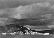 Tirpitz in Bogen, Ofotfjord. The Kriegsmarine used the Bogen fjord branch as a naval base.
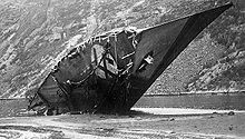
In the Battles of Narvik in World War II, the Ofotfjord was the scene for several naval battles, and many ships are resting at the bottom, especially in the vicinity of Narvik harbour. These are very popular among divers. However, some of these ship wrecks are declared war graves and are thus protected by law. The German destroyer Georg Thiele was scuttled and is still visible from around the railway between Straumsnes and Rombak railway station.
External links
Categories:- Fjords of Nordland
Wikimedia Foundation. 2010.


