- Cherokee Turnpike
-
Cherokee Turnpike
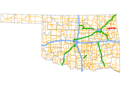
Route information Maintained by Oklahoma Turnpike Authority Length: 32.8 mi[1] (52.8 km) Existed: 1991 – present Major junctions East end:  US-412 west of Locust Grove
West end:  US-59 / US-412 west of West Siloam Springs
Location Counties: Mayes, Delaware Highway system United States Numbered Highways
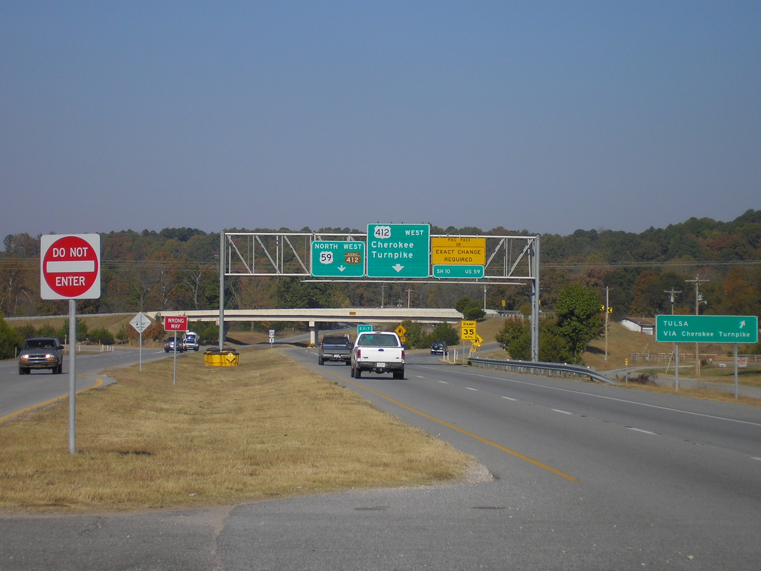
List • Bannered • Divided • Replaced Eastern terminus of the Cherokee Turnpike near Kansas, Oklahoma. Exiting right takes traffic onto the toll road; continuing due west is Scenic US-412/U.S. Highway 59.
The Cherokee Turnpike is a toll road in eastern Oklahoma. Opened in 1991, the route is a four-lane tollway carrying US-412 from east of Kansas, Oklahoma to east of Chouteau, and has a total length of 32.8 miles (52.8 km)[1] and a speed limit of 75 mph (121 km/h). An alternate route, Scenic US-412, provides a free but not controlled-access route through the towns bypassed by the Turnpike with only a 55 mph (89 km/h) speed limit.
Contents
Route description
The turnpike begins by branching off US-412 east of the Grand River in Mayes County. The turnpike carries US-412 for its entire length; the old alignment of US-412, which was also at one time State Highway 33, is now Scenic US-412. The Cherokee Turnpike runs within a close distance of Scenic US-412 for its entire length. The turnpike generally varies only a few degrees from true east–west throughout its entire route.
The turnpike's first exit is a diamond interchange with State Highway 82 just south of Locust Grove. From this point, the road travels 11 miles (18 km) without another exit.[1] During this interval, the highway crosses from Mayes into Delaware County. Just after crossing the county line, the Cherokee has its second exit, again meeting Scenic US-412 southeast of Rose. This second exit is a partial cloverleaf with loop ramps in the northwest, northeast, and southwest quadrants.
Continuing east, the turnpike's median widens to accommodate a service plaza available to both directions. After the service plaza, the turnpike passes through a barrier toll plaza. The final exit, another 11 miles (18 km) from the Scenic US-412 exit, occurs at US-59/SH-10, which is another diamond interchange. After this interchange Scenic US-412 crosses over the turnpike with no interchange. The median gradually widens again as Scenic US-412, now concurrent with US-59, crosses under the westbound lanes and begins running through the median. The eastbound lanes eventually merge with US-59/Scenic US-412. This marks the eastern terminus of both the Cherokee Turnpike and Scenic US-412. US-59 and mainline US-412 continue east toward West Siloam Springs, Oklahoma, where they split, and US-412 crosses the state line into Siloam Springs, Arkansas.
History
The Cherokee Turnpike resulted from the same 1987 compromise between urban and rural legislators that resulted in the Kilpatrick, Creek, and Chickasaw Turnpikes. The turnpike opened to traffic in 1991.[1]
Services
The turnpike contains one service area, near Leach. It is located in the median between the Leach and Kansas exits, west of the toll plaza. The service plaza contains a gas station with free restrooms and a restaurant.
An Oklahoma Tourism Information Center is located on the turnpike near the Kansas exit, 13 miles (21 km) from the Arkansas–Oklahoma state line. Free coffee is available at the tourism center.[2]
Law enforcement along the Cherokee Turnpike is provided by Oklahoma Highway Patrol Troop XD, a special troop assigned to the turnpike.[3]
Tolls
A two-axle vehicle currently pays $2.50 ($2.40 with Pikepass) to drive the full length of the Turnpike.[1] This is equivalent of a toll of 8¢ per mile. Drivers in vehicles with more than two axles, such as truckers, pay higher tolls.[1]
Tolls are collected for eastbound traffic upon exiting at Locust Grove and Leach, and entry at Kansas. Westbound traffic must pay toll upon exit at Kansas and entry at Leach and Locust Grove. All traffic passing through the barrier toll west of the Kansas exit must pay toll, regardless of direction.[2]
Exit list
Exits are unnumbered.
County Location Mile Destinations Notes Turnpike ends, becomes US-412 west towards Tulsa Mayes 0.0  US-412 Scenic
Eastbound exit and westbound entrance Locust Grove ~6  SH-82 – Locust Grove, Tahlequah
Delaware ~17 US-412 Scenic – Rose, LeachService Area Toll Plaza ~28  US-59 / SH-10 – Kansas, Tahlequah
32.9 US-59 / US-412 ScenicWestbound exit and eastbound entrance Turnpike ends, becomes US-59/412 toward West Siloam Springs See also
References
- ^ a b c d e f Oklahoma Turnpike Authority. "Toll/Fares Chart". http://www.pikepass.com/maps/charts/frmTollRate.aspx?TurnpikeID=8. Retrieved 2009-11-04.
- ^ a b Oklahoma Department of Transportation (PDF). Official State Map (Map) (2008 ed.). http://www.odot.org/hqdiv/p-r-div/maps/state-maps/pdfs/2008.pdf. Retrieved 2009-11-04.
- ^ "Oklahoma Highway Patrol". http://www.dps.state.ok.us/ohp/tngrct/OHPtroops.htm. Retrieved 2008-04-05.
External links
Oklahoma turnpikes Cherokee · Chickasaw · Cimarron · Creek · H.E. Bailey · Indian Nation · John Kilpatrick · Muskogee · Turner · Will Rogers
See also Oklahoma Turnpike Authority · Pikepass Categories:- Toll roads in Oklahoma


Wikimedia Foundation. 2010.