- Mézières-sur-Couesnon
-
Mézières-sur-Couesnon
Magoerioù-ar-C'houenon
 Mézières-sur-CouesnonLocation within Brittany region
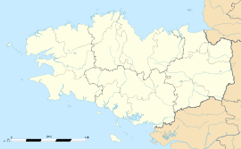 Mézières-sur-Couesnon
Administration Country France Region Brittany Department Ille-et-Vilaine Arrondissement Fougères-Vitré Canton Saint-Aubin-du-Cormier Intercommunality Pays de Saint-Aubin-du-Cormier Mayor Philippe Dolo
(2008—2014)Statistics Elevation 35–121 m (115–397 ft)
(avg. 90 m/300 ft)Land area1 24.74 km2 (9.55 sq mi) Population2 822 (1999) - Density 33 /km2 (85 /sq mi) INSEE/Postal code 35178/ 35140 1 French Land Register data, which excludes lakes, ponds, glaciers > 1 km² (0.386 sq mi or 247 acres) and river estuaries. 2 Population without double counting: residents of multiple communes (e.g., students and military personnel) only counted once. Coordinates: 48°17′47″N 1°25′54″W / 48.2963888889°N 1.43166666667°W
Mézières-sur-Couesnon (Breton: Magoerioù-ar-C'houenon, Gallo: Maézierr) is a commune in the Ille-et-Vilaine department in Brittany in north-western France.
Contents
Geography
Mézières-sur-Couesnon is located at 30 km (19 mi) northeast of Rennes and 42 km (26 mi) south of Mont Saint-Michel. As its name indicates, it is situated on the Couesnon River.
The communes bordering are Saint-Ouen-des-Alleux, Saint-Marc-sur-Couesnon, Saint-Jean-sur-Couesnon, Saint-Aubin-du-Cormier, Gahard and Vieux-Vy-sur-Couesnon.
Demographics
Inhabitants of Mézières-sur-Couesnon are called Mézièrais.
Historical population of Mézières-sur-Couesnon
(Source : INSEE[1])1962 1968 1975 1982 1990 1999 1007 962 881 816 807 822 From the year 1962 on: population without double counting—residents of multiple communes (e.g. students and military personnel) are counted only once. See also
References
External links
- Geography of Brittany(French)
- The page of the commune on infobretagne.com(French)
- The data base Mérimée - the French architectural heritage(French)
Categories:- Communes of Ille-et-Vilaine
- Ille-et-Vilaine geography stubs


Wikimedia Foundation. 2010.