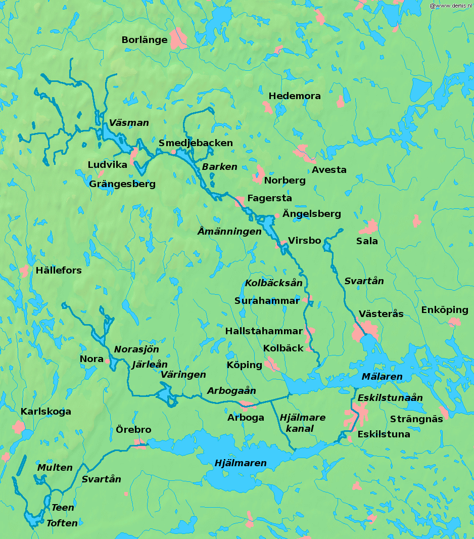
Bergslagen

Bergslagen
Map of Bergslagen

Bergslagen (Swedish for "Mountain's Law"[1]) is a historically, culturally, and linguistically distinct[citation needed] mining district located north of Lake Mälaren in northern Svealand, Sweden. In Bergslagen mining and metallurgic industry have been important since the Middle Ages. The region is to be distinguished from Malmfälten ("the Ore Fields"), the mining district of northernmost Sweden centered at the towns of Kiruna and Malmberget, that has been of greater importance during the 20th century.

Bergslagen covers part of the provinces of Västmanland, Dalarna (the southern part), and Värmland (the eastern part). Typical towns in the area include Nora, Fagersta, Sala, Kristinehamn, Filipstad, Ludvika and Hedemora. Also parts of northern Östergötland, around Finspång, as well as southern Närke can be included, then often referring to South Bergslagen. A wider definition of the area can include parts of Gästrikland (Hofors) and Uppland (the former iron manufacturing district centred around Dannemora) as well.

Contents

History

The conflict of interests between iron exports from Bergslagen and territorial conflicts at Denmark's southern border was a chief reason behind the Engelbrekt rebellion in 1434 and the following strifes that ultimately resulted in the dissolution of the Kalmar Union in 1523.

The region was an industrial powerhouse from the 17th century, up to the Steel crisis during the 1970s.

Minerals and mining

The Great Pit Stora stöten, Falun

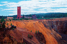
The area is very rich in minerals. Mining has been focused on iron ore for centuries but other ores has been mined as well. Most mines are now closed, but in the 1970s many mines were still in operation. The earliest signs of iron making dates back to 400 BC while industrial scale activities dates back to the 17th century.

At Långban, where iron and manganese has been mined, 270 mineral species has been reported to date. Many of these minerals are unique to the Långban deposit, and 67 minerals were first found at this site.

See also

References

  1. ^ The name originally referred to royal mining privileges.

External links

Coordinates: 59°50′N 15°45′E / 59.833°N 15.75°E / 59.833; 15.75


Wikimedia Foundation. 2010.

Игры ⚽ Нужна курсовая?

Look at other dictionaries:

  • Bergslagen — Bergwerk von Falun – Stora Stöten …   Deutsch Wikipedia

  • Bergslagen — ▪ region, Sweden       major ore producing region in central Sweden, lying northwest of Stockholm and extending from Lake Vänern (Väner, Lake) (Sweden s largest lake) to the Gulf of Bothnia (Bothnia, Gulf of). It falls predominantly within the… …   Universalium

  • Bergslagen — Le Bergslagen (loi de la montagne en suédois) est une région minière située au nord du lac Mälar, en Suède, qui se distingue par sa culture et son histoire. Les activités minières et métallurgiques remontent au Moyen Âge. Le Bergslagen ne doit… …   Wikipédia en Français

  • Bergslagen — Bẹrgslagen   [schwedisch bærj ], Industrie und Erzbergbaugebiet in Mittelschweden (fast phosphorfreie Eisenerze, Schwefelkies, Zinkerz; Kupfer und Silbererzbergbau eingestellt); Hauptorte sind Grängesberg, Norberg, Falun, Borlänge und Sandviken …   Universal-Lexikon

  • Tågåkeriet i Bergslagen — AB Rechtsform Aktiengesellschaft Sitz Kristinehamn, Schweden Branche Transport / Logistik Website …   Deutsch Wikipedia

  • Liste von Eisenbahnstrecken in Schweden — Der Schienenverkehr in Schweden wurde 1939, im Jahr der größten Ausdehnung, auf einem Netz von rund 16.900 km erbracht. Bis zum Jahr 2006 ist das schwedische Schienennetz auf noch 11.481 km geschrumpft, davon sind rund 9.400 km elektrifiziert.… …   Deutsch Wikipedia

  • Schienenverkehr (Schweden) — Der Schienenverkehr in Schweden wurde 1939, im Jahr der größten Ausdehnung, auf einem Netz von rund 16.900 km erbracht. Bis zum Jahr 2006 ist das schwedische Schienennetz auf noch 11.481 km geschrumpft, davon sind rund 9.400 km elektrifiziert.… …   Deutsch Wikipedia

  • Gran Montaña de Cobre de Falun — Zona de explotación minera de la «Gran Montaña de Cobre» de Falun …   Wikipedia Español

  • Surahammar Municipality — Infobox Kommun2 fullname=Surahammars kommun county=Västmanland County province=Västmanland capital=Surahammar arearank=223rd area=371.14 arealand=345.01 populationrank=213th population=10,109 densityrank=140th populationdensity=29.3… …   Wikipedia

  • Tågkompaniet — Infobox Rail companies logo filename = Tågkompaniet logo.png image filename = Tågkompaniet El16 24.jpg widthpx = 300px franchise = Upptåget Tåg i Bergslagen X Tåget nameforarea = route regions = Uppsala Tierp Gävle Tåg i Bergslagen X Tåget… …   Wikipedia

Share the article and excerpts

Direct link
Do a right-click on the link above
and select “Copy Link”